
Nam Weather Model, Rain For Thursday, 1st Snow For Midwest Cities
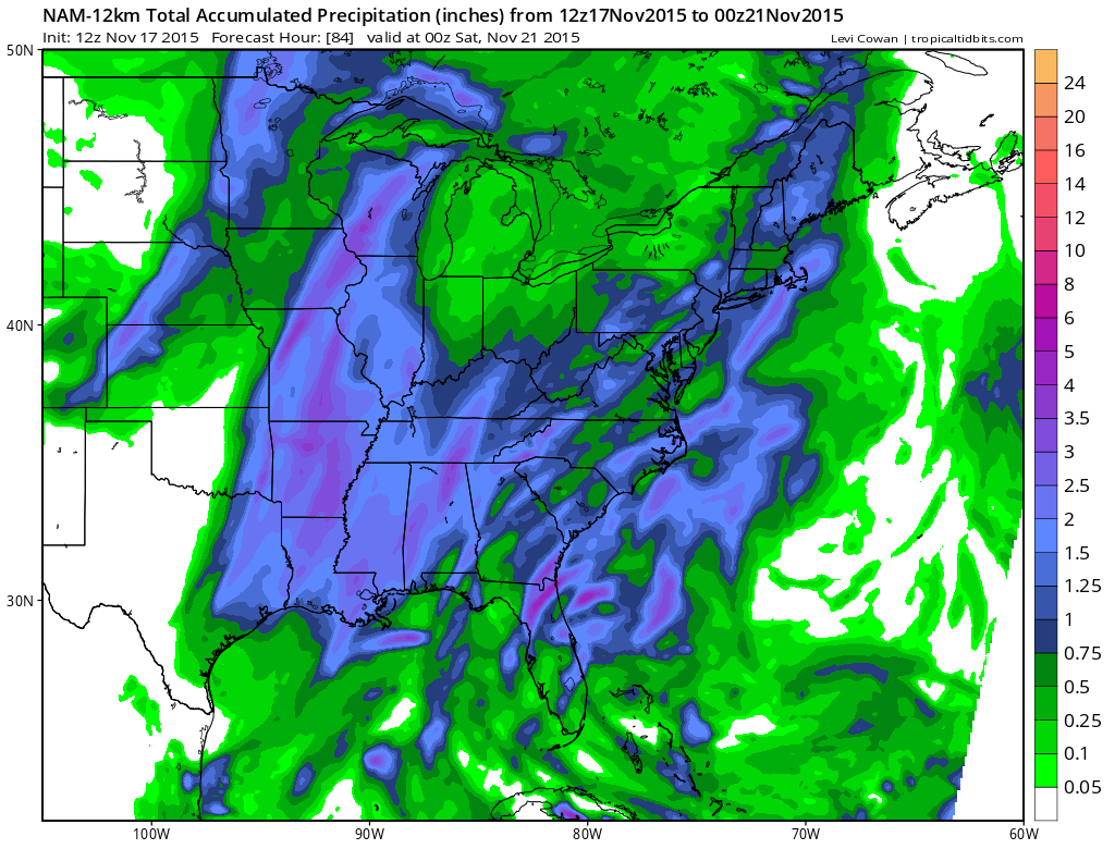
I thought I would do something a little different this morning and showcase the NAM weather model which is usually done by 10am. We can see the big high in the Saint Lawrence Valley that is giving us a nice crisp autumn day with temperatures 20 degrees colder than yesterday’s highs in some cases. We can also see the storm in the Rockies that is bringing snow and near blizzard condtions to Eastern Colorado and Western Kansas and Western Nebraska.
With regards to the rain for Thursday. The hope is that the front slows down a little and extends the rain for about 12 hours or so which would at least give us the chance to nail down a solid inch or so of rain. The other models do show the same idea so it will be a matter of whether the showers hold together or not. Remember dry pattern can mean underperformance but this morning’s run of the nam weather model did manage to grind out 1 inch plus liquids over much of the area from Southeastern Pennsylvania northward through Southern New England.
Now with regards to snow I’m taking this back to GFS from overnight and these are the forecast totals into Tuesday. So this would include whatever happens with that wave that brings our cold air and whatever lake effect occurs. My general rule on these maps this far out is that tend to get a little clown-ish so i would basically cut the amounts in half. Also where the darker blues show up it is more likely to be flurries or snow showers that don’t accumulate except maybe in the coldest part of the arriving air mass.
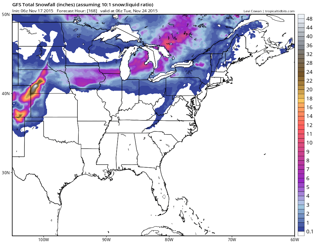
The gfs is showing some of that into parts of the Hudson Valley and Northwest New Jersey and I do believe that the air coming in during Saturday night could support some snow shower activity in those areas and perhaps other spots near by. It would not be unusual. Also the lake effect machine will be turned on in some areas but this does not appear to be any kind of unmanageable event upstate and west.
IF YOU ARE NEW YOU THE WEBSITE WELCOME. Do please like my facebook weather page so you will be notified about my latest posts and I’m also on Twitter @joecioffi!!
Later today JOESTRADAMUS will expand on the long range however here are some of the earlier posts.
JOESTRADAMUS LONG RANGE FROM VERY EARLY THIS MORNING


