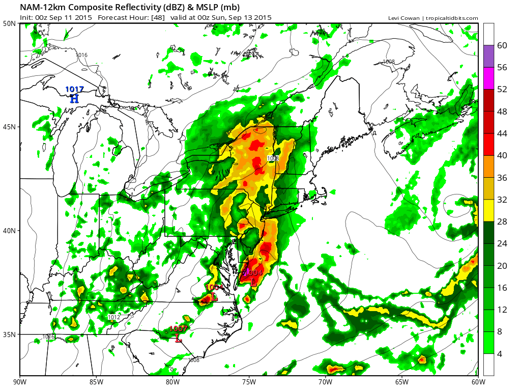
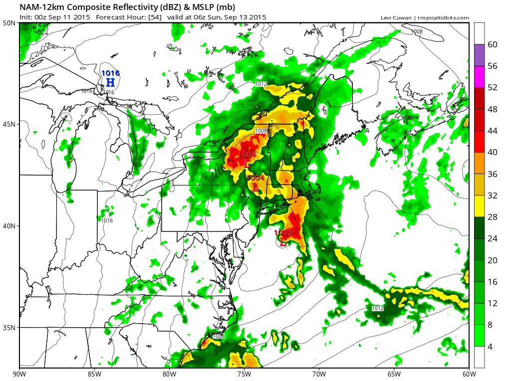
The next round of rain will come Saturday afternoon and Saturday night as a strong upper trough swings out of the midwest and into the northeast. There will be an impressive looking area of rain ahead of the trough but already we are seeing the Nam model showing less with every new model run. As impressive as the upper trough is, given we are seeing under performance with every system that has passed through in the last few month, it is likely that this one may under perform as well. My earlier thoughts were that this would be different this time but I am fighting a persistent dry pattern and a stubborn atmosphere that almost refuses to saturate and give up any of its moisture.
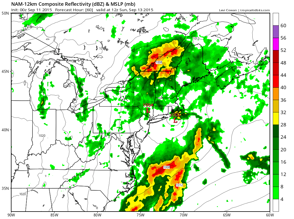
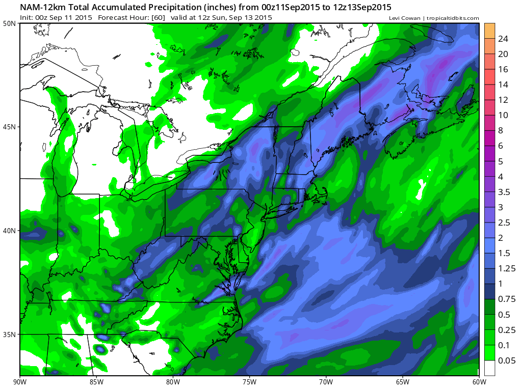
By Sunday morning the Nam has the rain already shifted away to the northeast with a few leftover showers around on Sunday morning. Rainfall amounts are in the half inch to an inch rain on average. I would think we should be able to pull that off. Some thunderstorms could probably produce locally higher amounts.