
NAM Model Late Week Forecast
![]()
Tonight’s NAM model takes us into Friday morning so this might be a good time to see if we can pick up any clues regarding the end of the week storm. To review, the Canadian weather model has a fairly well developed storm that moves up the coast and brings lots of snow. The European is south and east and mainly offshore. The GFS is offshore but close. All of this is going to depend as we have been saying on the timing of energy and whether we see phasing or no phasing of the two dominant jet stream players. Also let us bear in mind that there has been a tendency over the last couple of months of coastal systems trending northwestward at the last minute. That trend has produced significant impact to Long Island and Southern New England on 2 occasions.
NAM Model Late Week forecast WEDNESDAY MORNING SURFACE MAP
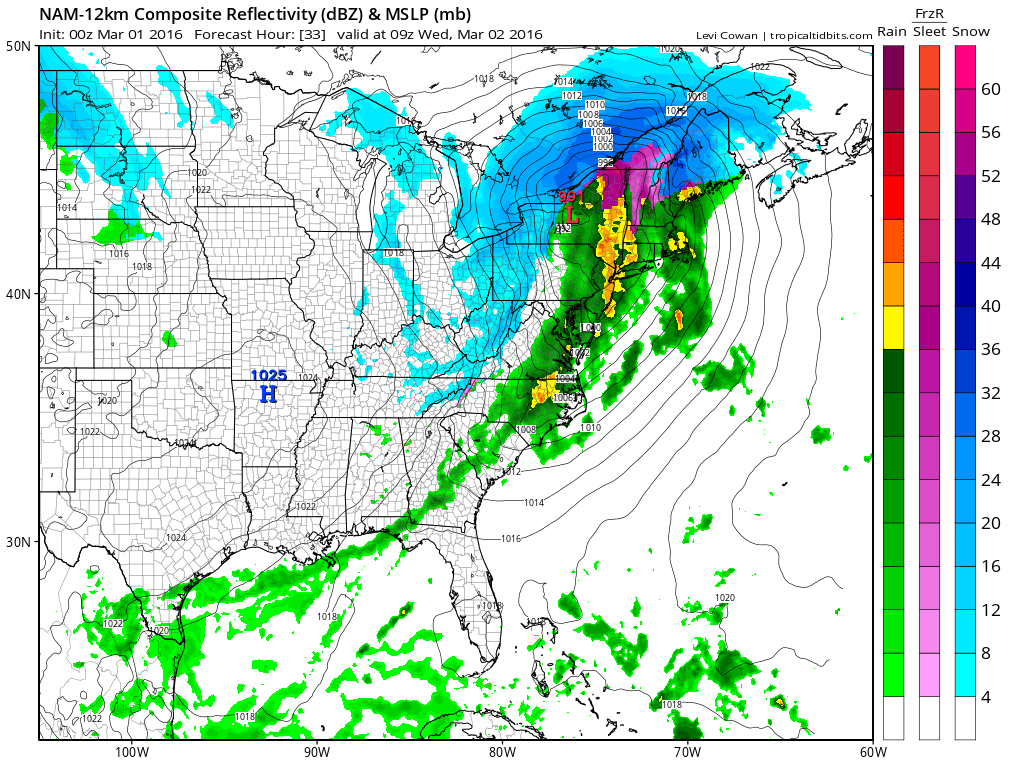
First off we have Wednesday’s weather system which will push a cold front through. It should be noted that while other models like the GFS model and the Canadian have changed a few times regarding this, the Euro model has been the most consistent with a single low tracking to our west. The NAM model goes along with this idea and brings through some showers and downpours here Tuesday night into Wednesday morning. A thunderstorm is not out of the question here but I don’t think severe weather is going to be an issue. Rainfall amounts are forecast to be around half an inch with higher amounts as you go north and northeast.
NAM Model Late Week Forecast LATE AFTERNOON WEDNESDAY UPPER AIR
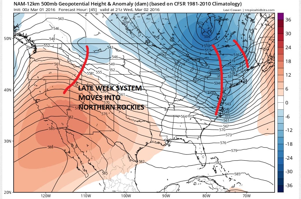
When compared to the last several runs of the NAM, the upper air matches up fairly well. There are some subtle differences in the position of the upper low in Eastern Canada and the weather system coming into the Northern Rockies. But so far there isn’t too much of a difference to in the nam model at this point so there is no discernible trend that I can see. However at 60 hours which is Thursday morning, the surface low is a little further northeast from the prior 2 nam model runs.
NAM Model Late Week forecast THURSDAY MORNING SURFACE MAP
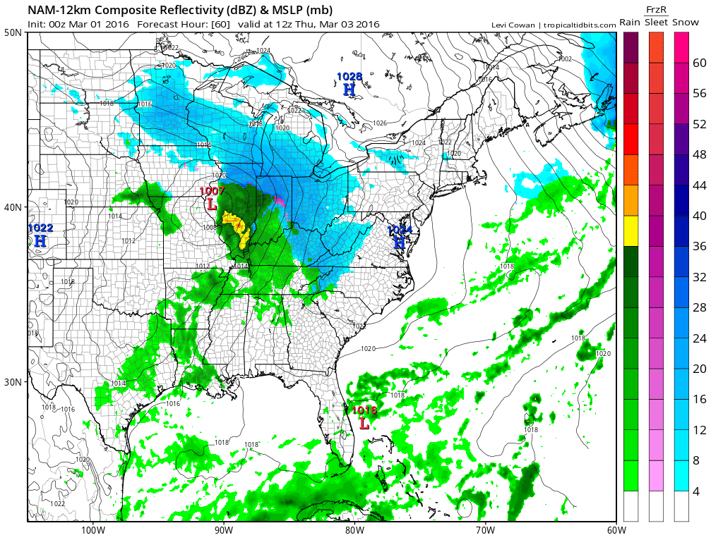
The NAM model speed of the southern system is faster than the other models. It has precipitation not that far away from our area by Thursday afternoon. How much of that is actually reaching the ground is a big question. If you want snow you want the primary low in the Ohio Valley to track as far north as it can given the strong dominant northern jet stream.
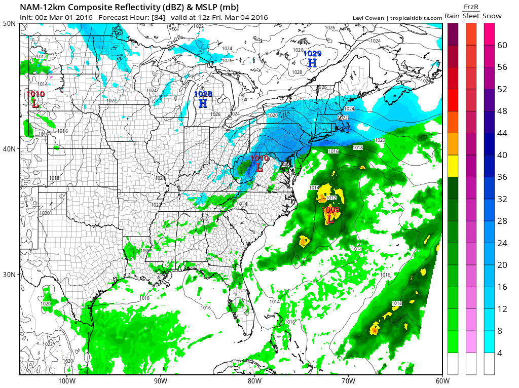
By Friday morning the NAM produces a coating to an inch or 2 across the area. Frankly I’m a little underwhelmed by this run as the features are shown to be rather weak. The model already has a weak secondary low forming offshore and moving northeast. This is unlike the other dayside models particularly the Canadian which appears way over developed compared to this. But remember this is the NAM model which can occasionally get things right and at other times can be very unreliable. Let’s wait until the overnight model series is done to figure this one out.
FiOS1 News Weather Forecast For Long Island
FiOS1 News Weather Forecast For New Jersey
FiOS1 News Weather Forecast For Hudson Valley
NATIONAL WEATHER SERVICE SNOW FORECASTS
LATEST JOESTRADAMUS ON THE LONG RANGE
Weather App

Don’t be without Meteorologist Joe Cioffi’s weather app. It is really a meteorologist app because you get my forecasts and my analysis and not some automated computer generated forecast based on the GFS model. This is why your app forecast changes every 6 hours. It is model driven with no human input at all. It gives you an icon, a temperature and no insight whatsoever.
It is a complete weather app to suit your forecast needs. All the weather information you need is right on your phone. Android or I-phone, use it to keep track of all the latest weather information and forecasts. This weather app is also free of advertising so you don’t have to worry about security issues with your device. An accurate forecast and no worries that your device is being compromised.
Use it in conjunction with my website and my facebook and twitter and you have complete weather coverage of all the latest weather and the long range outlook. The website has been redone and upgraded. Its easy to use and everything is archived so you can see how well Joe does or doesn’t do when it comes to forecasts and outlooks.
Just click on the google play button or the apple store button on the sidebar for my app which is on My Weather Concierge. Download the app for free. Subscribe to my forecasts on an ad free environment for just 99 cents a month.
Get my forecasts in the palm of your hand for less than the cost of a cup of Joe!
![]()
![]()
<


