
Move Further West By GFS Overnight Run
Latest GFS model run shows the jet stream split flow pattern however this particular run shows a 2 big differences from prior runs. This is for the weather system for early next week.
The first difference is the model speed with a cold front which a few days ago was shown to arrive late in the weekend. The model continues to speed this weather system up and it appears that this front will through sometime Friday evening and is nearly 18 hours faster than the day run European model. This is because the gfs weather forecasting model has a much less impressive northern jet stream in this split flow pattern. Each run continues to show a weaker northern stream. If you recall prior posts I have said repeatedly that split flows offer their own challenges because of the strength of the individual jets. There is a delicate balance that needs to take place and at least per this model, we seem to have a weaker northern stream that pulls out which takes this next weather system further left. That is the second difference. With no northern jet to suppress the southern feature, it has no where to go but west and in this particular run, the low tracks west of Chicago!
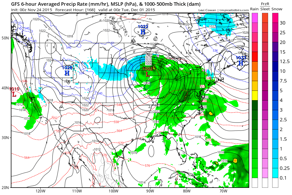
Im not understanding why the GFS model is so quick with this next front but it will be interesting to see if the European caves to this idea. The weaker lead system means the air this weekend isn’t going to be all that cold. I will update this in the morning after a good night’s sleep and taking a look a what the other models are showing.
I should make clear that even though there have been posts peppered throughout social media land over the last day or so, not one of my posts has even discussed or shown a snow map. Right now my focus has been on how this split flow is evolving and nothing more. Anything beyond day 5 in my view in regards to a snow map or anything is in the land of shear speculation. Certainly with this setup on this model, you won’t see many snow maps flying around Tuesday morning. That being said, we will wait for what the European model has to say about all this.
JOESTRADAMUS WINTER 2015-2016


