More Records Fall Cold Night Ahead Temps Moderate Into Friday
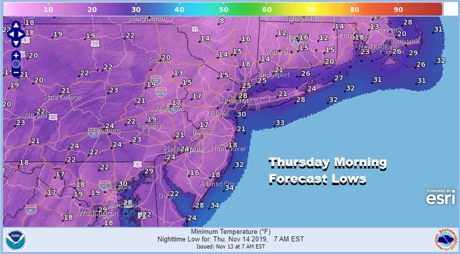
All the major reporting stations set record lows this morning and during the afternoon the highs set records as the lowest high temperatures recorded for the date. Skies are clear across the area but we see clouds offshore as well as clouds to the northwest. While we are sandwiched in between tonight we will stay clear at least for awhile which will allow inland temperatures to drop into the teens and urban centers in the 20s. If clouds come in after midnight temperatures will stop falling and may actually rise a few degrees into Thursday morning which will prevent records from being set. If it stays clear long enough than more records will fall for Thursday. No issues are showing up on the regional or local radars.
SATELLITE

REGIONAL RADAR

Thursday brings clouds in from offshore which could create broken to overcast skies over the area but the sun will try to poke through especially well inland. Temperatures Thursday will bounce back into the 40s but they would go higher were it not for the clouds.
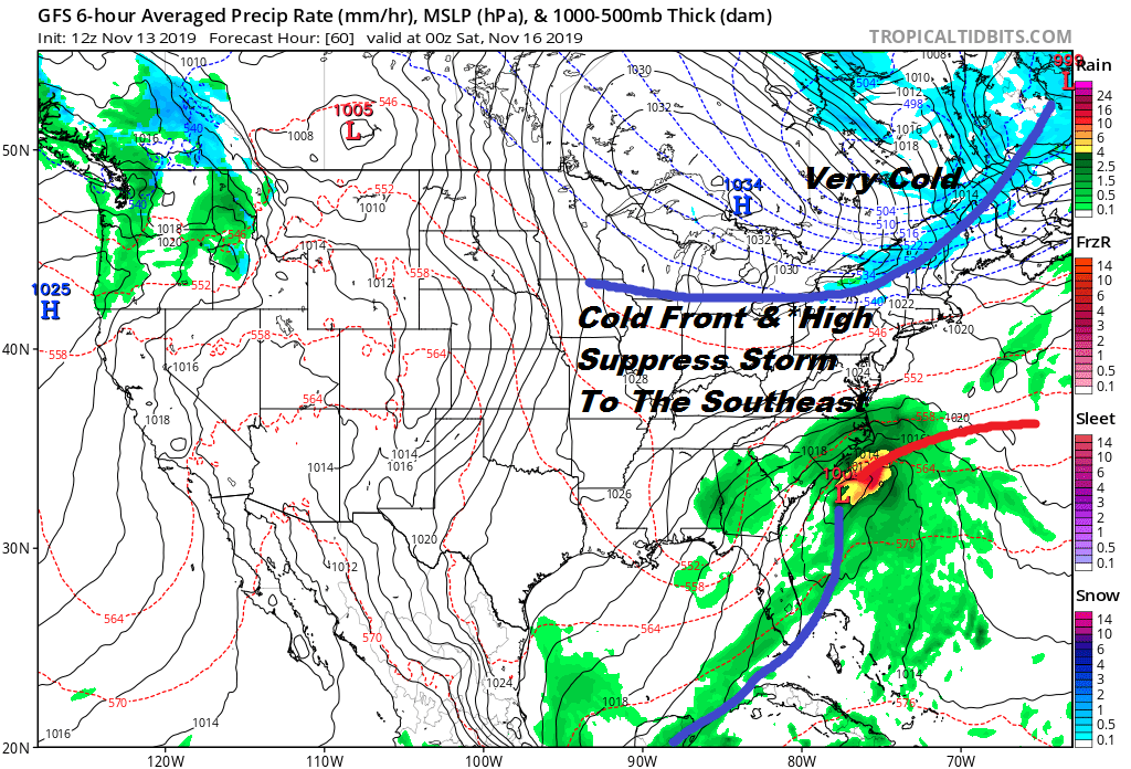
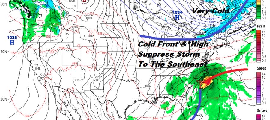
Friday will be the bounce day ahead of a cold front to the northwest and a storm off the South Carolina coast. The two streams of the jet streams remain separate so the cold front and high will suppress the coastal storm to the southeast with no issues here. Friday we will see a mix of sun and clouds and we should climb into the 50s before the front passes. The front is dry and colder air comes back for Saturday. We will have sunshine Saturday with a northeast wind and highs probably not getting out of the 30s.
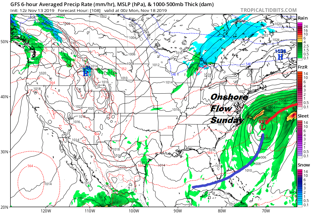
Sunday the high moves out to the east into New Brunswick and our coastal storm is well off the North Carolina coast. The issue for Sunday will be the onshore flow which may put us in clouds and keep temperatures just in the 40s but no rain is forecast for the weekend. Next week there could be another low off the Southeast Coast that will try and creep northward and it might come a little closer for Tuesday into Wednesday. The extreme cold pattern relaxes and the jet stream will be going through an evolution that might take a week or two to play out.
BE SURE TO DOWNLOAD THE FREE METEOROLOGIST JOE CIOFFI WEATHER APP &
ANGRY BEN’S FREE WEATHER APP “THE ANGRY WEATHERMAN!
MANY THANKS TO TROPICAL TIDBITS FOR THE USE OF MAPS
Please note that with regards to any severe weather, tropical storms, or hurricanes, should a storm be threatening, please consult your local National Weather Service office or your local government officials about what action you should be taking to protect life and property.


