DOWNLOAD MY NEW FREE JOESTRADAMUS WEATHER APP FOR ALL DEVICES
THE APP IS ABSOLUTELY FREE TO ALL BUT CONSIDERING SUBSCRIBING TO PATREON FOR A WEATHER EXPERIENCE FREE OF ADS, EXCLUSIVE VIDEOS FOR MEMBERS ONLY AND MUCH MORE…STARTS AT $2 A MONTH..MESSAGE ME AT ANY TIME
Model Differences Low Along East Coast Midweek
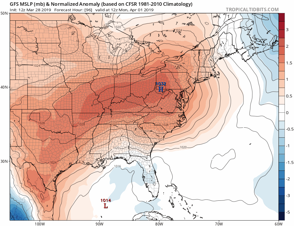
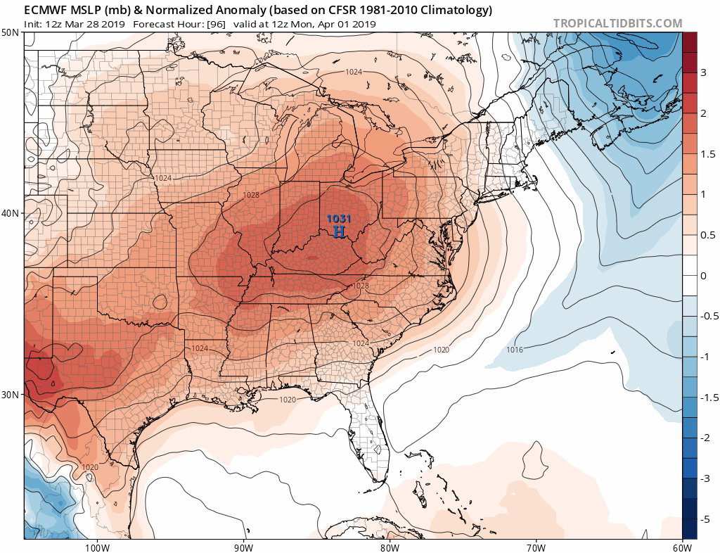
The cold front moving through Sunday will bring an end to the warm temperatures of Saturday and what will follow are two dry days Monday and Tuesday. The southern end of the front will stall out in the Gulf of Mexico and low pressure is likely to develop there Monday into Tuesday and then head across Florida to off the Southeast coast of the US. As usual we have model differences here as they try to settle on the strength of the northern jet stream and what the impact of that will be as the system attempts to make the turn northward along the East Coast.
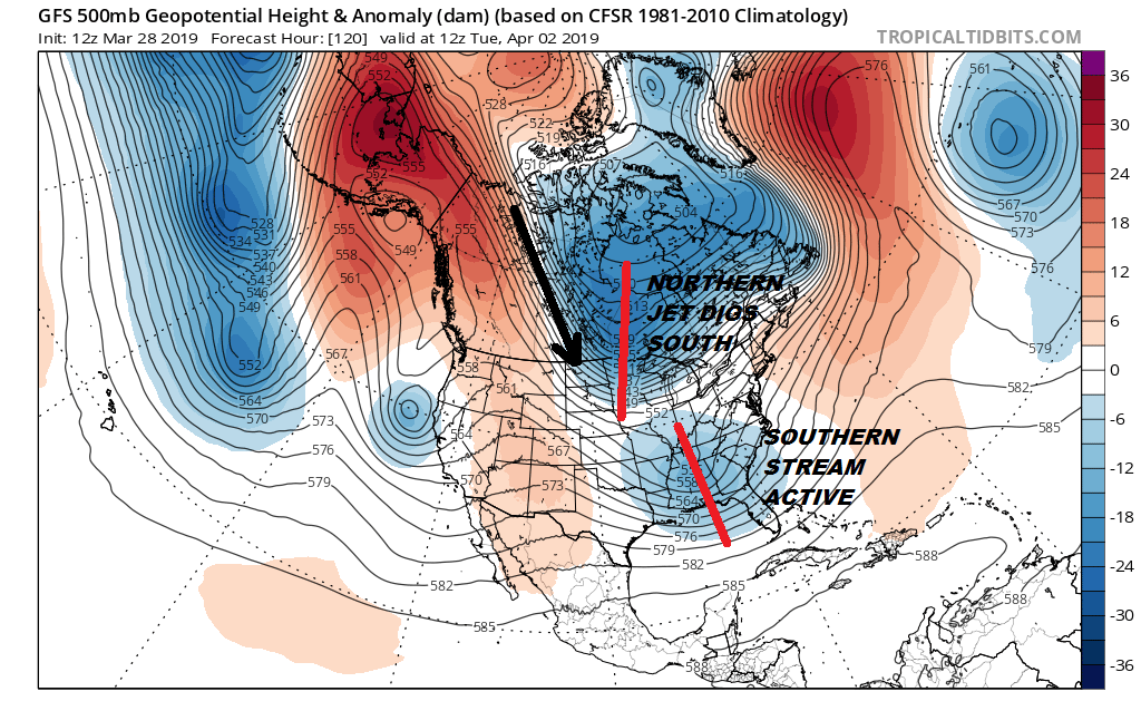
The GFS has a rather amplified look to it with an active southern stream trough and the northern jet driving a short wave into the Western Lakes. You can carry this out another 24 hours and picture that northern shortwave lifting the southern stream system northward along the East Coast. This would certainly argue for some rain late Tuesday into Wednesday along with some gusty winds along the coast.
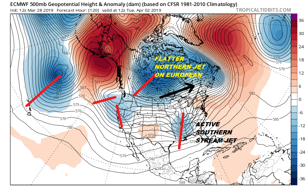
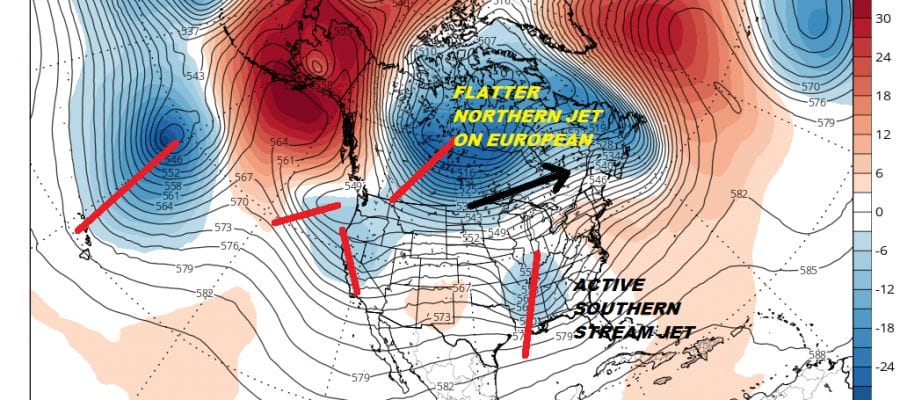
The European and the GFS agree on the southern jet fairly well. It is in the northern stream where the models diverge. The European has a flatter look across Southern Canada as much of the northern energy is focused in the Northwest/Northern Rockies rather than the Western Great Lakes. This would eject the southern stream system northeastward in similar fashion to the GFS. They both seem to get to the same place though the methods are a bit different.
Timing is the big difference between the two models as the GFS is about 18 hours faster than the European. The GFS would be Tuesday night into Wednesday while the European would be later Wednesday into Thursday.
I remain cautious here on all of this particularly with the way the GFS handles the northern part of the jet stream. That seems to go against the idea that the trough wants to go more to the west rather than in the East. We are in watch wait and see mode here going forward. In the meantime be sure to enjoy the relative calm and relative warmth we have into the weekend. By the way for you snow lovers the answer is NO!
MANY THANKS TO TROPICAL TIDBITS FOR THE USE OF MAPS
Please note that with regards to any tropical storms or hurricanes, should a storm be threatening, please consult your local National Weather Service office or your local government officials about what action you should be taking to protect life and property.