Maria Strengthening Rapidly All Sorts of Possibilities Long Range
Maria Strengthening Rapidly All Sorts of Possibilities Long Range
Maria seems determined to take out the lowest pressure in Irma which was 915 mb. Irma has been strengthening rapidly again with pressures dropping 12 millbars since this morning. Winds are now 165 mph as it moves west northwestward. The core structure of the hurricane remains intact and the satellite presentation remains excellent. There is no wind shear to speak of and the water is like a bathtub. Don’t be surprised if Maria challenges the 900 mb mark depending on the eye wall replacement cycles. Forecast tracks on hurricane tracking models have actually shifted a little further south which means that the eye of Maria will move over the Virgin Islands Weather conditions in the Virgin Islands are deteriorating now with a move through the islands overnight and a landfall in Puerto Rico early Wednesday morning around daybreak.
SATELLITE LOOP

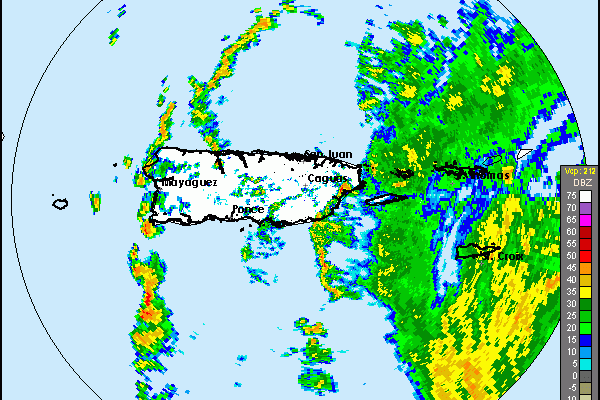
HURRICANE MARIA APPROACHES SAN JUAN RADAR
Radar from San Juan shows the first bands of rain arriving in Eastern Puerto Rico and the heavier bands now moving over the Virgin Islands. The eye of Maria is not yet in range.

HURRICANE MARIA LONGER TERM WILL HINGE ON WHAT JOSE DOES
What is so unusual about this hurricane season is that the 4 major hurricanes have come so close together and each one seems to have had an impact on the one that followed it. Irma pulled Jose northward, Jose will do the same to Maria and there are all sorts of possibiilites regarding its track. It seems Jose will be doing a loop just off our coastaline and it will be around for days and even drop southwestward. This creates a weakness in the ridge along the east coast that Maria responds to and turns northward.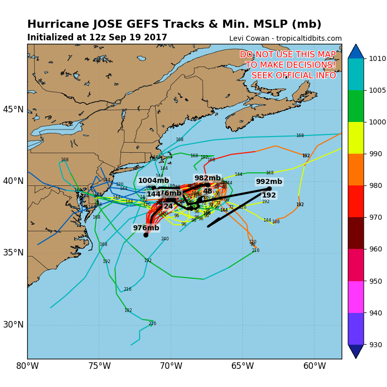
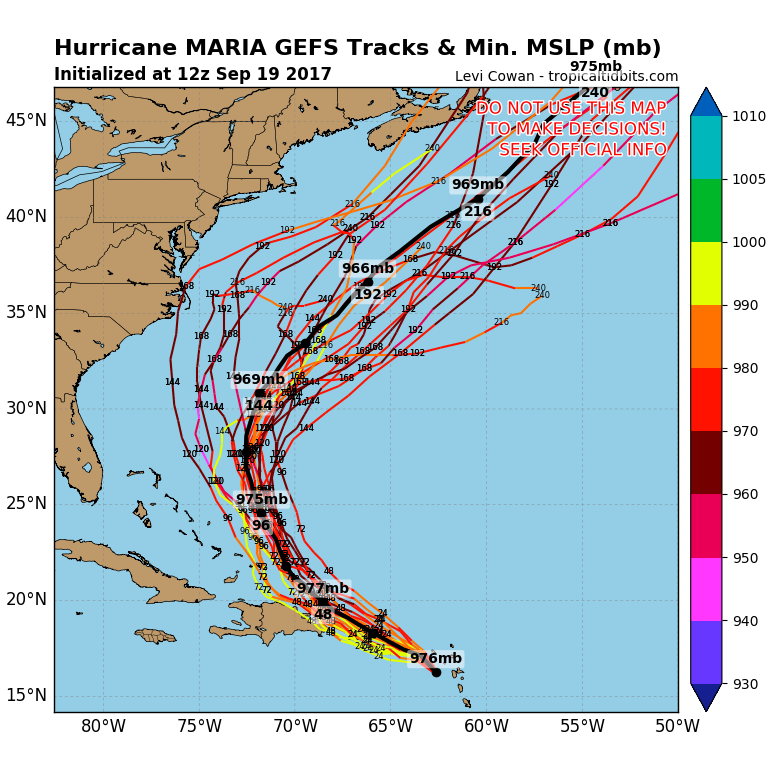
Above is the GFS and all its members offering all sorts of solutions and the most likely one is an out to sea solution. However there are all sorts of complications including one where Jose maintains a strong identity and rushes westward into the Middle Atlantic Coast. Today’s European model grabbed on to this idea and it is an idea it suggested 2 days ago as well.
EUROPEAN MODEL SATURDAY THROUGH NEXT WEDNESDAY
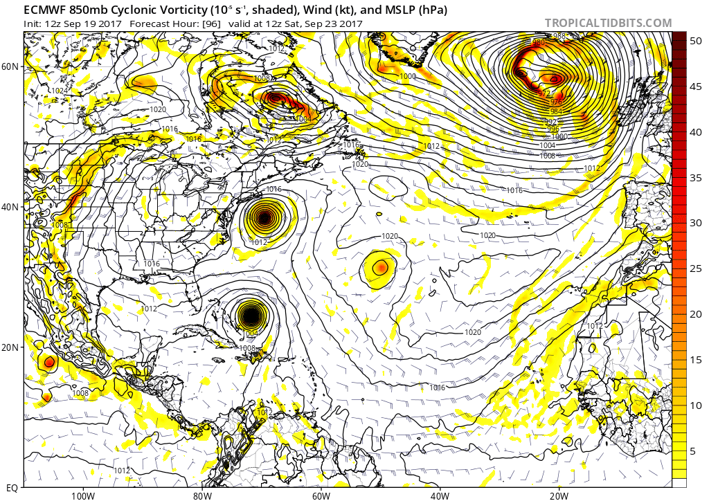
One of the important keys among several is a trough in the west that is going to swing eastward toward the East Coast as Maria is sitting offshore. Timing will mean everything here and the trough will either bring it northward nearer to the coast or kick it out to sea.
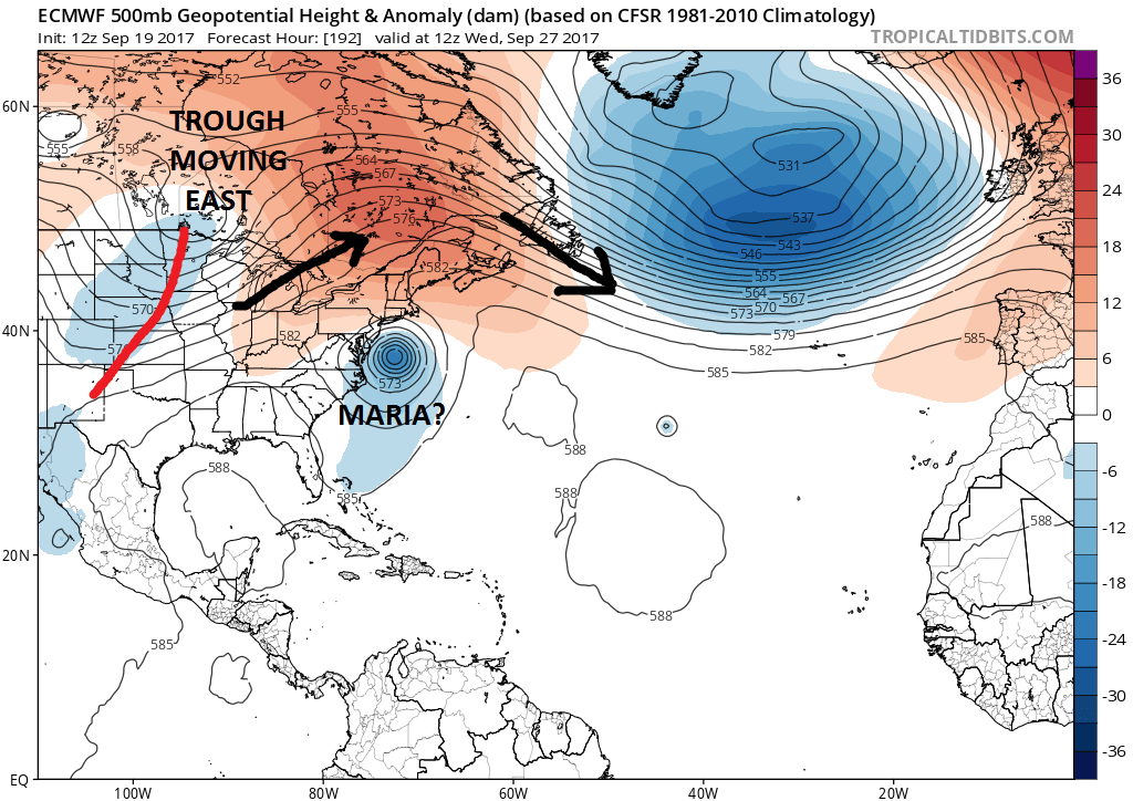
Going forward we will be watching Jose and what it does, Maria and what it does, and the the changes in the upper atmosphere across North America. One other possibility is if Jose moves away to the northeast which would allow Maria to move more to the west and toward the Southeast US coast. Right now everything is on the table.
FiOS1 News Weather Forecast For Long Island
FiOS1 News Weather Forecast For New Jersey
FiOS1 News Weather Forecast For Hudson Valley