Maria Near Turks Island 125 MPH Category 3
Maria Near Turks Island 125 MPH Category 3
…HURRICANE CONDITIONS OCCURRING ON THE TURKS AND CAICOS ISLANDS…
SUMMARY OF 800 AM EDT…1200 UTC…INFORMATION
———————————————-
LOCATION…21.9N 70.9W
ABOUT 30 MI…50 KM NNE OF GRAND TURK ISLAND
ABOUT 465 MI…745 KM ESE OF NASSAU
MAXIMUM SUSTAINED WINDS…125 MPH…205 KM/H
PRESENT MOVEMENT…NW OR 315 DEGREES AT 7 MPH…11 KM/H
MINIMUM CENTRAL PRESSURE…959 MB…28.32 INCHES
WATCHES AND WARNINGS
——————–
CHANGES WITH THIS ADVISORY:
The government of the Bahamas has changed the Tropical Storm Watch
for the central Bahamas to a Tropical Storm Warning.
SUMMARY OF WATCHES AND WARNINGS IN EFFECT:
A Hurricane Warning is in effect for…
* Dominican Republic from Cabo Engano to Puerto Plata
* Turks and Caicos Islands and the Southeastern Bahamas
A Tropical Storm Warning is in effect for…
* Dominican Republic west of Puerto Plata to the northern border of
the Dominican Republic and Haiti
* Central Bahamas
SATELLITE LOOP
Even though the eye of the hurricane has become cloud filled the latest pressure from the Air Force plane shows the pressure is still holding around 959 mb and the maximum winds are around 125 mph. Hurricane Maria is near Turks Island and continuing on a slow northwest course. A gradual turn to the north northwest and then to the north is forecast to occur later today or tonight.
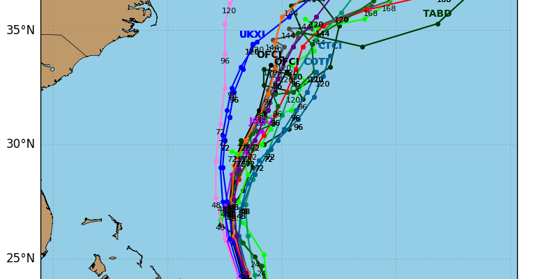
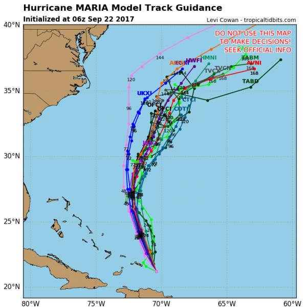
Hurricane model track guidance continues to remain fairly consistent and tightly clustered. Perhaps it nudged a little bit to the left (west) but they all turn Maria northeast out to sea once it reaches the latitude of North Carolina. The European model was a somewhat left of the GFS model before turning it northeast while the Canadian model is the only one with a land falling weakening Maria coming in from the East into North Carolina or Southeast Virginia. We continue to believe that the out to sea solution with Maria is the most likely outcome at this point.
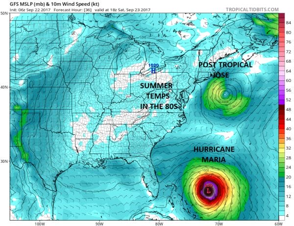
Once again Jose which is no longer a tropical storm but a post tropical one holds one of several keys here as it continues to sit off the coast of Southern New England on a slow westward drift. It is creating the weakness for Maria to turn northward but just how much of a weakness in the upper flow remains to be seen.
HURRICANE CENTER 8AM DISCUSSION AND 48-HOUR OUTLOOK
——————————
At 800 AM EDT (1200 UTC), the center of Hurricane Maria was located
near latitude 21.9 North, longitude 70.9 West. Maria is moving
toward the northwest near 7 mph (11 km/h), and a motion toward the
north-northwest is expected later today and Saturday. On the
forecast track, Maria’s eye will move near or just east of the Turks
and Caicos Islands and southeastern Bahamas today.
Maximum sustained winds are near 125 mph (205 km/h) with higher
gusts. Maria is a category 3 hurricane on the Saffir-Simpson
Hurricane Wind Scale. A gradual weakening is forecast during the
next 48 hours.
Hurricane-force winds extend outward up to 70 miles (110 km) from
the center, and tropical-storm-force winds extend outward up to 160
miles (260 km).
The minimum central pressure based on data from an Air Force
Reserve Hurricane Hunter aircraft is 959 mb (28.32 inches).
HAZARDS AFFECTING LAND
———————-
WIND: Tropical storm conditions across portions of the Dominican
Republic should subside during the next several hours. Hurricane
conditions are spreading into the Turks and Caicos Islands and the
southeastern Bahamas and will continue through today. Tropical
storm conditions are expected in the central Bahamas beginning
tonight.
STORM SURGE: A dangerous storm surge accompanied by large and
destructive waves will raise water levels by as much as 9 to 12 feet
above normal tide levels within the hurricane warning area of the
southeastern Bahamas and the Turks and Caicos Islands.
RAINFALL: Maria is expected to produce the following rainfall
accumulations through Saturday:
Turks and Caicos…8 to 16 inches, isolated 20 inches
Puerto Rico…additional 3 to 6 inches, isolated maximum storm
total amounts 40 inches
Eastern Dominican Republic…additional 4 to 8 inches, isolated
storm total amounts 20 inches
Western Dominican Republic and northern Haiti…additional 3 to 6
inches
Mayaguana, southeast Bahamas…4 to 8 inches
Inagua Islands and Crooked Island, Bahamas…2 to 6 inches
Rest of eastern Bahamas…1 to 3 inches
Rainfall on these islands will continue to cause life-threatening
flash floods and mudslides.
FiOS1 News Weather Forecast For Long Island
FiOS1 News Weather Forecast For New Jersey
FiOS1 News Weather Forecast For Hudson Valley


