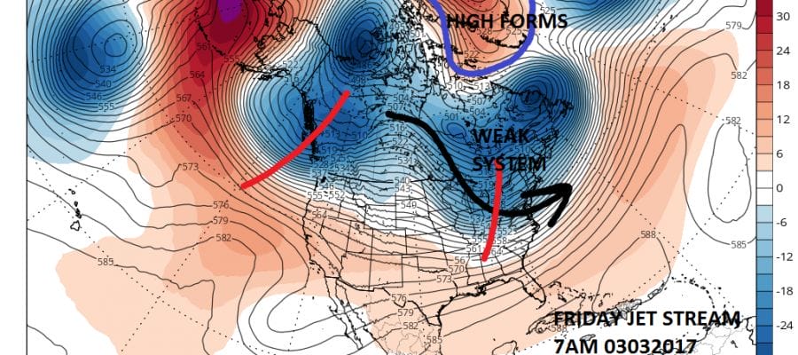
March Lion Blocking Pattern Developing

March Lion Blocking Pattern Developing
Weather models for the last 4 or 5 days across the board have been developing a signature blocking pattern in the North Atlantic. The differences lie in how strong a block and each model has its own ideas regarding this. Ultimately it will be the strength of such a block that will determine how cold it will be (or won’t be). Given the unstable nature of blocking patterns model volatility will continue to run rather high from day to day and from run to run. Blocking patterns have been responsible for some big storms in the past however the block alone is not a guarantee of any storm weak or strong. There are other factors in the atmosphere that are in play as well and the odds of all those factors coming together for one particular area are usually pretty low and are not going to be shown very well in the long range.

The block appears over the next few days and begins to strengthen as the week progresses. This forces troughing in the east and we do have a weak system that is rotating in the flow for Thursday night into Friday morning. There really isn’t much room for this system to develop and only precipitation is forecast from this. It should be cold enough for it to be snow and it looks like it could be a coating to a couple of inches for somebody from the Northern Ohio Valley to Southern New England.
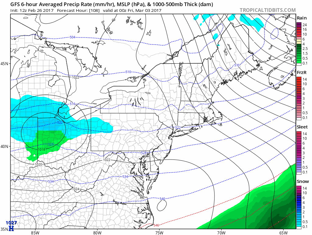
MARCH LION GFS MODEL CLIPPER SYSTEM THURSDAY NIGHT-FRIDAY MARCH 2-3 2017
CLICK TO ANIMATE
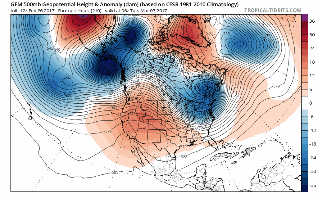
Once this system moves out models diverge somewhat because each model has a different idea of how the block evolves over time. The GFS model and Canadian model both show troughs in the east with the higher pressures over Greenland but again strength of the block dictates the depth of the trough.
GFS MODEL LONG RANGE MARCH 5-7 CLICK TO ANIMATE

The GFS wants to drive another storm into the Great Lakes early next week, The Canadian model does not. as the Canadian has a stronger block and does not see a western system coming into play.
CANADIAN MODEL LONG RANGE MARCH 5-7 CLICK TO ANIMATE
With regards to the short range, there will be another round of big volatility for Tuesday and Wednesday of this week and we will address this issue separately later today. In the meantime we watch the March lion come roaring in this week and see whether he plans to stick around for awhile. Meteorological spring begins.
MANY THANKS TO TROPICAL TIDBITS FOR THE WONDERFUL USE OF THE MAPS

GET JOE A CIGAR IF YOU LIKE!
SNOW REMOVAL COMPANIES FOR YOUR WINTER NEEDS
LONG ISLAND ROCKLAND COUNTY Connecticut

![]()

ROCKLAND COUNTY TRI STATE SNOW REMOVAL JOHNSTOWN PA


FiOS1 News Weather Forecast For Long Island
FiOS1 News Weather Forecast For New Jersey
FiOS1 News Weather Forecast For Hudson Valley
NATIONAL WEATHER SERVICE SNOW FORECASTS
LATEST JOESTRADAMUS ON THE LONG RANGE
Weather App

Don’t be without Meteorologist Joe Cioffi’s weather app. It is really a meteorologist app because you get my forecasts and my analysis and not some automated computer generated forecast based on the GFS model. This is why your app forecast changes every 6 hours. It is model driven with no human input at all. It gives you an icon, a temperature and no insight whatsoever.
It is a complete weather app to suit your forecast needs. All the weather information you need is right on your phone. Android or I-phone, use it to keep track of all the latest weather information and forecasts. This weather app is also free of advertising so you don’t have to worry about security issues with your device. An accurate forecast and no worries that your device is being compromised.
Use it in conjunction with my website and my facebook and twitter and you have complete weather coverage of all the latest weather and the long range outlook. The website has been redone and upgraded. Its easy to use and everything is archived so you can see how well Joe does or doesn’t do when it comes to forecasts and outlooks.
Just click on the google play button or the apple store button on the sidebar for my app which is on My Weather Concierge. Download the app for free. Subscribe to my forecasts on an ad free environment for just 99 cents a month.
Get my forecasts in the palm of your hand for less than the cost of a cup of Joe!
![]()
