
This is a sponsored post written by me on behalf of Urgent.ly for IZEA. All opinions are 100% mine.
Long Range Blocking Woes

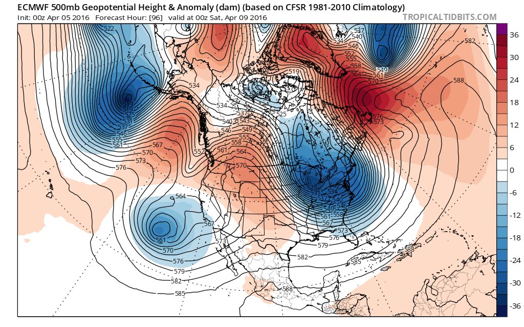
There are no major changes in the long range indicators. What stands out is the very strong blocking pattern that is setting up across the North Atlantic. This is something that models tried to show from time to time during the winter with no success. Now that few really want it, it naturally appears. Actually when you think about the winter we had with the strong El Nino, it seems only natural that the atmosphere seems to be reversing itself now as the El Nino wanes and the La Nina takes over.
Long Range Blocking Woes Outlook Long Range Teleconnections

The first change will come Thursday as another cold front approaches. Ahead of it temperatures will moderate Wednesday as we head back into the 50s. With the front coming through Thursday we should hit the 60s with showers likely. Cold air does not return in a rush however it is there building across Central Canada and beginning to make its move southward.
Long Range Blocking Woes GFS model Friday Night
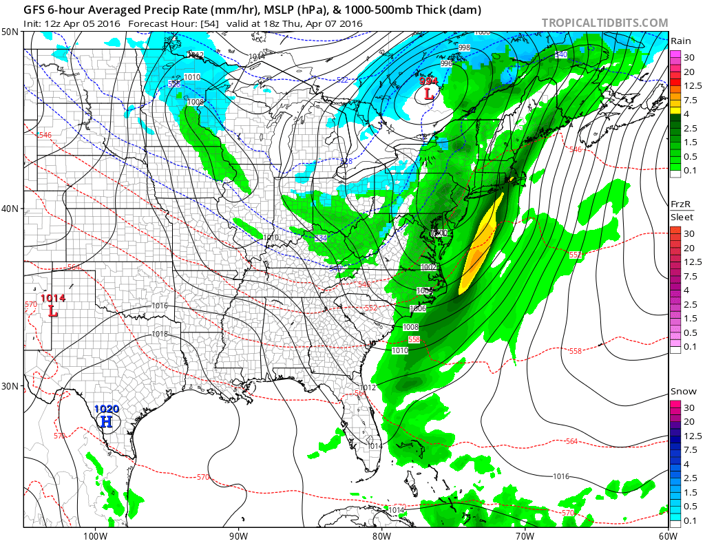
The upper air pattern is shaping up for another vortex to come into position over Hudson’s bay. This is also accompanied by a strong disturbance dropping southward toward the Ohio Valley. This has implications for later Saturday into Sunday morning. Once again we are faced with the run to run battles over timing and phasing (or no phasing). The Euro model showed something like this last night and the GFS model today follows the same pattern.
Long Range Blocking Woes GFS model & EURO model Saturday Night

Both models point to some sort of storm development off the Middle Atlantic Coast. The broadness of the trough would suggest a low that goes out to sea or skims the coast with some precipitation. The GFS model today makes it a relatively close call. Among the many keys is what is going on upstream in Northern Canada. Another upper low is forming there and will move southward which forces the system to the south to move along in time. We will now wait to see what the Euro model does with this today. Regardless of storm development, the weekend will feature another round of much below normal temperatures across much of the Eastern United States.
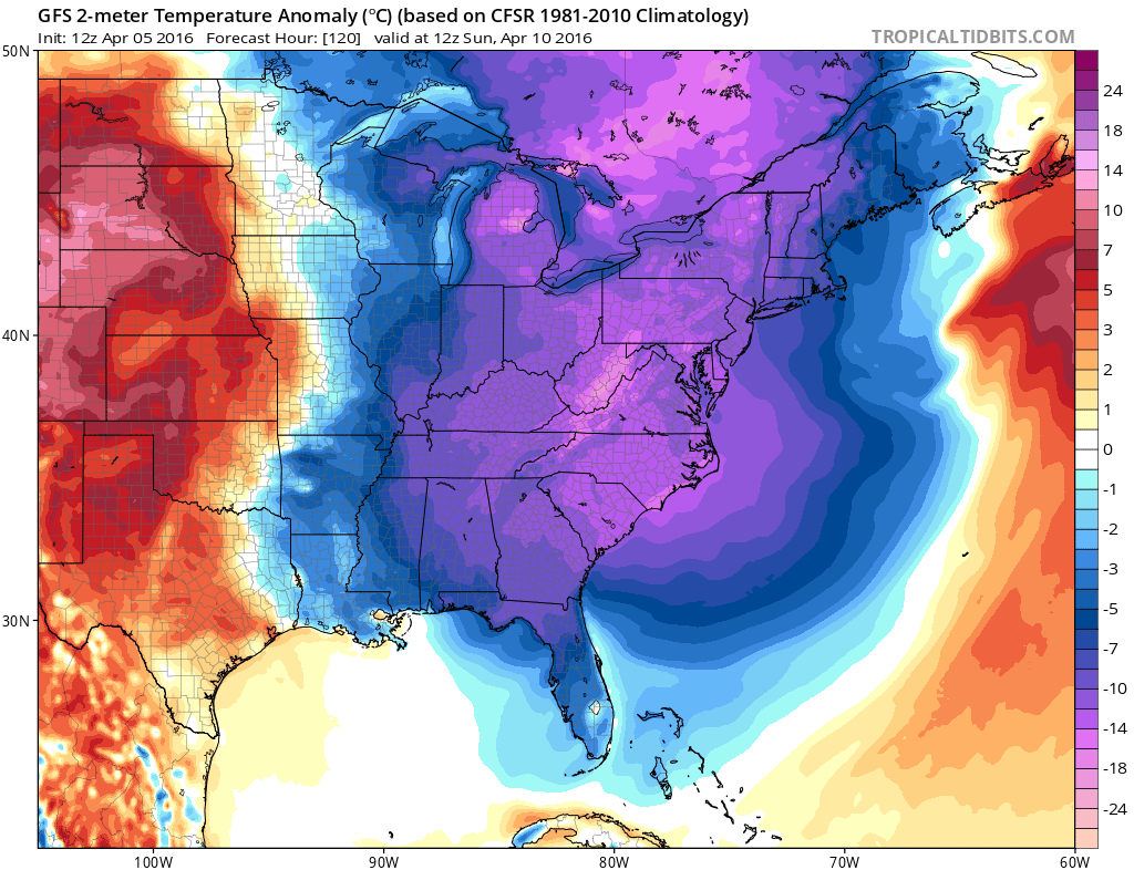
The good news for you warm weather lovers. The vortex does pull out early next week which should lead to a brief warm up of sorts for a few days. Meanwhile all eyes on the Euro model run which begins shortly.
NATIONAL WEATHER SERVICE SNOW FORECASTS
LATEST JOESTRADAMUS ON THE LONG RANGE
