Long Range Autumn Pattern Controls North America
Hurricane Michael has kept us rather busy lately so we haven’t been able to comment much about the large scale pattern change that is underway at the moment. We are finally done with the warm humid conditions around here and we will be transitioning to a real autumn pattern going forward for the rest of the month and possibly longer. Yes there could be the odd warmer day in between cold fronts but overall below average temperatures will be taking hold of the weather in the Eastern US until further notice.
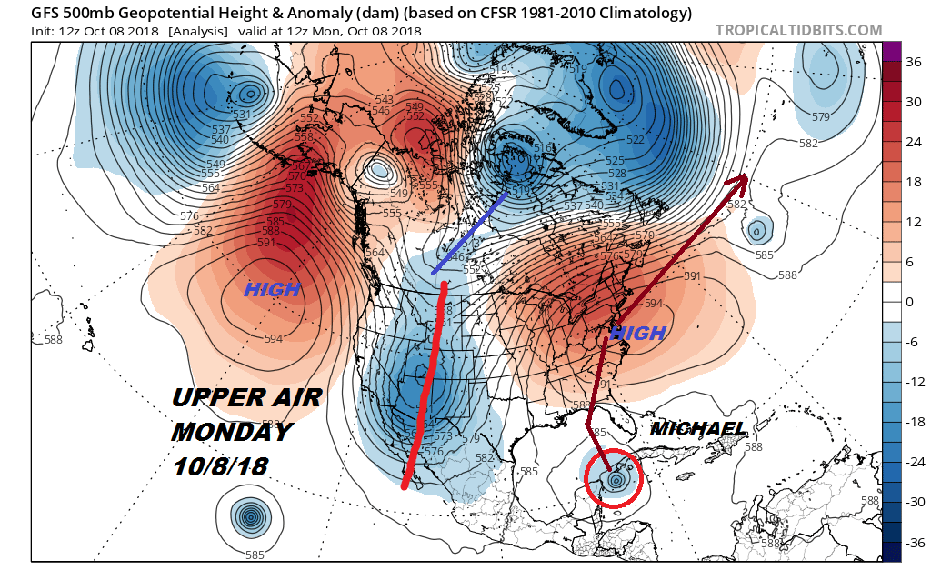
Let’s go back to Monday when we were setting the table for Hurricane Michael. The upper air had that large ridge along the East Coast, a deep trough in the West and a ridge in the Gulf of Alaska. Another deep trough was lined up along the International Dateline. This was our warm tropical set up for the East this week. But in this jet stream flow the seeds of change in the pattern were planted and they are bearing Autumn fruit this weekend
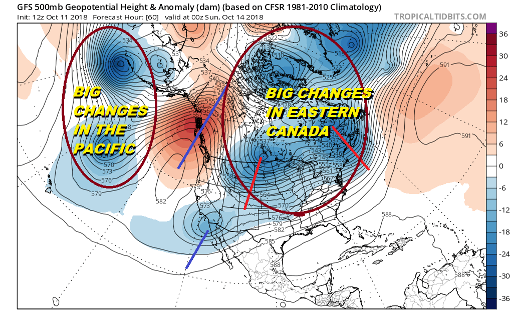
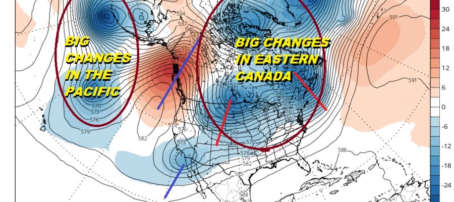
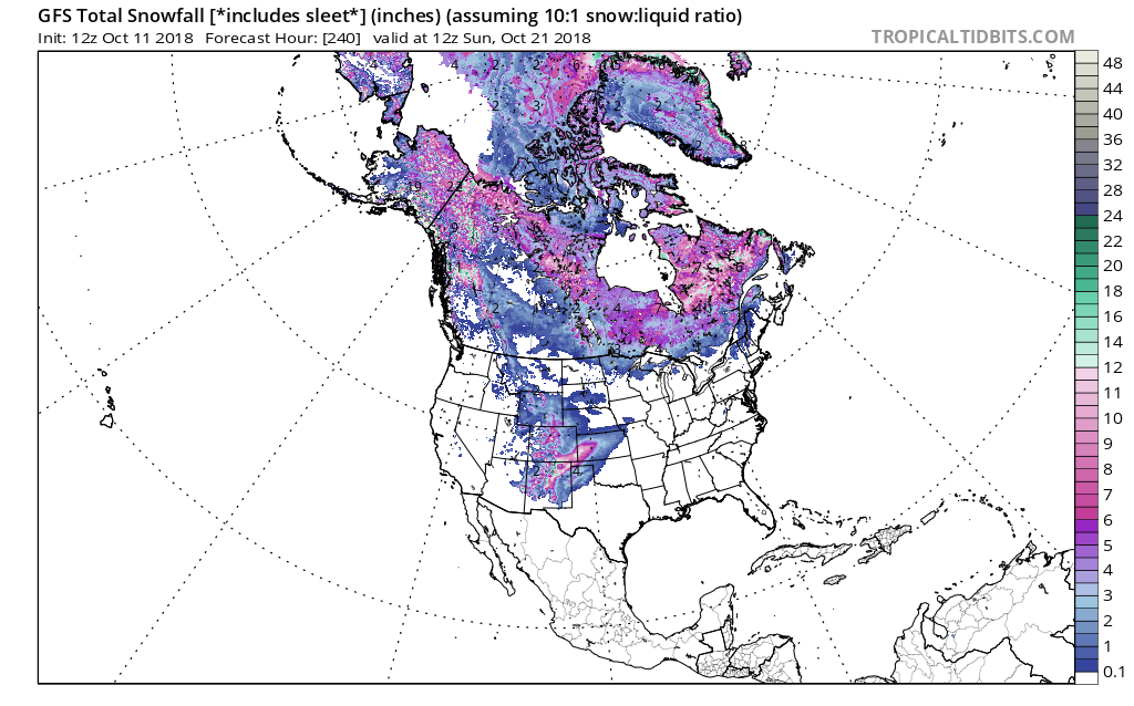
The upper air pattern undergoes a radical change across Eastern Canada as well as in the Pacific. The upper high in the Gulf of Alask shifts eastward into the Canadian northwest while we see a wholesale collapse of the ridge in the Eastern US. Eastern Canada sees a busy upper air pattern developing with a large complex of three strong upper air lows. This opens the door wide open for chilly Canadian air to flood most of the US with cooler than normal air this weekend. The first push comes in Friday and through the weekend with another push during next week. This at least means frequent cold fronts will be coming through so other than the odd day where temperatures warm up somewhat, a new shot of cooler air follows. There is no sign of the ridge in the East coming back in the long range. Global model all support each other on these changes though the day to day details vary. All of these changes will lead to parts of the US (mainly in the Rockies) seeing their first snows of the season.
Before anyone asks the answer is NO! The next six weeks we will be watching closely how snow cover grows across North America and Siberia. As for the tropics keep an eye for an early shutdown of the hurricane season. If it materializes and the ridge in the east doesn’t return, it could be a bullish signal for an early start to winter.
SUBSCRIBE TO PATREON FOR A WEATHER EXPERIENCE FREE OF ADS, EXCLUSIVE VIDEOS FOR MEMBERS ONLY AND MUCH MORE…STARTS AT $2 A MONTH..MESSAGE ME AT ANY TIME

THANKS TO TROPICAL TIDBITS FOR THE USE OF MAPS
Please consult your local National Weather Service office at weather.gov for the latest information on any tropical or storms or hurricanes that could be a threat to your area. Consult your local government officials regarding action you may need to take to secure life and property
FiOS1 News Weather Forecast For Long Island
FiOS1 News Weather Forecast For New Jersey
FiOS1 News Weather Forecast For Hudson Valley