Last Weekend of Summer Dry Warmer, Week Ahead Hints And
Tropical Storm Fiona Latest Update

We have arrived at the last weekend of the summer season and it will go out as most of the summer weekends have which is warm with sunshine and no rain. Before we get there however we have today which is going to be a nice sunny day. We bottomed this morning in the 40s in many areas away from warmer urban centers. We have actually seen the first 30s this morning in Northwest New Jersey and over parts of Eastern Long Island!

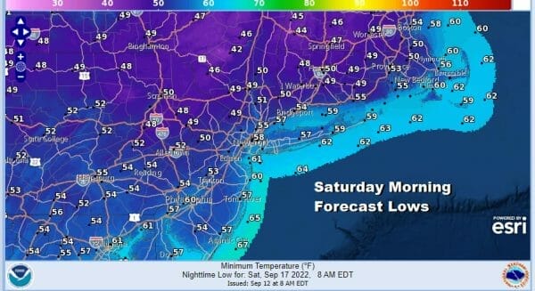
As for high temperatures today, we should reach the middle to upper 70s. Some of the warmest spots in South Jersey and points southward might tough 80 degrees. Humidity levels are very low thanks to dew points in the 40s to around 50. Tonight looks to be another coold night under clear skies and light winds. The lengthening nights are allowing temperatures to fall. Most lows again will be in the 50s in coastal areas, closer to 60 or so warmer urban centers and 40s inland.
High pressure will make its way from New England to off the Middle Atlantic coast. After a cool start Saturday we will see lots of sunshine. Dew points will come up a little but it will still be nice and comfortable. Highs will be in the upper 70s along the coast and we should reach 80 or lower 80s inland.

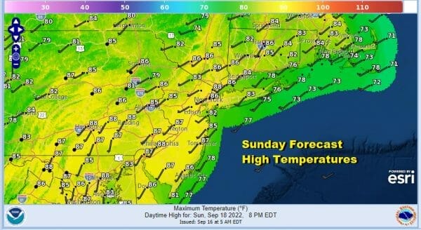
The warm up continues Sunday though we will still have another day of partly to mostly sunny skies. It will technically be more humid because dew points will make their way into the lower 60s but that is still relatively reasonable. Highs Sunday will be in the mid to upper 80s. Again no rain is forecast for Eastern Pennsylvania to Southern New England right through the weekend.
TROPICAL STORM FIONA & THE WEEK AHEAD
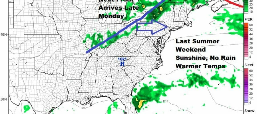
Next week begins with the first of two cold fronts. Neither front is going to be able to produce much in the way of rain however. Monday will be very warm and humid with partly sunny skies ahead of the front and the chance there could be a downpour or thunderstorm late in the day as the front passes. Monday’s highs will reach the mid to upper 80s and even a 90 degree high in hot spots are not impossible. It will be cooler at the shore.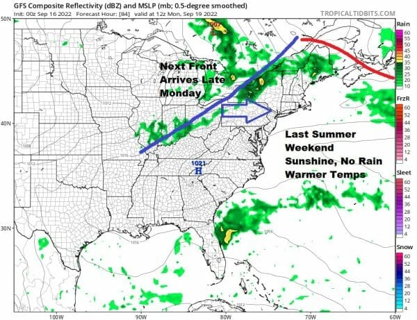
It won’t turn much cooler behind the first cold front and we will have to wait for a stronger front late Thursday. Tuesday and Wednesday will be dry and warm. Thursday could see a shower or thunderstorm. Highs each day will be in the 80s. After that it will turn much cooler for Friday. We will get more specific over the weekend. Both weather fronts will have some impact on Tropical Storm Fiona which is approaching the Leeward Islands today.
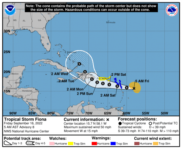
SUMMARY OF 500 AM AST…0900 UTC…INFORMATION
———————————————-
LOCATION…15.7N 58.1W
ABOUT 265 MI…425 KM ESE OF THE LEEWARD ISLANDS
MAXIMUM SUSTAINED WINDS…50 MPH…85 KM/H
PRESENT MOVEMENT…W OR 260 DEGREES AT 15 MPH…24 KM/H
MINIMUM CENTRAL PRESSURE…1004 MB…29.65 INCHES
SUMMARY OF WATCHES AND WARNINGS IN EFFECT:
A Tropical Storm Warning is in effect for…
* Antigua, Barbuda, St. Kitts, Nevis, Montserrat, and Anguilla
* Saba and St. Eustatius
* St. Maarten
* Guadeloupe, St. Barthelemy, and St. Martin
A Tropical Storm Watch is in effect for…
* Puerto Rico, including Vieques and Culebra
* U.S. Virgin Islands
* British Virgin Islands
Fiona is not a well developed system and remains a sheared tropical cyclone. Strong westerly winds aloft are keeping the storm disorganized and it probably won’t strengthen much as it begins to interact with the islands over the next several days. Maximum winds are 50 mph and we have Tropical Storm Warnings for the Northern Leeward Islands and Tropical Storm Watches for Puerto Rico as of 5am this morning. The two fronts will try to pull Fiona northward bringing it into the Atlantic side and near the Southeast Bahamas by the middle of next week. The question is whether Fiona will be able to exploit a weakness in the upper ridge along the East Coast which will allow it to turn north and northeast offshore, or will the storm stay weaker and further south and southwest. Those are the issues that lie ahead and we probably won’t have a clearer picture on Fiona until early next week.
BE SURE TO DOWNLOAD THE FREE METEOROLOGIST JOE CIOFFI WEATHER APP &
ANGRY BEN’S FREE WEATHER APP “THE ANGRY WEATHERMAN!
MANY THANKS TO TROPICAL TIDBITS & F5 WEATHER FOR THE USE OF MAPS
Please note that with regards to any severe weather, tropical storms, or hurricanes, should a storm be threatening, please consult your local National Weather Service office or your local government officials about what action you should be taking to protect life and property.


