
Last Summer Days Dry Rain Wednesday Night Into Thursday Blocking Long Range

Weather in 5/Joe & Joe Weather Show Latest Podcast
Last Summer Days Dry Rain Wednesday Night Into Thursday Blocking Long Range
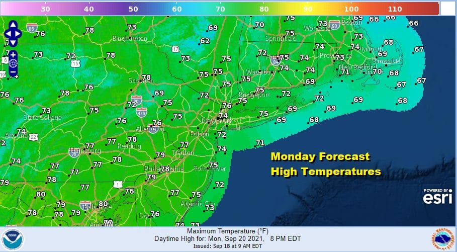
The new work week begins and no one would blame you if you extended your weekend by a day. We have mainly cloud free conditions in the Northeast and Mid Atlantic states. The satellite shows the eastern edge of clouds back in Ohio and Kentucky. Things are moving slowly in the atmosphere these days with a strong high moving off the New England coast keeping dry air in. Look for a good deal of sunshine today with highs in the 70s to near 80 degrees with reasonable humidity. There are no radar issues to deal with.
SATELLITE

WEATHER RADAR

Over the next 2 days it will be a slow deterioration of weather conditions. Dew point will gradually increase as the winds become more east, then southeast, and then south. This is the time of year that we see overnight low clouds develop and I think we could see some tonight into Tuesday morning but that should burn off to partly sunny skies Tuesday. Highs will be in the 70s to near 80 degrees.

Humidity levels gradually come up as we head into to Wednesday and Thursday. Showery rains will start to develop and we will see and period of heavy rain for a few hours Wednesday night. Then the rains end from west to east as we move through the day Thursday though it may take all day to get the rain out from coastal areas. Inland areas should see some slow improvement. Wednesday’s highs will be in the 70s to near 80. Behind the front comes cooler air with highs Thursday in the just into the 70s. Friday will be nice and cool with sunshine. Most highs will be in the 60s to around or just over 70 degrees.
BE SURE TO DOWNLOAD THE FREE METEOROLOGIST JOE CIOFFI WEATHER APP &
ANGRY BEN’S FREE WEATHER APP “THE ANGRY WEATHERMAN!

MANY THANKS TO TROPICAL TIDBITS & F5 WEATHER FOR THE USE OF MAPS
Please note that with regards to any severe weather, tropical storms, or hurricanes, should a storm be threatening, please consult your local National Weather Service office or your local government officials about what action you should be taking to protect life and property.


