Labor Day Sunshine As Dry Weather Pattern Continues For Much of This Week
We have come to the final day of the Labor Day holiday weekend and other than some patchy clouds that are on the satellite loops this morning along the coast of Long Island and Southeast New England, it is another day of partly to mostly sunny skies. The wind from the east will keep temperatures in check as a dry high to the north and northeast remain in charge. Highs today will be in the upper 70s with some warm spots touching 80 while it will be a few degrees cooler along the coast thanks to the east wind. Radars are nice and quiet and will remain soon for another 3 days at least. Most lows tonight under mainly clear skies will be in the 50s with some warm spots closer to 60 and that would be in urban areas mostly.
SATELLITE WITH LIGHTNING STRIKES
WEATHER RADAR
There is nothing regarding the overall weather pattern that seems to be changing anytime soon. The general northwest flow from Canada continues and this current high moves to Atlantic Canada with an arm back across the Northeast. That keeps it dry through at least Wednesday. Then as the high finally gives way we do have a weather front that will be approaching the Northeast and Middle Atlantic states Thursday.
What is lacking as far as moisture is concerned, is any kind of inflow from the Gulf of Mexico or the Atlantic as they remain virtually cut off from any weather system moving into the Eastern US. As the European model shows, the moisture with this cold front basically starts to dry up as it reaches the East Coast later Thursday or Thursday night so it is conceivable that this front could come through and not produce much in the way of rainfall.
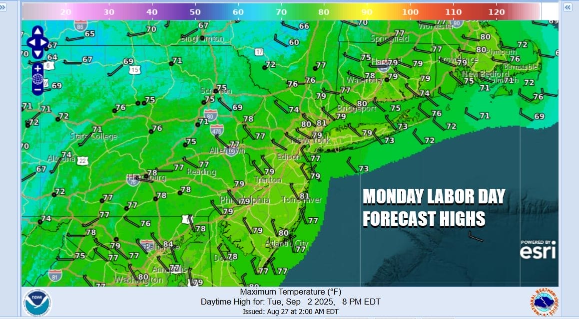
Ahead of this for Tuesday as well as for Wednesday, both days should feature no worse than partly sunny skies. We may be getting into a place where some low clouds and fog develop during overnight periods just to burn off after sunrise. Highs both Tuesday and Wednesday will be in the upper 70s to around or even just over 80 degrees inland and cooler low and mid 70s along the coast. No rain is forecast for either day.
Thursday we will put in the for the chance there could be some scattered showers late in the day or Thursday night but ahead of it we will see clouds and some sun with highs in the upper 70s to lower 80s. We expect the front to move along to the east and another dry cool air mass from Canada is likely to build into the Northeast and Middle Atlantic states next weekend. No major weather issues are in sight including the tropics which for now remain rather quiet.
BE SURE TO DOWNLOAD THE FREE METEOROLOGIST JOE CIOFFI WEATHER APP \\\&
ANGRY BEN’S FREE WEATHER APP “THE ANGRY WEATHERMAN!
MANY THANKS TO TROPICAL TIDBITS FOR THE USE OF MAPS
Please note that with regards to any severe weather, tropical storms, or hurricanes, should a storm be threatening, please consult your local National Weather Service office or your local government officials about what action you should be taking to protect life and property.