Jose Stalls East of the Bahamas 85 mph Winds
Jose Stalls East of the Bahamas 85 mph Winds
The satellite loop of Hurricane Jose shows us a rather ill defined hurricane with top winds of 85 mph. Jose has been essentially under a stranglehold moving in tandem with hurricane Irma but now that Irma has weakened the stranglehold is broken leaving Jose in the middle of atmosphere nowhere at the moment. There is no real push in either direction so Jose looks to still still for awhile until something begins to move it one way or the other.
SATELLITE LOOP

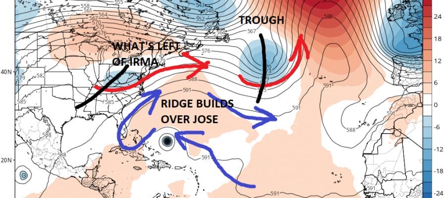
The upper air steering pattern with Jose is extremely weak at the moment because Jose lies between 2 strong features in the upper atmosphere; one being Irma to the northwest and a strong non tropical storm to the northeast. In the middle is a weak ridge of high pressure that is forecast to build over the next 2 days. This should turn Jose toward the west.
GFS UPPER AIR STEERING THURSDAY 8PM
Weather models like the GFS above build the upper high around Jose and cradle it. The clockwise flow around the high will give it a push to the west or west northwest. Jose is cut off from the main jet stream that lies to the northwest. Jose will be able to push westward as long as that ridge holds and that is the key question here. Will the ridge hold and force Jose toward the Bahamas or will it begin to break down?
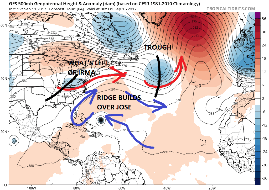
GFS UPPER AIR STEERING SATURDAY NIGHT

The GFS model for Saturday night would suggest the upper high slides to the east and Jose rotates around it but it is not as clear cut as it looks. The European model and the late afternoon GFS show a weak trough dropping into the Northeast creating a small but significant weakness which could allow Jose to turn north and northeastward passing offshore and perhaps being a threat for Nova Scotia.

The situation becomes more complicated. If that trough is very weak or a non factor, there is one other possibility and that is that the ridge in the Atantic is stronger for a longer period of time (much like what happened with Irma) and pushes Jose further west. There is another upper high building to the west of Jose which could create a bit of a bridge. This is probably a long shot however 2 of the hurricane track models as well as the UK Met model (British model) show this.
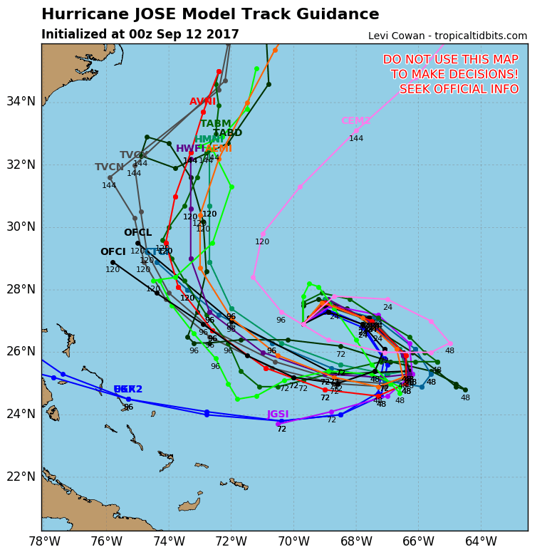
The hurricane tracking models show that uniformity of a northwest and then a turn to the north offshore but you can see the two models that track it more toward the west. Needless to say that at least through day 4 in the long range we are in good agreement on. After that the uncertainty grows. Odds favor a north and then northeast out to sea solution but the recent experience with Irma and the extended westward motion leave the door of uncertainty open. This is the very reason why you can’t look at long range map prints with any degree of confidence. The amount of variability in the atmosphere and the possibilities grow as time passes.
 GET JOE A CIGAR IF YOU LIKE

FiOS1 News Weather Forecast For Long Island
FiOS1 News Weather Forecast For New Jersey
FiOS1 News Weather Forecast For Hudson Valley