Jose Moving West Euro UK Models Also Moving West
Jose Moving West Euro UK Models Also Moving West
Tropical Storm Jose with winds of 70 mph still has a sheared look to it though we are seeing thunderstorms increasing a bit near the center. Movement is to the west at a slow 6 or 7 knots as it responds to the building ridge of high pressure aloft. Westerly motion should continue for the next day or 2 and then after that a turn toward the northwest and north will begin. How far west will be key to whether Hurricane Jose will be a close call or a much closer call. Weather models today did shift westward by a rather significant amount.
SATELLITE LOOP

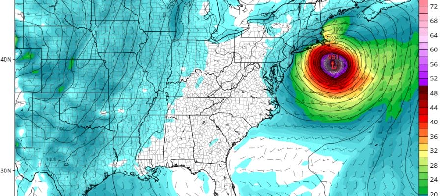
Today’s GFS model comes close enough to bring gales to the coastal waters from New Jersey to Southern New England with gales touching the coast over Eastern Long Island. Southeastern New England gets a bit more into the gales for a longer period of time. However the European & UK Met model are significantly further west and slower with Jose. The slowness allows the weak trough remnant of Irma to completely disappear. This temporarily at least closes the door to an out to sea solution at least for a day or so making a close call even closer.
The UKMET model is almost ridiculously further left with the low on the Outer Banks of North Carolina. Frankly I don’t know it could get that far west given the upper air an the speed of movement. The only way this happens in my view is if Jose slows down even more and takes an extra day to move out of its current position.
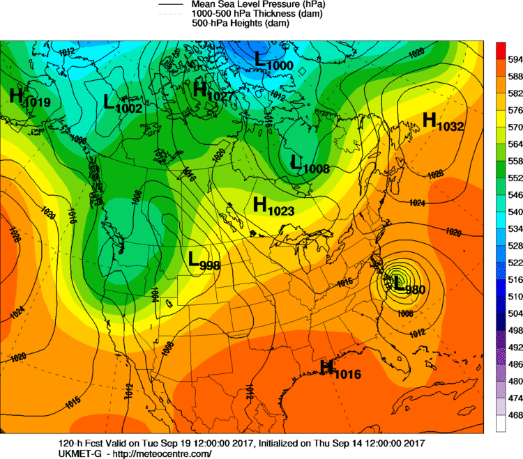
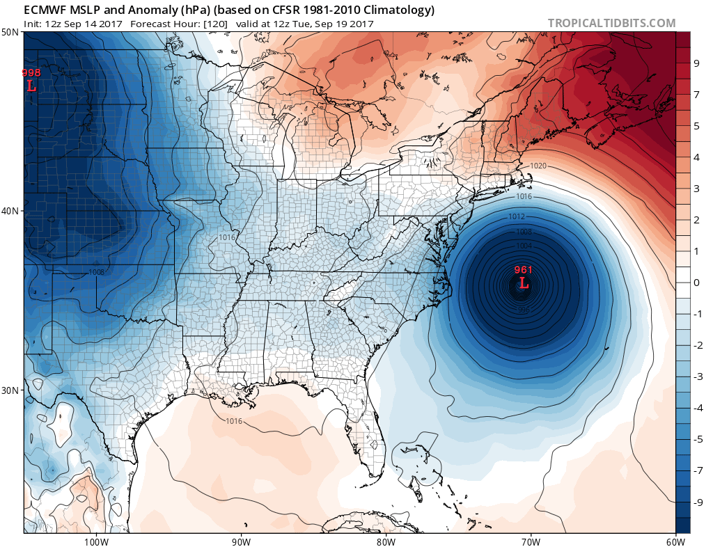
By Wednesday morning both the European & the GFS have Jose almost in exactly the same spot. By this time we would see Jose probably looking more like a winter type cyclone than a true tropical storm. This would cause the wind field to spread out with gales just offshore New Jersey and touching Eastern Long Island while Cape Cod gets into solid gales.
GFS MODEL WEDNESDAY MORNING 8AM

EUROPEAN MODEL WEDNESDAY MORNING 8AM
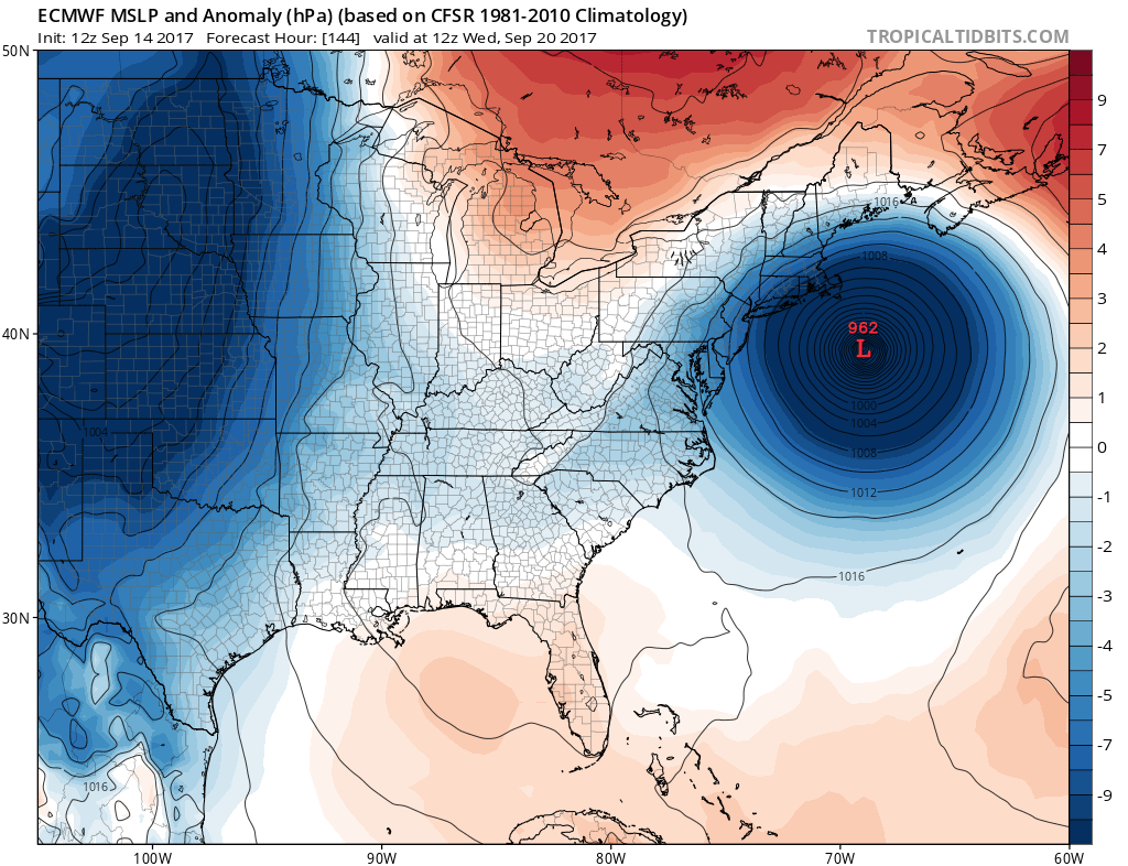
What is happening is that the European builds the upper high to the northwest too late to pull Jose back westward. This is what the model showed yesterday and it appears that this idea was overdone. The timing would be off by a day. Certainly today’s model runs would suggest that the out to sea solution is growing more likely. Only the UK MET model has Jose in a place where there would be some impact.
UK MET MODEL WEDNESDAY MORNING 8AM
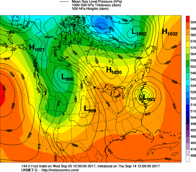
I still remain cautions here. The players aloft are not intense but rather weak. This could still create change over the next 2 days. Certainly the odds of an offshore track are growing but the UK Met still has me looking over my shoulder. This model suggests that the Atlantic ridge that Jose is under now remains stronger for a longer period of time which results in the more westerly track. Let me put it like this. If we are still seeing Jose moving west on Saturday with no signs of a turn toward the north, then our risk would increase. Also we will need to reevaluate the strength of the ridge building across the Northeast next week. For now we are still watching.
LOCAL RADAR MIAMI FLORIDA
 GET JOE A CIGAR IF YOU LIKE

FiOS1 News Weather Forecast For Long Island
FiOS1 News Weather Forecast For New Jersey
FiOS1 News Weather Forecast For Hudson Valley