Jose Looks Harmless But There Are Questions
Jose Looks Harmless But There Are Questions
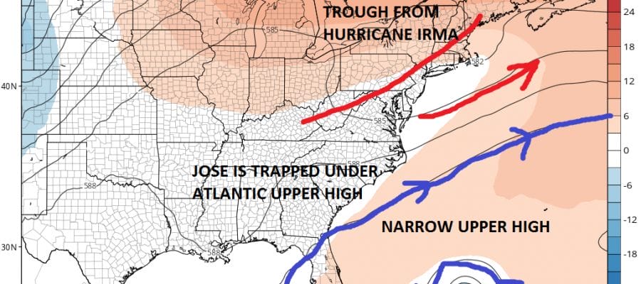
At the moment Hurricane Jose is a shadow of its former self. 2 days ago it had 150 mph winds and today it sits as a minimal hurricane with 75 mph. It is currently about midway between the Bahamas and Bermuda. The hurricane is drifting to the east. Wind shear continues and this is preventing Jose from strengthening and has been responsible for the weakening we have seen. The hurricane appears to be starting a clockwise loop which will take several days to play through. When that looping is done Jose will begin to track to the west.
SATELLITE LOOP

The westward motion makes sense given the upper air pattern. A large upper high is building around the hurricane and is going to trap it from the southwest winds that will due to the remnant Hurricane Irma upper trough to the northeast.
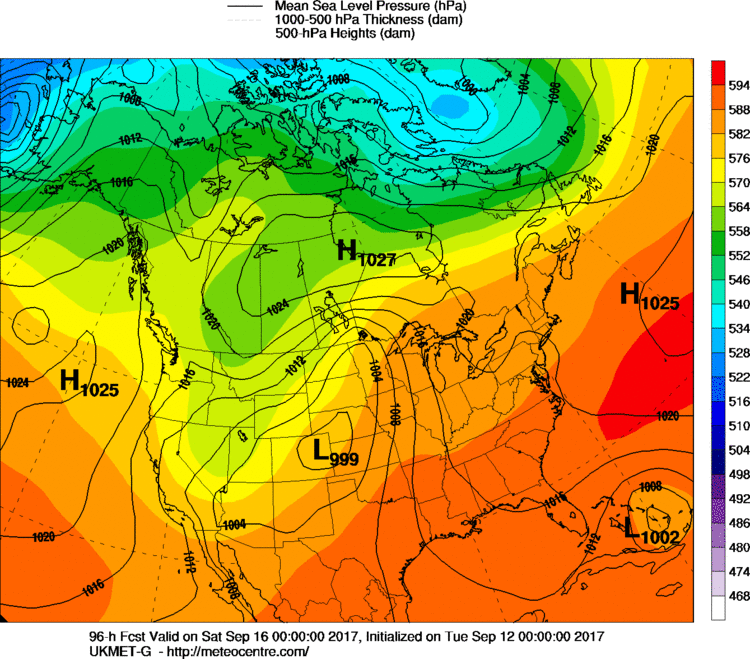
GFS UPPER AIR FRIDAY 2PM

You can see from the GFS above how Jose is cradled under the upper high and shielded. If that upper high were to hold up this certainly would track westward from here and threaten the Bahamas and possibly Florida. However the GFS as do all the other models (except for 1) show a weakness developing in that ridge along or just west of 70 degrees west. You can see on the loop below if you click on the map how Jose breaks through the ridge and then heads northward.
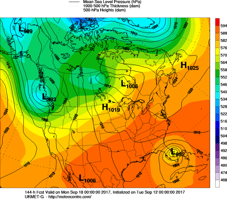
GFS UPPER AIR FRIDAY THROUGH SUNDAY CLICK TO ANIMATE

The global models have been consistent with this idea. However one model insists on a different outcome. The UKMET model or the British model which has been known to hit home runs from time to time, is absolutely insistent that Hurricane Jose will not break through the ridge. This model was very good with Hurricane Irma showing the more westerly track and heading into Cuba.
The reason why the UKMET does what it does is that it weakens Jose to a tropical storm. A weaker Jose would more likely respond to lower level steering rather than the higher level steering and move west or even southwest. The result is a tropical storm over the Bahamas and then a west track into Florida.
Right now we are cautiously laying the UKMET aside since all the others are pointing in the other direction. I think the key will be what happens to Jose strength wise. If it weakens to a tropical storm, it stands a better chance for a more westward track. If it keeps its strength as is, it will probably break through the ridge and move to the north and then eventually to the northeast. We continue to lean to the out to sea solution but we are looking over our shoulder at the UKMET model.
LOCAL RADAR MIAMI FLORIDA
 GET JOE A CIGAR IF YOU LIKE

FiOS1 News Weather Forecast For Long Island
FiOS1 News Weather Forecast For New Jersey
FiOS1 News Weather Forecast For Hudson Valley