
JOESTRDAMUS Phase No Phase?
Blizzard 2016 is barely shoveled out and we continue to keep an eye of developments for late Thursday into Friday. Having another weather event right after a major weather event is unusual but not unheard of. For example back in 1996 there was another 6 to 12 inch snowfall that occured for some areas just 5 days later. Now just because something may look the same doesn’t necessarily mean it will be the same. The idea that there could be another major winter storm just five days after a major winter storm would be really pushing the limits. However given that we seem to be in a volatile and at times extreme atmosphere for the last 2 plus months, it is probably wise not to take any solution off the table.
The issue with regards to any event late this week is going to hinge on phase or no phase. By this I mean that unlike Blizzard 2016 which is strictly a southern stream event, this one is going to rely on both the polar jet stream and the subtropical jet stream to phase together. They have to do it in the perfect spot in order to create another serious snow threat. So let’s see where the models are with this.
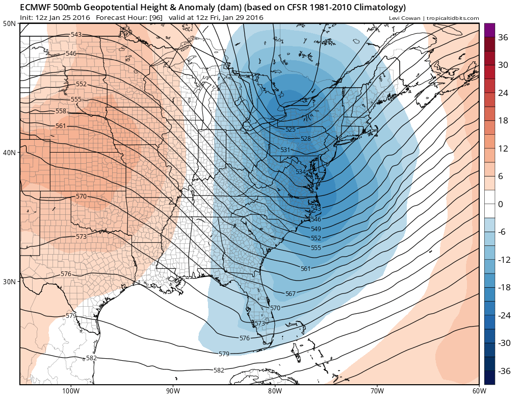
JOESTRDAMUS Phase No Phase? European Model Forecast For Thursday Morning

The above maps are the European ensemble forecast and the operational European. The ensemble for those of you new to this is basically a whole bunch of European models; each has a different paramter or component which gives varying solutions. The ensemble mean is basically the average of all the models. You can see that the operational which is what everyone sees and the ensemble are pretty close. There are no publicly available maps showing precipitation but I can tell you that the European on this run keeps all precipitation offshore on this particular run.
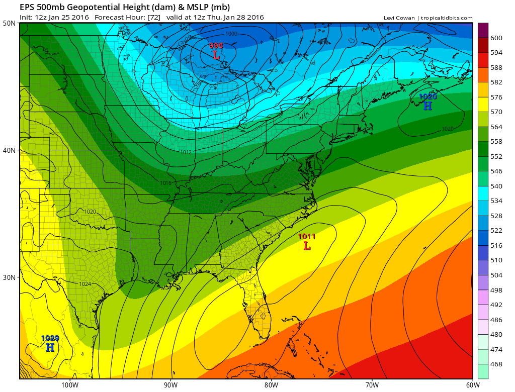
JOESTRDAMUS Phase No Phase? European Model vs GFS Model
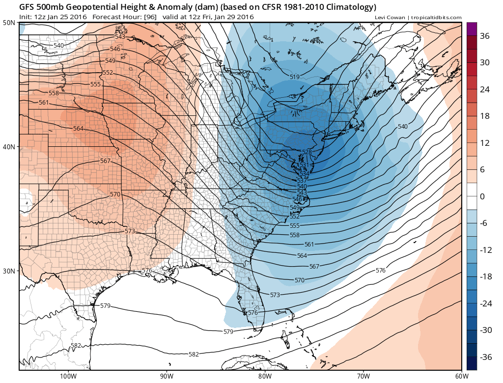
The European is to the left of the GFS on this run but what is key is the upper air. The trough along the east coast is deeper and left of the GFS even though the surface storm is offshore for both. Both models suggest a miss with the European suggesting a closer miss. It should be noted that the European has been trending to the right with an out to sea solution. However once again we are talking a handful of miles here and given that the last 2 storms among others have trended northwest at the last minute, I don’t think we are a point to sound an ALL CLEAR signal. We are also not in any position to sound a snow in imminent signal either.
Which brings us to the NAM. The NAM was the big winner with the last event so we need to pay attention to this even though this is different from the last event. The setup atmospherically is different because of the northern jet stream getting involved. That might be a better handle for the global models. The middle run of the NAM is out and it has shifted to the right of the previous run which had precipitation on the coast. It really is a simple matter of the two troughs phasing and whether they phase in time for a storm to be tucked in to the coast instead of being ejected further east.
JOESTRDAMUS Phase No Phase? NAM Model Thursday morning
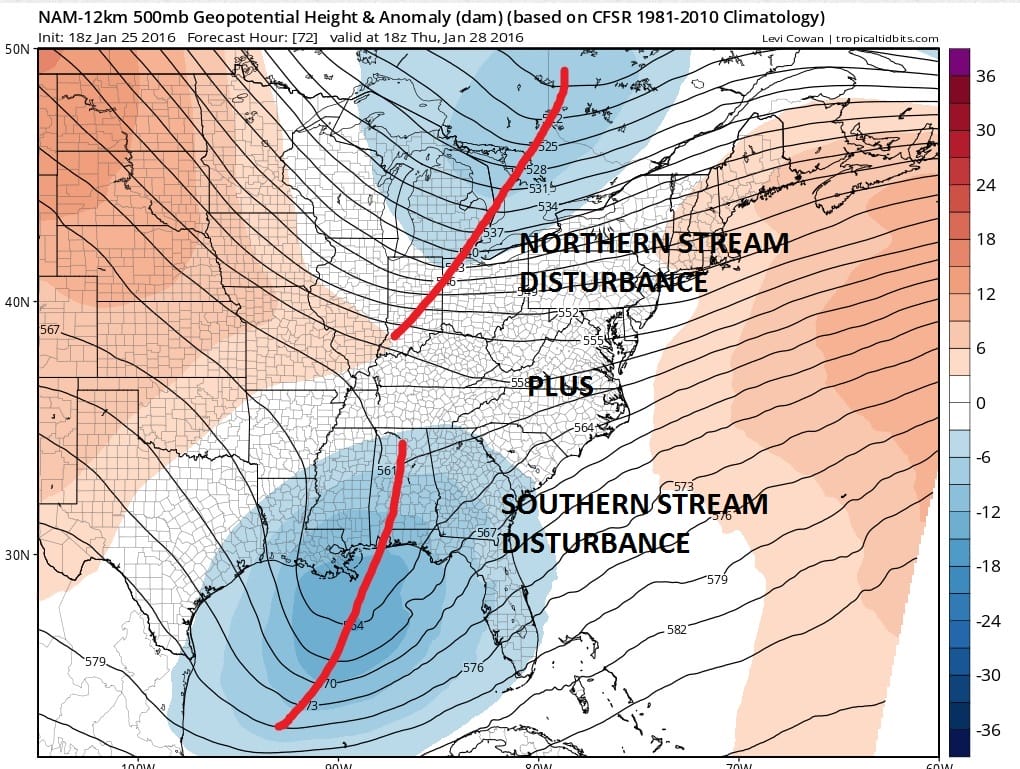
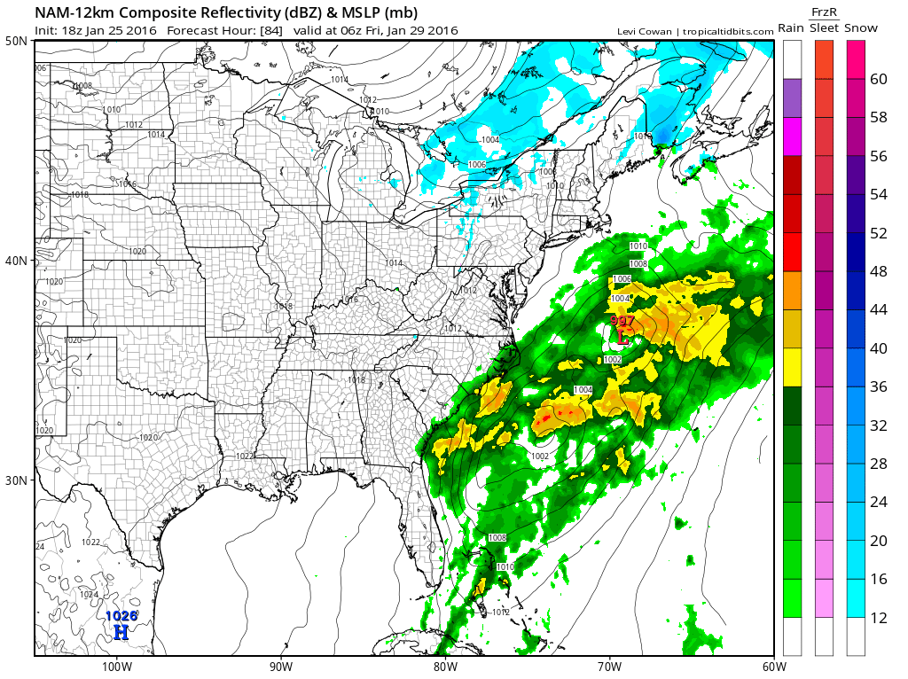
The NAM surface map for 1am Friday morning shows an offshore track. If the phase occurs too far east , then it is offshore and goodbye.
CONCLUSIONS:
I think at this point the odds are beginning to favor an out to sea solution but given the models recent trends of pushing northwestward at the last minute, we need to be very careful from a forecast perspective. In the last event the NAM sounded alarms 3 days before and we are almost at that point. Before writing this off I completely, I prefer to wait at least until this time tomorrow before coming to a final conclusion. For now I’m going to mention the chance for snow in my forecast for Thursday night and Friday morning and leave it at that. Also it should be noted that if this were to become a problem, there will be a north/south sharp cut off to the precipitation as opposed to east/west. This means that the immediate coast, Long Island & Coastal Southern New England are more at risk than inland areas north and west of the big cities of Boston, New York City Philadelphia & Washington.
JOESTRDAMUS Phase No Phase? THIS AFTERNOON’S VIDEO ANALYSIS
NATIONAL WEATHER SERVICE SNOW FORECASTS
LATEST JOESTRADAMUS ON THE LONG RANGE
Weather App

Winter is here! Don’t be without Meteorologist Joe Cioffi’s weather app. It is a complete weather app to suit your forecast needs. All the weather information you need is right on your phone. Android or I-phone, use it to keep track of all the latest weather information and forecasts. This weather app is also free of advertising so you don’t have to worry about security issues with your device. An accurate forecast and no worries that your device is being compromised.
Use it in conjunction with my website and my facebook and twitterand you have complete weather coverage of all the latest weather and the long range outlook. The website has been redone and upgraded. Its easy to use and everything is archived so you can see how well Joe does or doesn’t do when it comes to forecasts and outlooks.
Just click on the google play button or the apple store button on the sidebar for my app which is onMy Weather Concierge. Download the app for free. Subscribe to my forecasts on an ad free environment for just 99 cents a month.
Get my forecasts in the palm of your hand for less than the cost of a cup of Joe!

![]()