
The overall look of the upper pattern for this coming week shows some subtle changes but nothing really extradordinary. It seems that we are stuck in mid to late August mode here with ridges and troughs flexing from time to time but nothing that changes the look over North America to a major degree. 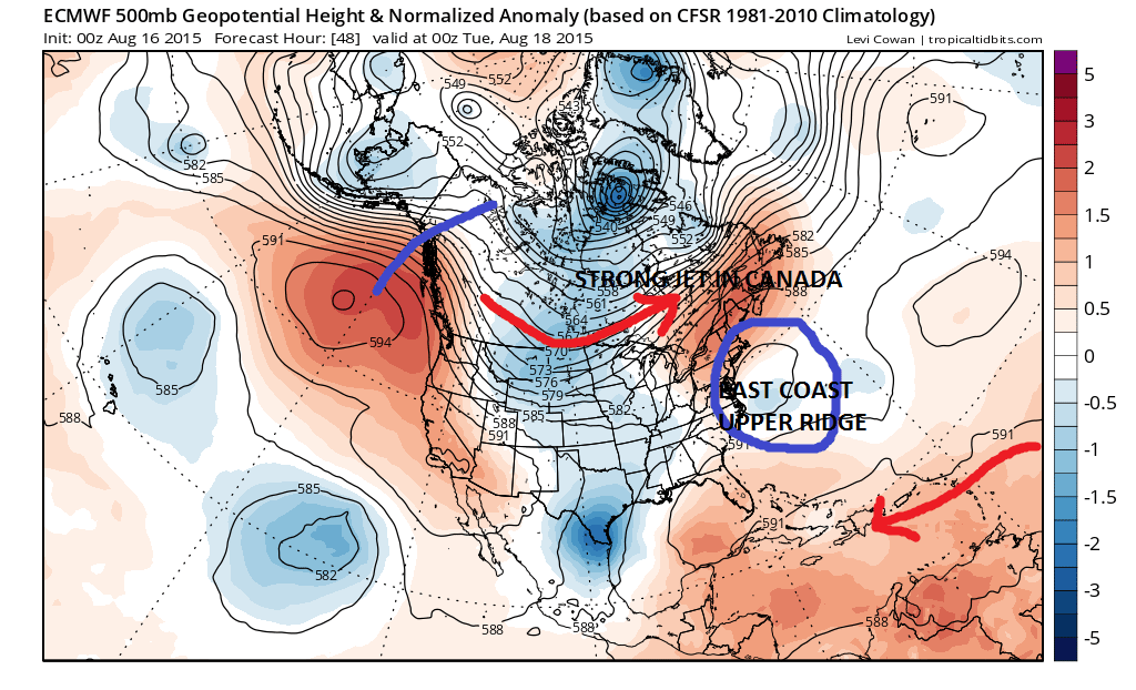 One of the reasons that this latest stretch of 90 degree weather is really modest from the standpoint of heat in humidity is that the ridge comes and goes. If you look at years where heatwaves were really prolonged events of 10 days of 90+or more it comes with the ridge in the east just sitting there for weeks on end flexing its strength northward and holding for long periods. This would allow time for heat to build up and spread northward. This really isn’t the case at least for this summer. This ridge in the east is along the coast and not inland and west of the coast which makes a difference as heat is not really permitted to build up to an extreme. We aren’t seeing 100 degree record breaking readings occuring anywhere.
 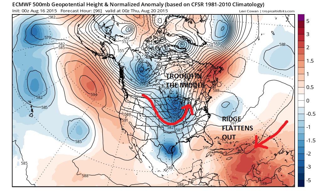 In fact by the middle of the week a trough is setting up and getting ready to swing a cold front through the east along about late Thursday. The ridge in the east flattens out. However on the other hand we have seemed to have lost (for the time being) the troughing in the east in that this trough will probably weaken as it moves eastward rather than establishing itself. The air flow is not exactly coming straight out of Canada which cuts off truly cool dry air to a large extent.
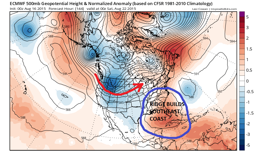 Notice that by 144 hours or late next week the ridge is back building up again and this will probably keep temperatures a little above normal as we move along. But again it does not appear to be something that would cause us to go into a prolonged heatwave mode. The trough is in the western states. It just has the look of things moving along and not setting up for long periods of time.
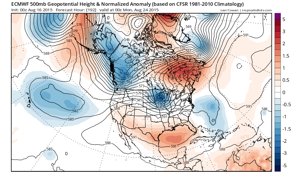 By late next weekend a trough is swinging toward the lakes. The ridge in the east is flattening out. More of the same really. The bottom line is that we seem to be a benign summery pattern overall. Through this stretch I would think the best chance for any widespread thunderstorm activity might come late Thursday and Thursday night and other than isolated cells that develop in the heat, not much rain will fall. Much of the days will feature at least some sunshine. Temperatures overall will average a little above normal. The only thing that would change that is if the tropics decide to wake up and throw a wrench into all of this. For now this doesn’t look to happen but that could be more of shorter range forecast issue since we have to wait for something to develop in order to consider any possibilities. The tropics in the Atlantic as of today are quiet except for a low cloud swirl out in the tropical Atlantic. We are heading now into the peak of hurricane season but with the raging el nino in the Pacific, the Atlantic continues to snooze away. At some point something will develop and we will deal with that if and when it happens.