
While baseball is in the midst of playoffs with Met fans glued to their sets, JOESTRADAMUS along with some meteorologists, snow lovers, and the like may be watching baseball but they are also watching snow cover growth in Siberia as a future indicator of the winter to come. Dr Judah Cohen has been at the forefront of this theory tying the rate of snow cover growth in October over Eurasia and the kind of winters experienced in the northeast. Now there is a lot of debate over the value of this indicator given that his forecast conclusions regarding the growth of snow the evolution did not play out last year. Instead other factors came into play that created the snowy cold northeast. Those conditions did not play out elsewhere in the east. But we are going to shy away from the debate and simply focus on what is happening so far. Two things to remember. First off it is where we finish the month and not where we are now. Second it is the rate of growth that matters and not the actual snow cover on the ground. The geographic area of importance is south of 60 degrees north.
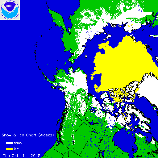
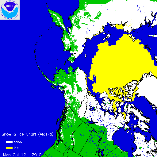
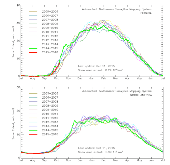
The snow cover through yesterday has grown extensively though the rate of growth is lagging the last 2 winters. Snow cover now extends south of 60 degrees north which is what we focus on.
With regards to the rate of growth you can see on the chart the prior 2 winters stand out at the high end of the range.
The overall pattern over the next 2 weeks favors continued rapid snow growth in the sub 60N region. One of the factors favoring this is the ice free waters of the Arctic Ocean. The ice cover is growing rapidly but remains below normal for the date. Snow cover is growing across Northern Canada and Alaska though the growth so far has been rather slow and does not factor into the equation.
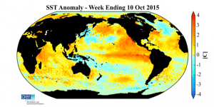
One other thing I would like to look at here are the sea surface temperatures in the Pacific where El Nino is raging. The 2 things that stand out to me regarding this is the warm pool of water in the Gulf of Alaska and in the Northeast Pacific. This is different from the 1997-98 profile where below normal sea surface temps were the rule in that region. The second area that is different is the large pool of cold water that has been growing south of Greenland in the North Atlantic which is also opposite the profile of 1997-98. My own view is that these 2 factors are going to be the big wild cards this winter assuming everything remains the same 2 months from now.rr
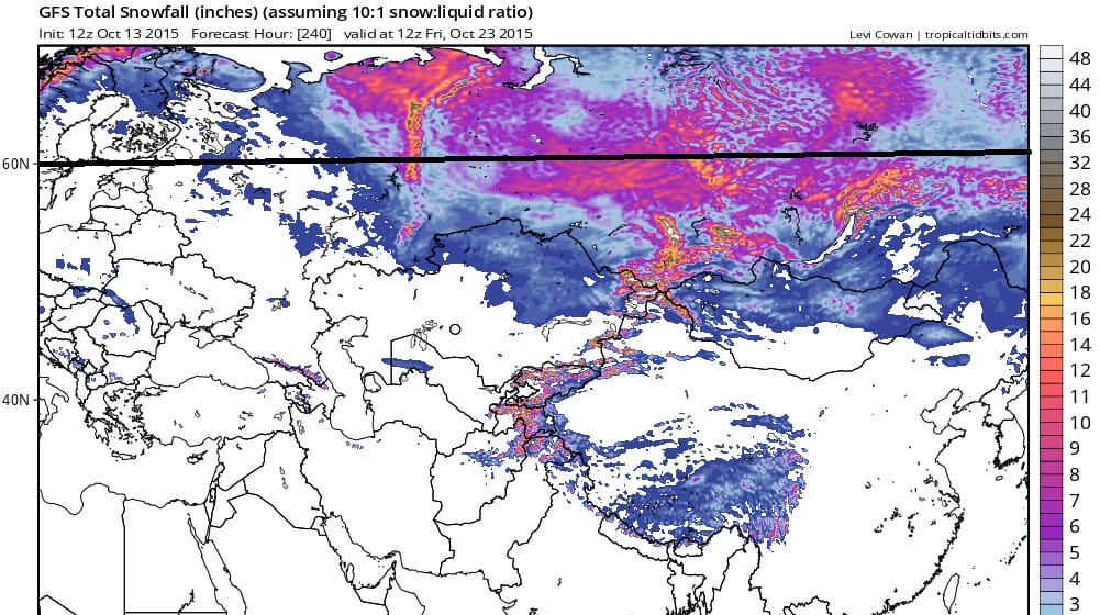
Right now based on what I am seeing pattern wise it looks to remain warmer than normal once we get past this weekend, at least through much of next week. Models have backed off from the blocking pattern developing at least for the time being. I have an idea of what I think the winter is going to be like but I want to wait a little longer to see how we finish the month before I venture a guess (and that is what it will be…a guess). Admittedly I am not a long range fanatic though I do find it interesting as I am more short and mid range oriented in my training and my forecast approach. I do believe that whatever the primary pattern that sets up, that the North Atlantic Oscillation or Greenland block will appear from time to time this winter unlike the past 3 winters where the block has be notably absent. What the means is that warmer air in the far northern latitudes displaces the jet stream further south in the eastern states. The last 2 winters it was the warm Northeast Pacific waters that favored displacing the arctic jet further south. That pool remains for now. Add to that the 2 other factors, El Nino and the cold water North of Greenland, and we could have the ingredients for seeing something pattern wise that we may not have seen before. All food for thought as we go forward. Meanwhile here is the GFS forecast of total snowfall (not snow cover) over the next 10 days.
The charts are from Dr Judah Cohen’s blog that is updated every other Wednesday. It is very technical but worth the read. I will be glad to try to explain as best I can any questions you may have.
Be sure to have my weather app handy this winter. Download for free and subscribe to my forecasts for just 99 cents a month.