
First off thanks to “http://tropicaltidbits.com”>TROPICAL TIDBITS for the maps in this post
The first part of this week involves a cold front that will be moving through early Tuesday. Ahead of it Monday iw will be hot and humid with temperatures reaching the 90s or near 90 in many locations. Though the humidity will be higher Monday there may not be a whole lot for this front to work on. Thunderstorms if they occur won’t happen until sometime Monday night and even then I’m not confident that they will be all that strong. Nonetheless the front pushes through Tuesday morning and humidity levels gradually lower as the day goes on though the thermometer could still hit 90.
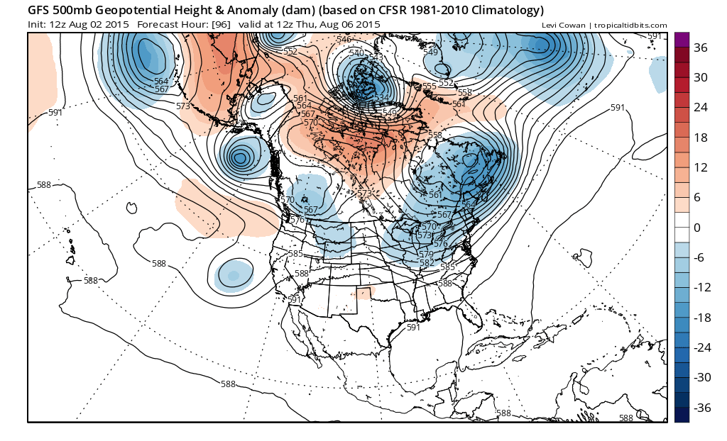
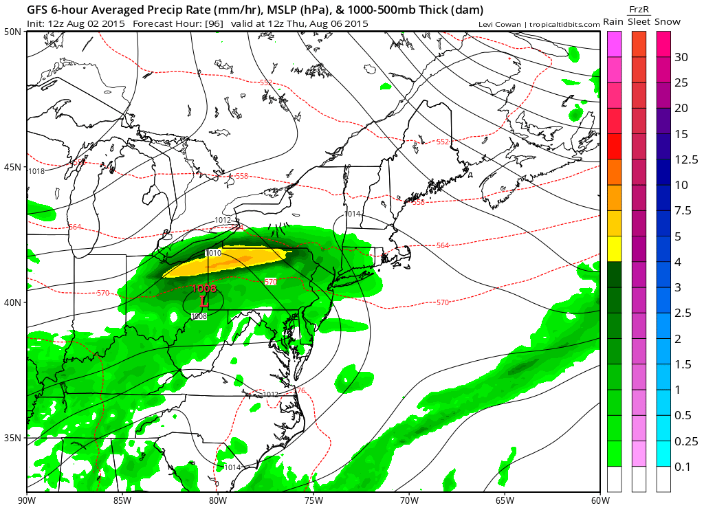
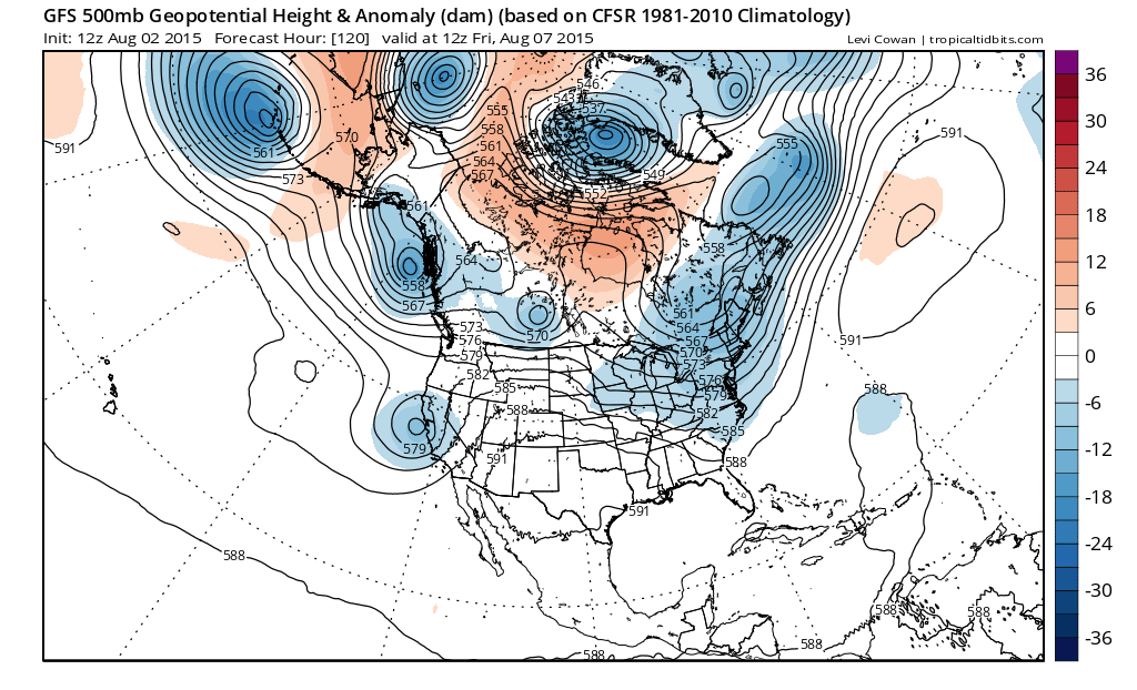
The issue for this week as the upper air flow shows above for what it looks like Thursday morning is that we have troughing in the east around an upper low in Eastern Canada. A disturbance rotating around this will amplify some and this creates a wave on the old cold front. Now models seem to be trending to an idea that there will be 2 waves. The first here on the gfs as shown on the 96 hour and 108 hour surface map below moves through here on Thursday with a pretty good shot of rain and a northeast wind.
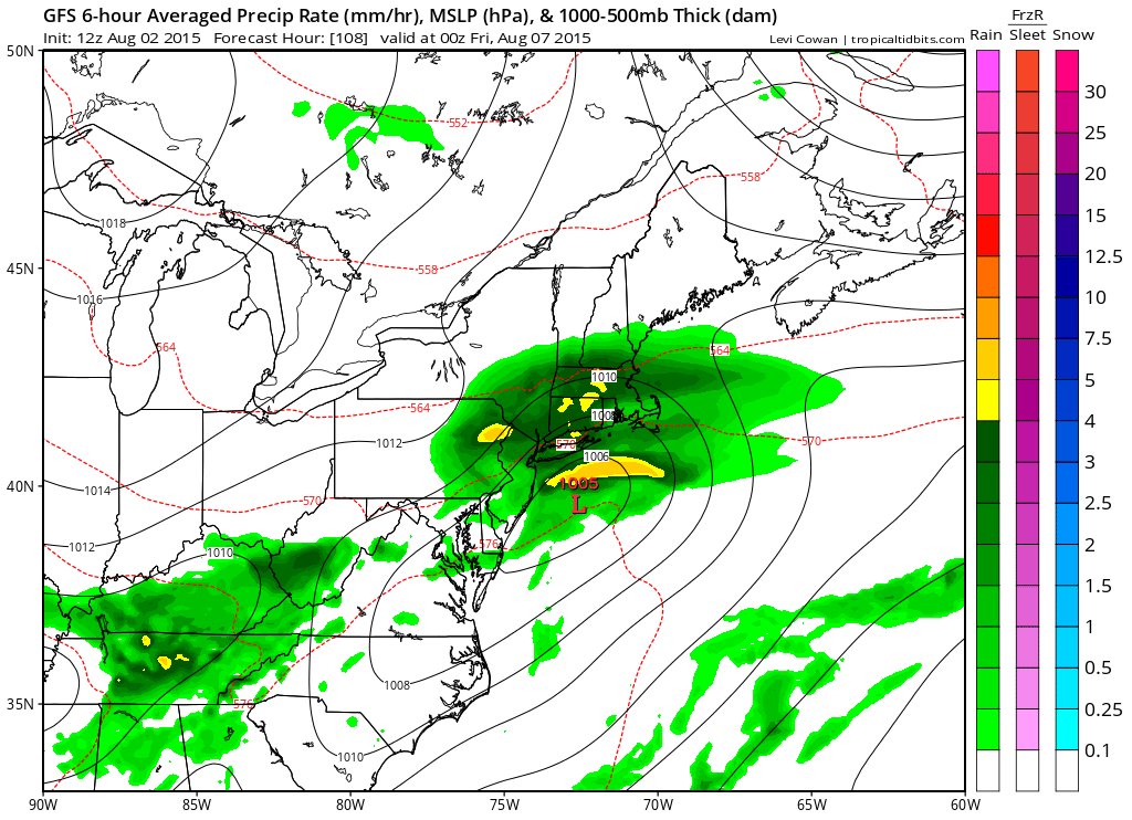
One main difference from earlier runs is that this lead system seems to be more amplified which would mean we would get a shot of rain late Wednesday night into late Thursday. Then as the wave goes by the front sags to the south. The second wave that develops on that front is then suppressed to the south which means dry weather returns Friday and next weekend looks dry and nice with sunshine and cooler than normal temperatures.
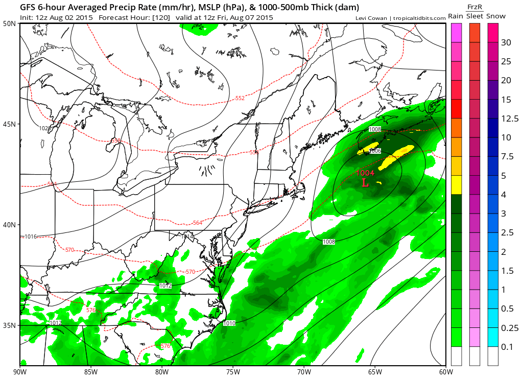
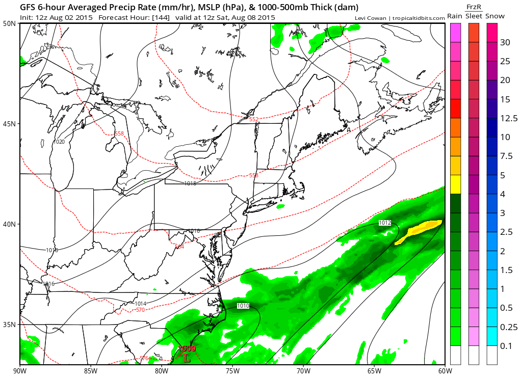
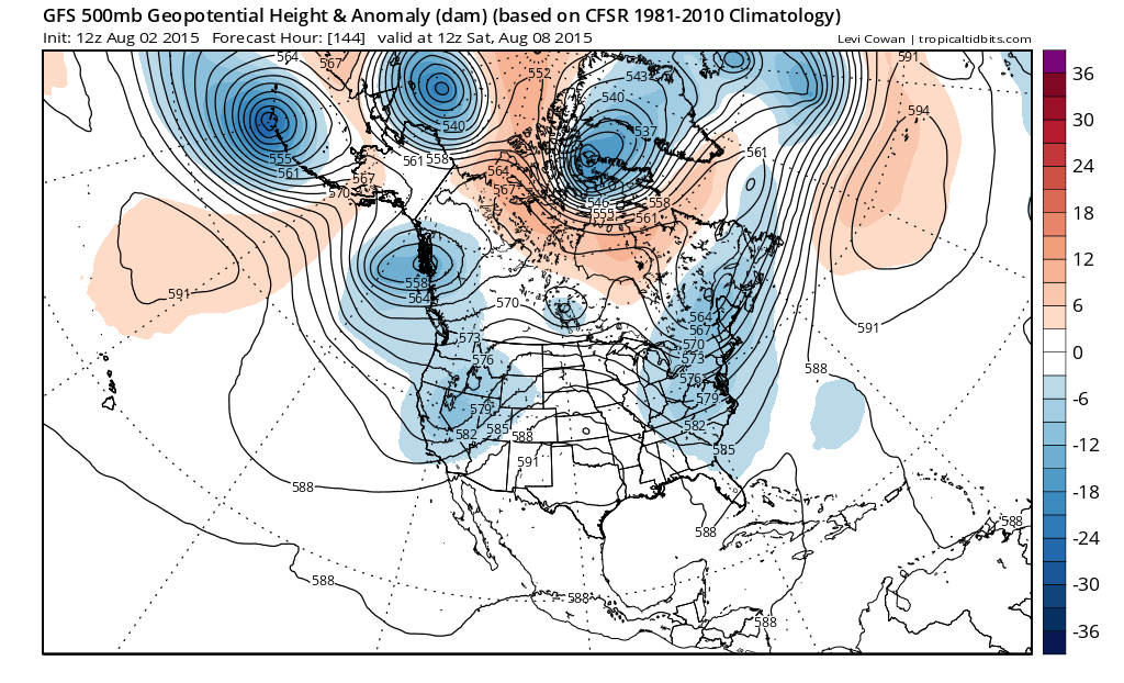
The upper air shows this idea very well as the first trough moves off and the second one sets up further east then overnight runs which attempted to washout at least half of next weekend. You need the axis of the trough to be west of us..along 80 or to allow for enough room in the atmosphere for a low to move up the coast and bring rain here. In this case it would too far east and clouds and rain would be well to the south. This would simply mean dry weather Wednesday, rain Thursday, the dry Friday through probably at least Sunday.
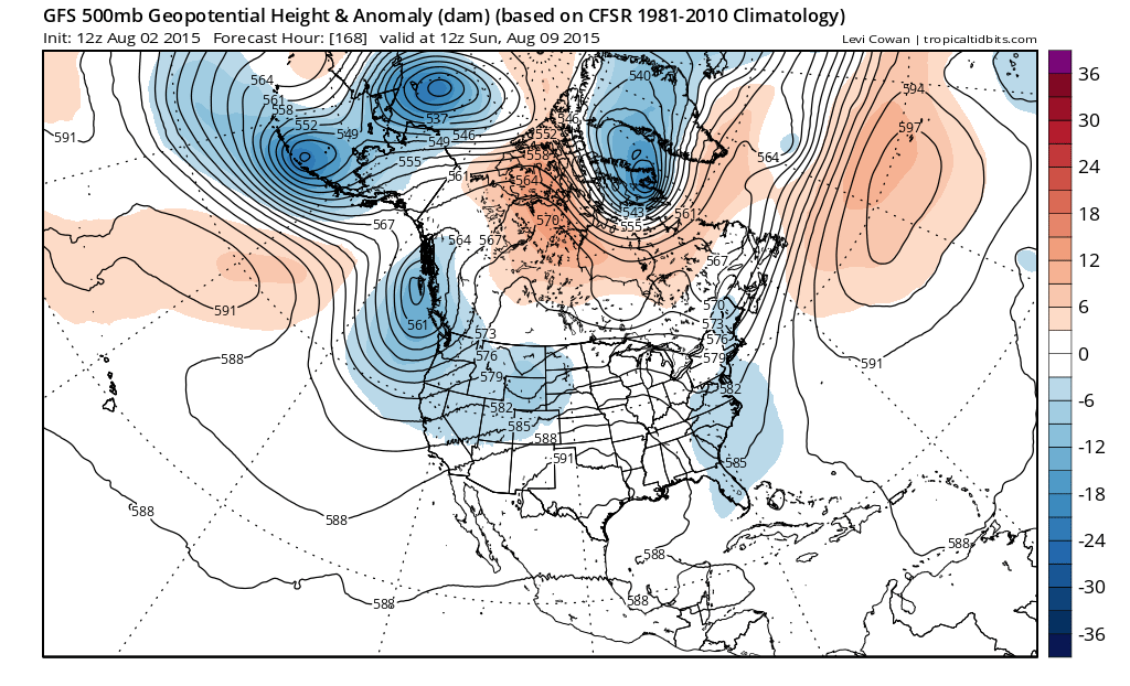
Joestradamus is not sure of this yet. Often times models tend to over-amplify lead systems and underdevelop the ones that follow. The key lies in whether the trough position remains hung up to our west for several days, or whehter something in the northern stream kicks everything along so it is basically one and done. The European overnight was supportive of the lagging look. In fact it would have argued that the first shot of rain for Thursday would not amount to much while the second shot for next weekend would be an issue. We will see what that shows us later today.
Overall it does appear that after Tuesday the 90s will disappear for awhile. This is not to say that the 90 degree weather is over for the summer. All we can say is that it does appear that it will be taking a break for a little while..at least into early next week.