
Joestradamus Sees Damp Chilly Weather Ahead
![]()
After the extreme temperatures of over 30 degrees above normal, we are seeing the atmosphere returning to something resembling typical spring. While the fantasy version of spring is sunshine and 70s everyday, the reality is spring is not the nicest time of year. Especially the early part of spring, we can be subject to the effect of the cold ocean. Either it is with an ocean wind that keeps things rather cool, or it is an onshore flow that sets up that can make things damp and dismal. The second option is where we are headed early next week. The weekend looks rain free and Saturday will be the better of the two weekend days. Sunday we will begin the onshore flow and that will bring in clouds from the east and south. We are using the Euro Model for analysis as this seems to have the best idea going forward.
Joestradamus Sees Damp Chilly Weather Ahead Euro Model Sunday Morning

Sunday’s outlook is a bit tricky because there will be dry air just to the north and it is possible that some of that dry air could build southward and keep things no worse than partly sunny at least at the beginning of the day. But by days end clouds will probably take over and begin to shift northward. I don’t think any rain will fall Sunday during the day except maybe in Southernmost New Jersey and Southeastern Pennsylvania. By Monday morning.
Joestradamus Sees Damp Chilly Weather Ahead Euro Model Monday Morning

What will probably happen is a low will form on the warm front to the south and enhance the ocean flow. We should see rain from this on Monday. In terms of amounts the rain will not be especially heavy. It looks we could see up to an inch or so of rain into Tuesday. The rain will probably not be continuous but when it is not raining steadily, there will be light rain or just drizzle around. Temperatures are likely not to get out of the 40s in most places through Tuesday.
Joestradamus Sees Damp Chilly Weather Ahead Euro Model Tuesday Morning
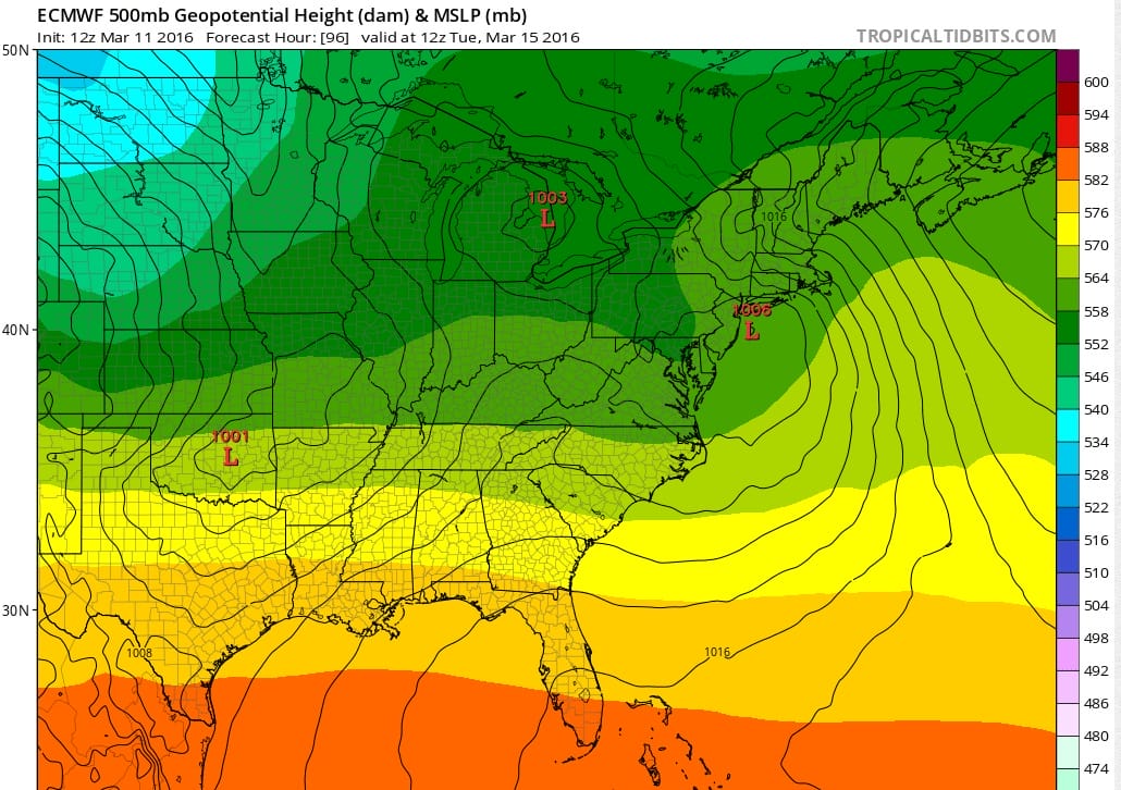
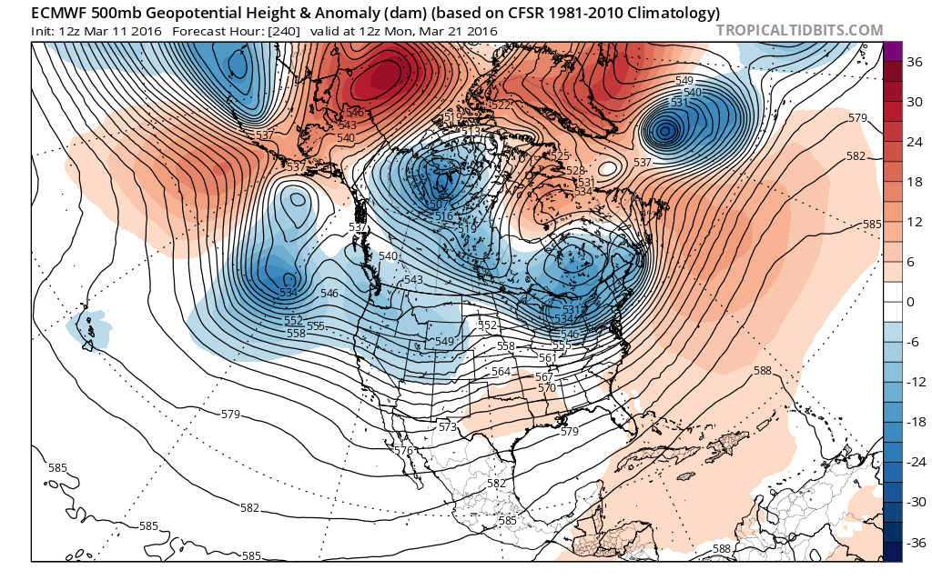
Because there is a crashing North Atlantic Oscillation next week, the system will be slow to get out of the way. Rain will probably be lingering around for at least part of Tuesday before weather conditions begin to improve Tuesday night and Wednesday. Beyond Wednesday the upper air pattern takes a colder look to it as a vortex forms in Southeast Canada and the flow opens up from the northwest. Right now there are no serious storm threats down the road worth considering. At this stage of the calendar nothing short of perfect setup would bring about any kind of early spring snow threat. Even if all the long term indicators point to a colder pattern it doesn’t mean that the short term factors line up for a late season snow. However we can say that temperatures will trend below average later next week.
Joestradamus Sees Damp Chilly Weather Ahead Euro Model Upper Air Late Next Week
FiOS1 News Weather Forecast For Long Island
FiOS1 News Weather Forecast For New Jersey
FiOS1 News Weather Forecast For Hudson Valley
NATIONAL WEATHER SERVICE SNOW FORECASTS
LATEST JOESTRADAMUS ON THE LONG RANGE

NOMINATED FOR AN APPY AWARD FOR BEST WEATHER APP!!
Weather App

Don’t be without Meteorologist Joe Cioffi’s weather app. It is really a meteorologist app because you get my forecasts and my analysis and not some automated computer generated forecast based on the GFS model. This is why your app forecast changes every 6 hours. It is model driven with no human input at all. It gives you an icon, a temperature and no insight whatsoever.
It is a complete weather app to suit your forecast needs. All the weather information you need is right on your phone. Android or I-phone, use it to keep track of all the latest weather information and forecasts. This weather app is also free of advertising so you don’t have to worry about security issues with your device. An accurate forecast and no worries that your device is being compromised.
Use it in conjunction with my website and my facebook and twitter and you have complete weather coverage of all the latest weather and the long range outlook. The website has been redone and upgraded. Its easy to use and everything is archived so you can see how well Joe does or doesn’t do when it comes to forecasts and outlooks.
Just click on the google play button or the apple store button on the sidebar for my app which is on My Weather Concierge. Download the app for free. Subscribe to my forecasts on an ad free environment for just 99 cents a month.
Get my forecasts in the palm of your hand for less than the cost of a cup of Joe!
![]()
