
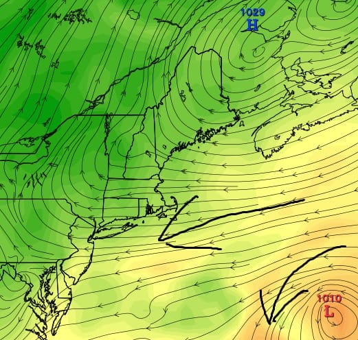
An onshore flow which is how we describe winds that are blowing from the direction of the ocean onshore..that is a wind with an easterly component or for Long Island in the summer it is the south wind as well as the east wind. In this case we are not talking the normal seabreeze action but when the dominant flow is basically from the east. It usually but not always means nasty weather but not always. In this case it might mean both because it often has to do with where you are in the onshore flow with respect to the position of high and low pressure.
Take tonight and tomorrow as the first example. We are seeing as per the European a pretty long fetch of easterly winds for overnight into Tuesday. The flow is moist at lower levels but low pressure is showing up well off shore and there isn’t much going on to the south. This is why we are forecasting clouds. Sometimes you can get a little light precipitation out of something like this and we do see some light showers popping up on the radar in parts of Southern Pennsylvania and Delaware on the radar but it is very light since there really is no driving mechanism aloft to create dynamics for something heavier.
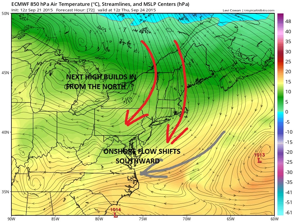
Once this flow relaxes and it will later tomorrow we see the next high beginning to build in. Winds will then become more north northeasterly over time which brings down dry air from the north and northwest so that we should be back to sunshine Wednesday and Thursday. The strongest onshore flow shiftst southward to Virginia and North Carolina in the meantime.
This is where the main action with regards to rain will probably be taking place and 2 models do show an area of rain breaking out to the south. This is also where the major models begin to diverge.The gfs below shows rain breaking out across the Middle Atlantic states. Given how it has the high to the north it would be logical that that rain will lift northward.

The primary model differences show up with the European.
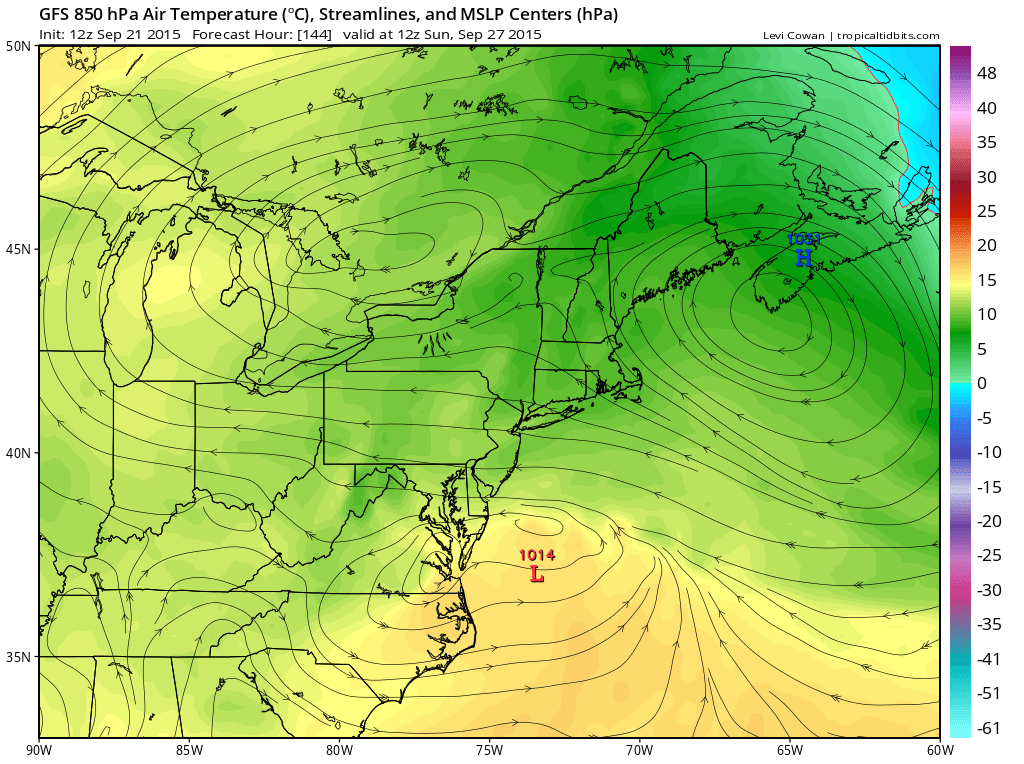
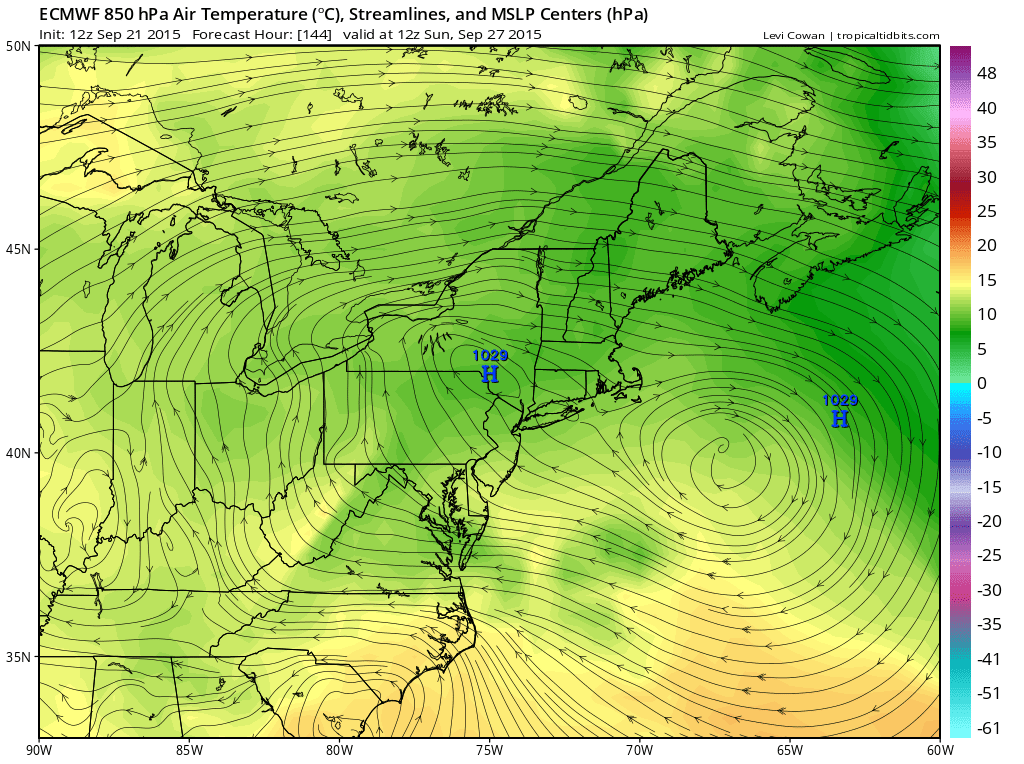
Look at the 2 models and how the highs are. The Euro has the highs virtually overhead which would keep rain way south and it never gets here. The GFS has the highs much further north and a wave off the Virginia coast. The GFS would probably bring rain and even gales offshore for the weekend! Needless to say that if we do get rain this coming weekend it would be after 14 days in a row of no rain which doesn’t happen around here too often. The European would have our weather dry and quite nice right through the weekend. In fact it doesn’t show a drop of rain for the next 10 days!
What is my thinking on this? Well with regards to the models it seems that which every model these days whether it is the European or the GFS or the Canadian, whichever ones show a threat for rain around here turn out to be wrong. The drought pattern and the “trend is your friend” approach seems to have worked very well so I continue to remain in prove it to me mode until proven otherwise. In the meantime temperatures this week will be in the 70s with readings closer to 70 when there are clouds and closer to the mid or upper 70s when we have more sun. Nights will be cool with 60s and 50s when we have some clouds around..40s inland when we don’t! Decent but not always picture perfect is the story for the rest of the work week and no rain to get in the way of Yankees and Mets winding down their seasons, nor for the Jewish holyday of Yom Kippur or for the arrival of the Pope!