
It has been very hard to get a grasp on the long range weather pattern. Every run has a different solution on how the change is going to take place and what magnitude will the change be. Each run places emphasis on one ridge verses one trough. There is also the question of Hurricanes Ignacio and Jimena and how far north they move and the get absorbed into what could be a strengthening upper low in the Gulf of Alaska. These factors keep changing and as a result the models keep changing on the overall long range outlook.


For example here we have the upper flow from last night’s gfs run verses today’s gfs run. Notice the stark difference in the upper flow over Southern Canda as we go from 2 weaker troughs to now one stronger one that splits the difference. The short term implication of this would be that the next cold front will be slower to get to the east coast…perhaps not until late Friday instead of late Thursday. Last night’s run implied the front could stall out and a wave could form bringing perhaps a period of (gasp) rain for us. Now it just pushes it through and done with cooler air for next weekend. The magnitude of the cool air mass is stronger than the one we are getting tonight and Saturday and could last a few days longer. However it makes forecasting from day to day a hair pulling experience which you usually save only for snow events!
This trough takes its time moving out and by Tuesday 9/15/15 it pulls out and the ridge in the east begins to build again.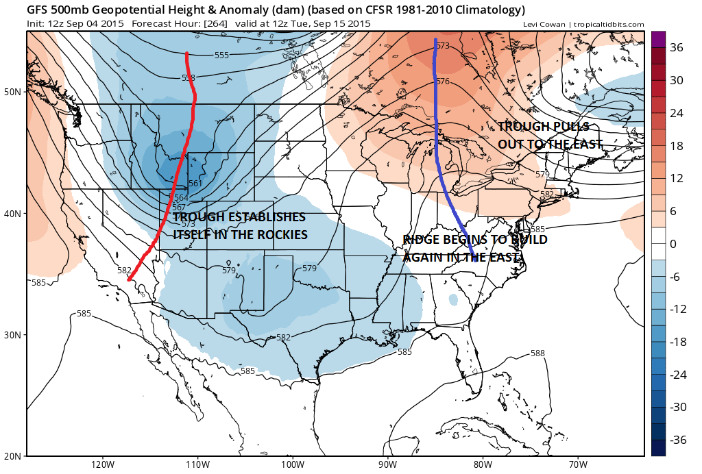 That ridge locks in for a few days as the trough in the rockies deepens which, quite frankly, i have no idea if this is even correct. We have seen so many flips back and forth on how this all plays that confidence in all this remains very very low.
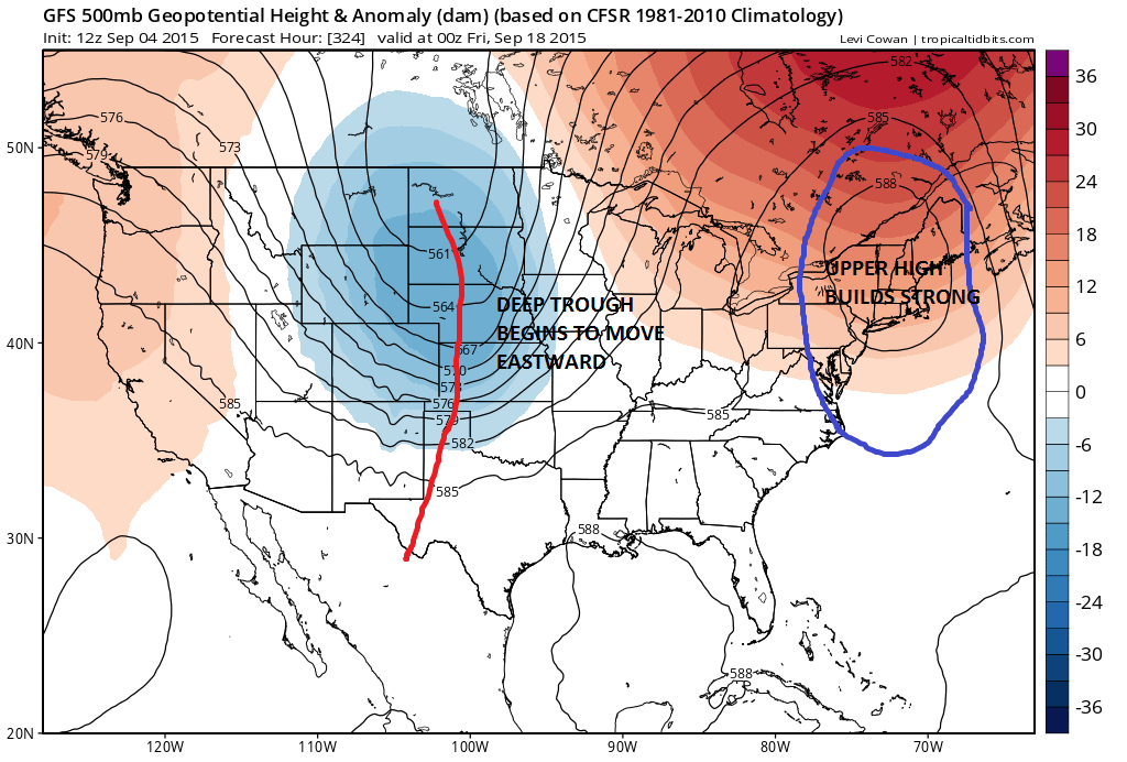 This would suggest another warmup for days 11-13 in the long range period. Again who knows with this given the volatility. We can say at least there appears to be no chance for a wide spread rain with all this unless something from the tropics were to get going. Given this setup for example (and only as an example) something could manage to find its way off the southeast coast it might have a chance. But this hurricane season has been stingy with opportunities for even tropical rains. This is today’s gfs view of things. The European will certainly have its view on things later today. For the short term outlook into next week be sure to check joes forecast or any of the local forecast pages.