
With temperatures knocking on the door of upper 80s to around 90, I thought what better time than now to look at world wide Northern Hemispheric snow cover. It won’t be too long before we will be looking at Siberian snow cover and the growth rate and how it compares to last year, what it means, what it doesn’t mean, etc etc etc.
Okay here is the theory. The rate of snow cover rate growth in Siberia correlates with cold snowy winters in the northeast. At least that is the theory. Last year we saw the second fastest rate of growth which led those to reach conclusions regarding long range patterns, North Atlantic Oscillations, among others. The theory’s supporters reached conclusions regarding these patterns that were wrong even though the northeast had a very cold snowy winter (at least from Jan 15th through mid March). In other words they got it right for the wrong reasons. Back to the drawing board on that but I want to at least start keeping tally on this so we have maps to look back to for comparison and what it means down the road…if it means anything.
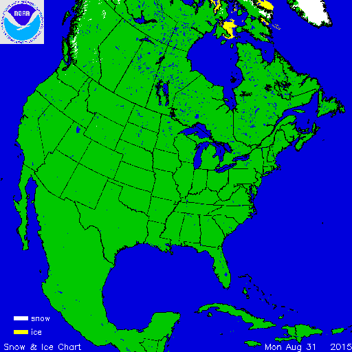
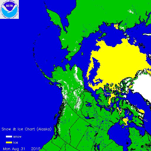
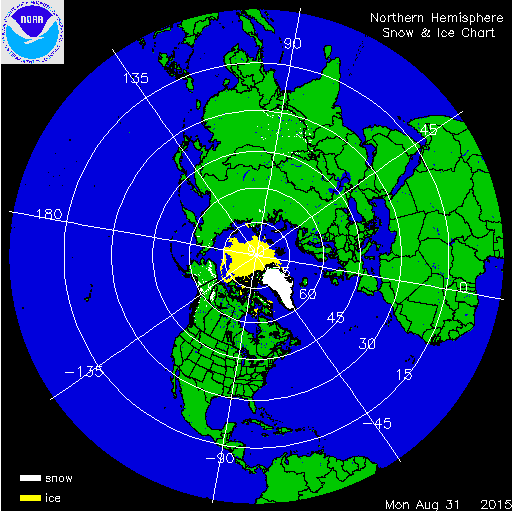 You can see from the Northern Hemisphere maps that outside of Greenland and the ice at the arctic there is next to nothing so far. Northern Alaska put down a little snow cover this weekend. That’s it for now. Looking at the long range pattern models this afternoon are hinting and the first snows for some areas in Central and Northern Canada beyond the 10 day forecast period. The GFS is creating a colder look across Canada and seems to be going back and forth on what happens in the US beyond day 10. We can say the very very dry conditions shows no signs of ending. Pattern shifts are not showing any openings of moisture sources and we seem to be a dead issue for now with regards to anything tropical.
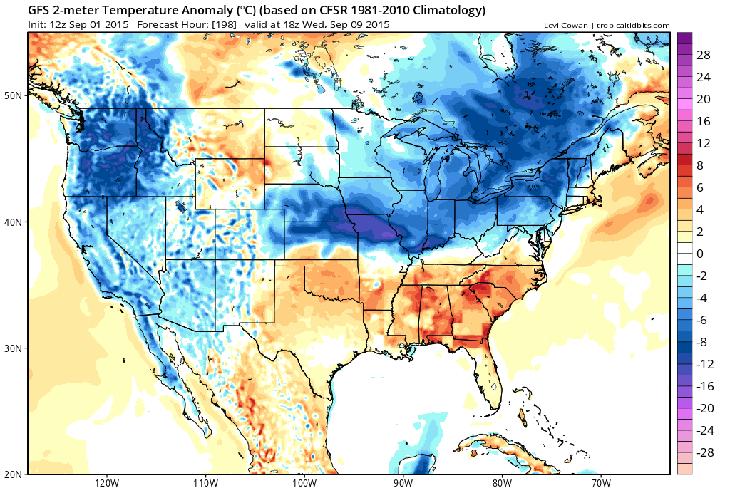
I jumped around a little in the long range to see what’s coming as far as temperatures go and it looks like the period from day 7 to day 16 will be normal or below normal temperature wise if today’s day run of models is correct. My confidence level on this is not all that high at this point.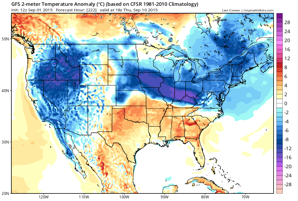
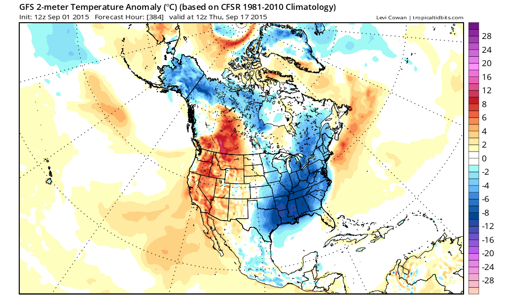
Take a look at the loop of this over 16 days and you can see that we seem to shift around day 7 to a cooler look. Beach weather hangs for another week and then a couple of shots for fall weather appear to be in the cards. This is the view this afternoon at least.