
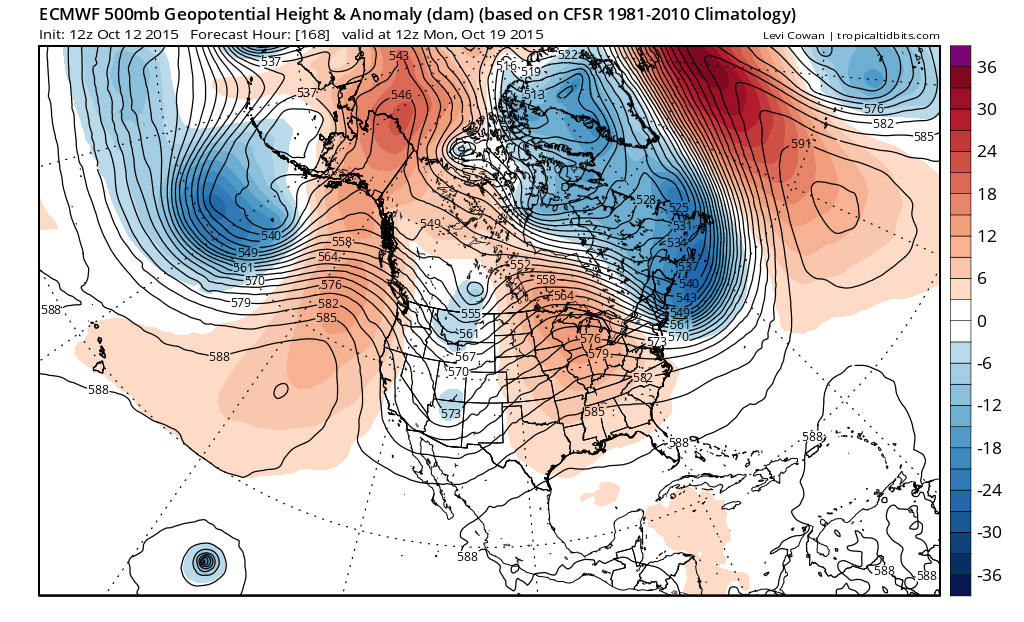
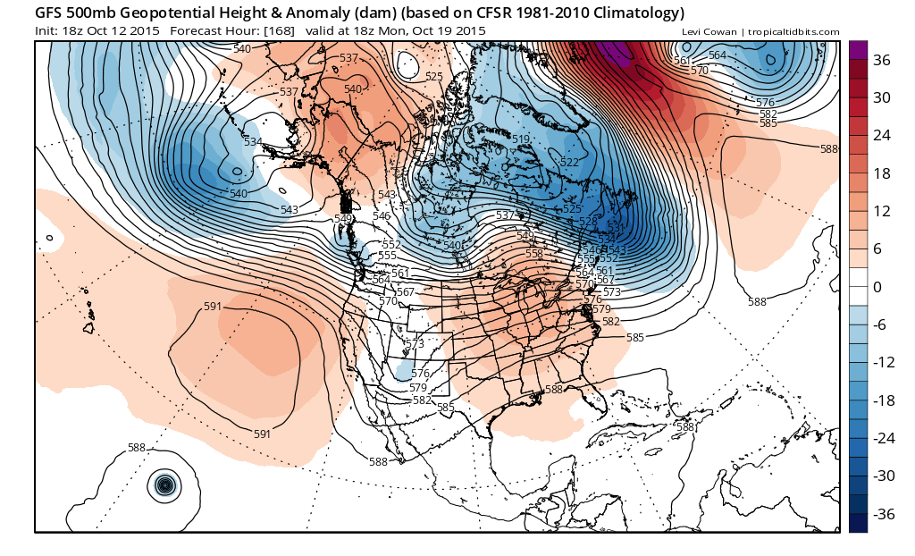
After several runs where models were showing blocking of one form or another, they have now moved away from that idea. One of the issues is the low west of Spain which models appeared to lock in place for a long period of time which would force blocking to develop across the Northeast Atlantic to Greenland. This apparently is not going to be the case as that storm is now forecast to slowly move east which basically breaks up any log jam that might have occured. Instead it appears that everything will be allowed to progress along. Both the European model and the GFS model seem to agree with this idea. If you remember back to last winter, every time the model showed blocking developing it turned out to be wrong. That trend seems to be continuing.
By next monday the deep trough in the east is forecast to lift up and out which means the cold shot over the weekend moves out and we moderate. However there is another system waiting in the wings that brings another cold front through here by day 10 which would by next Thursday. This results in a couple of days of moderation before another cold front moves through. At least that will mean more opportunities for rain with each system.
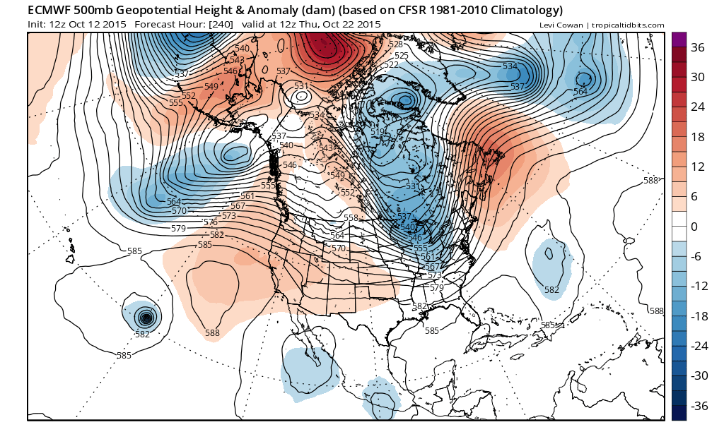
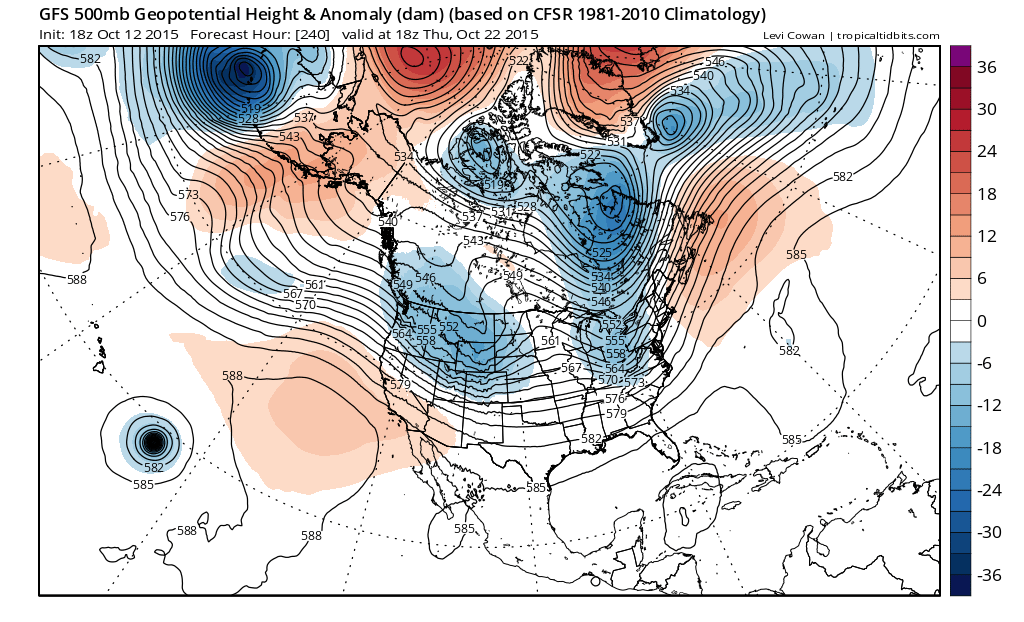
Both models show a trough approaching by day 10. The European appears to be a little deeper than the GFS but it is roughly the same idea. Behind that we have another cold air mass but because the trough is not as impressive as the one for this coming weekend, the cold air behind it is not overly cold. Now this is the simplified look assuming it happens this way. There are a lot of variables here that I think means that the model may change this view somehow. I think the forecast through the weekend looks pretty much locked up and it is just a matter of figuring out the short term issues of wind and clouds when it comes to just how cold and just how extensive the frosts and freezes will be. The warmer urban areas are likely to avoid frosts and freezes.
Of course there is always the chance that models are mishandling big features in the Atlantic and Pacific somehow. We will wait and see how this all plays out.
Be sure to download my app and subscribe to my forecasts. The app is free and subscription is just 99 cents a month for specific local forecasts for New York, New Jersey, Eastern Pennsylvania, and Southern New England.