Joestradamus Long Range Watching Next Week As Dynamic Pattern Evolves
We never really were enthused about snow possibilities for the cold front and wave of low pressure for Thursday night and we still aren’t. However we have been far more intrigued by the possibility of something more substantial for next week in the Tuesday Wednesday time frame and we remain very interested on the possibilities here.
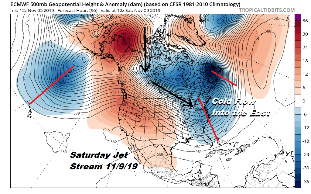
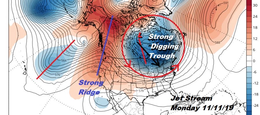
The table is being set for a dynamic pattern evolving early next week. The upper air is actually shaping into a very interesting situation here. We have a deep trough at 160 West (Hawaii) which is pushing a ridge up the west coast. The flow is split in the west and the northern branch revolves around 2 upper lows in Eastern Canada. This drives cold air in behind the Thursday night system and gives us a solid 2 day shot of very cold air for Friday and Saturday. It will be cold enough Saturday for temperatures not getting out of the 30s for highs.

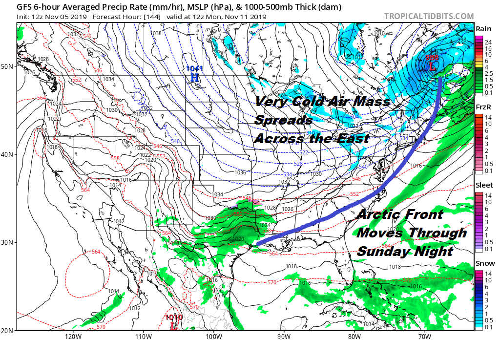
Early next wee the upper low in Eastern Canada and with ridges and troughs in tact elsewhere. We have the table set for a trough rotating around the upper low to begin digging southward into the Great Lakes. All the models show this in some form or another. The strength of that shortwave is key going forward next week. The first thing that happens is an arctic front approaches Sunday so we see temperatures bouncing up into the upper 40s and lower 50s before the front passes.
From here it becomes interesting. Does that digging upper trough do just that and dig southeastward? Or does it get suppressed and swing through harmlessly through the Great Lakes and northeast with no real consequence?
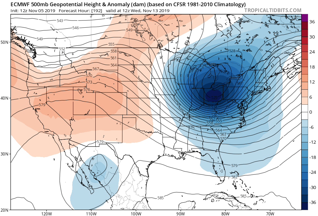
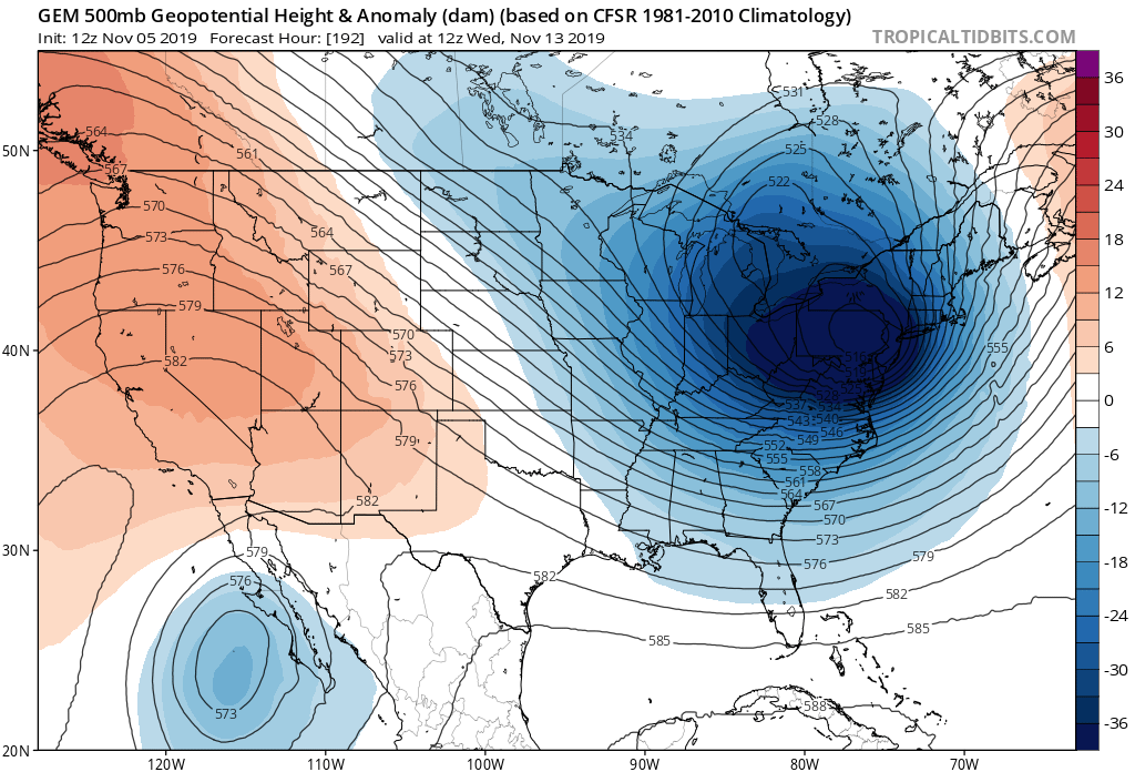
The Canadian and European models certainly take the dynamic route here with the upper system plunging into the East with a storm developing on the old arctic frontal boundary shown the GFS above with cold air all over the place. The GFS suggests the flatter approach (it loves to do that) with no real issues here as everything remains offshore.
We continue to look at this situation with increasing interest for the next Tuesday Wednesday timeframe. There is a lot of energy running around and clearly models will be dancing around all this over the next few days. We will just sit back and watch this all play out. Many days and many runs are ahead of us.
BE SURE TO DOWNLOAD THE FREE METEOROLOGIST JOE CIOFFI WEATHER APP &
ANGRY BEN’S FREE WEATHER APP “THE ANGRY WEATHERMAN!
MANY THANKS TO TROPICAL TIDBITS FOR THE USE OF MAPS
Please note that with regards to any severe weather, tropical storms, or hurricanes, should a storm be threatening, please consult your local National Weather Service office or your local government officials about what action you should be taking to protect life and property.