
The long range outlook is really like looking at a jigsaw puzzle as you try to make sense of the pieces and then try to figure out which piece makes the best fit given the overall pattern. Models often key on the wrong system which create a feedback loop. A feedback loop is when you change one thing and by doing so you wind up changing everything. We saw a beautiful example of this from the GFS a few days ago with make believe hurricanes in the Atlantic that created a pattern in the eastern United States that was just not going to happen given the current conditions so we discounted that out. This morning we have another example of this when we look at the 3 global models. 2 seem plausible and 1 does not.


 The three models at 168 hours which is a week from today do not look unreasonable given the current state of affairs. We have a ridge that wants to be in the east and trough that wants to be in the west. This has been the case for weeks and except for this past weekend when we had a deep trough in the east, this pattern has pretty much held. Beyond 168 hours we have a few things going that alter the look for one model.
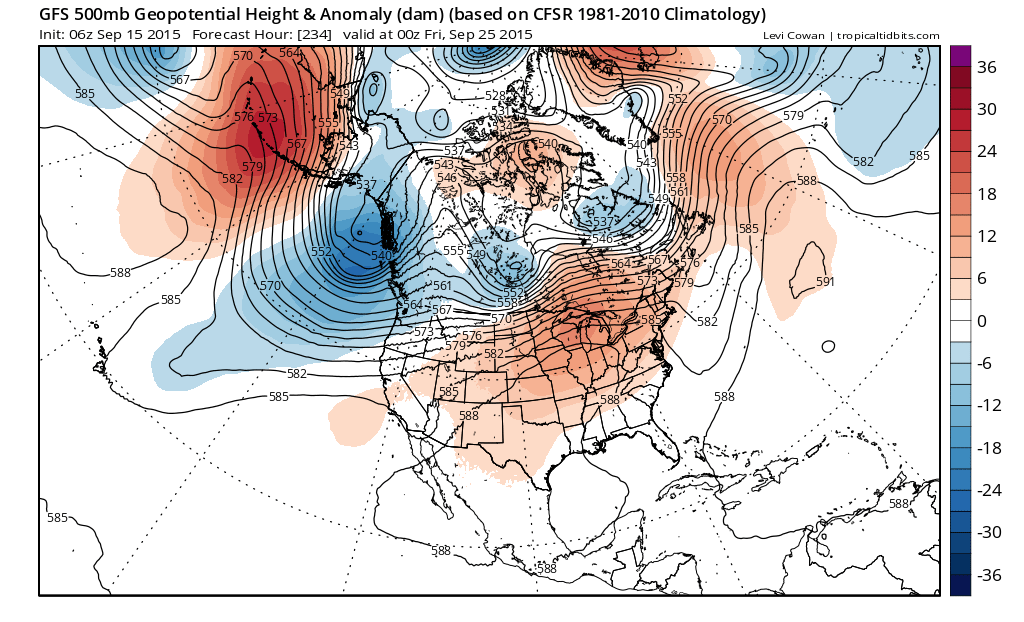
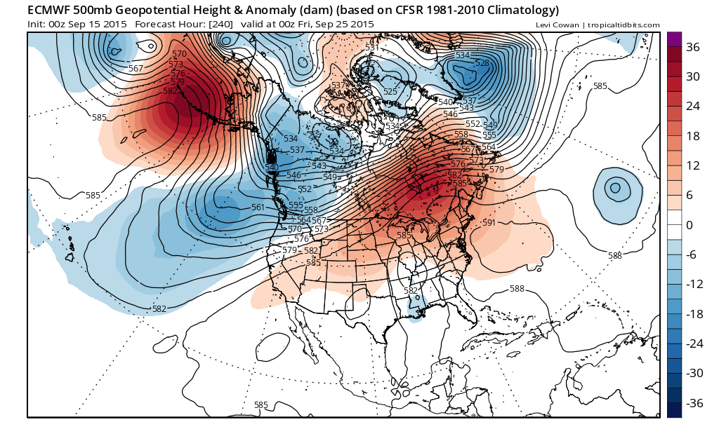
 Now lets jump out to 10 days from now. The GFS and the European have plausible solutions. The European has a tropical storm out in the Atlantic well southeast of Bermuda which creates a ridge off the northeast coast. The GFS has no such system so it allows a system from the maritimes to have more of an influence and has a much flatter look in the east. Okay I can accept either one as possible because the one changing factor is whether there is a tropical storm out there or not. The Canadian however has a totally different look.

Back to the Canadian 168 again and it has at least 1 tropical system and possibly 2. What it does is that it takes energy across Canada which absorbs the tropical system (or systems) and makes a large cyclone in the Canadian maritimes which makes for a much colder look in the east. The model is basically doing the same thing the gfs did with tropical cyclones that probably won’t be there.
Here is the bottom line. Unless something radically changes, i think the basic pattern remains unchanged for the next 10 days. It will be dry with little or no rain. Sunshine by day and clear by night most of the time. There will be an air mass change this weekend back to cool and dry for the start of next week and unless we actually get a hurricane to form that becomes some sort of a game changer, we will view any radical model shift with great skepticism.