
Joestradamus has continued to be utterly frustrated with models that show rain and then no rain and then rain again. It is also each model that flips back and forth. The running trend has been whichever models shows rain has been the one that is wrong. Last night for example the European showed a soaking rain here for later Sunday into Monday. Now the European shows nothing! The gfs still has rain but shows timing is slower and the rain is no where near as impressive as it was last night. Even then it wasn’t very impressive.
The overall pattern remains the same where rain is sparse at best. We will be watching the moisture off the coast as this is what is being lifted northward.

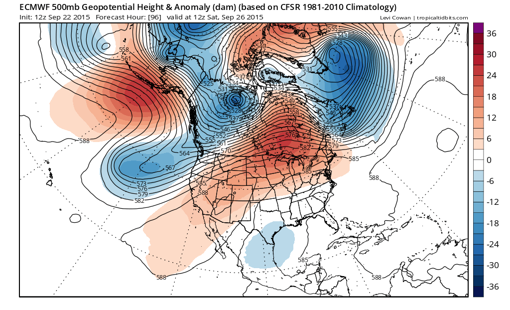
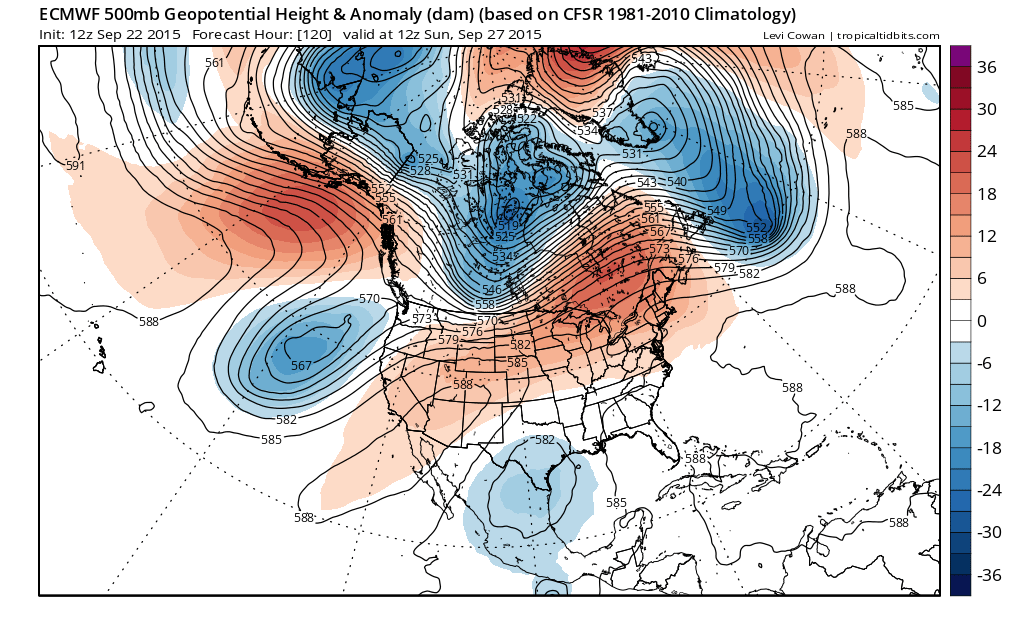
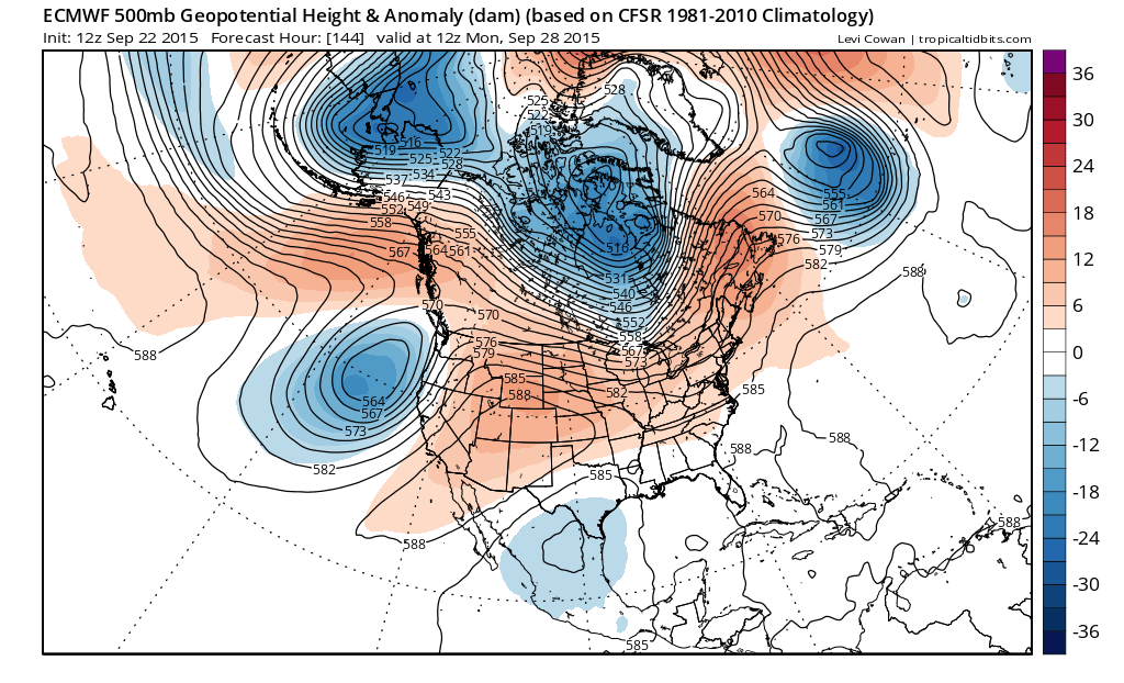
We still have a strong ridge that dominates the east and in fact dominates the flow across most of the United States. Deep troughs are off the west coast and well off the east coast. This set up is a bit unusual and it has also been dominating the pattern for quite awhile. Tropical mositure is effectively shut off. On the other hand the flow does allow for big surface highs to come down from the north which doesn’t help the moisture argument either,
A weak disturbance attempts to lift up but just can’t see to get here. The model shoves moisture, at least on this run to the south and east. Here is the bottom line. Joestradamus thinks that until further notice or until we get some clarity on what is going on off the east coast, rain will not be an issue at least through Saturday and possibly through Sunday…and possibly through much of next week! The only problem might be in the form of cloud cover as the onshore flow sets up again for Friday and the weekend. Temperatures will be either a little below normal on some days or a little above normal on others, 70s by day and low 70s to upper 60s on days with clouds. Nights will be in the 50s to near 60 for the most part.
Be sure to download my weather app and subscribe to my forecasts. The app is free and a subscription is just 99 cents a month..free from advertisements and no security issues.