
Back late last week JOESTRADAMUS noticed blocking showing up on several models and posted about this a couple of times. Then as is typical the model completely lost the blocking and frankly JOESTRADAMUS had all but given up on the idea this morning. Now in come the afternoon models and lo and behold the blocking pattern shows up again. Now I want to emphasize that I am very cautious about this because the blocking depends on one very important factor. If you remember Hurricane Joaquin it wound up becoming a post tropical storm east of Spain and has been sitting there for many days now.
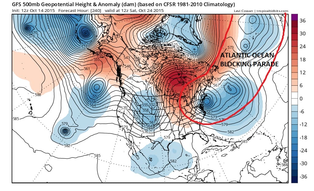
I went out to the GFS Day 10 forecast map which shows a log jam developing in the Atlantic south of 40 degrees north. I mentioned a few days ago when models backed away from blocking that the reason is that storm off Spain (post Joaquin) which the models decided to open up and move eastward which basically keeps the flow going from west to east and hence no blocking. This is the major change in the model run today and frankly I’m skeptical about this. Now it has decided rather than move it eastward, it retrogrades westward! This allows major pressure rises north of 40 degrees north and forces the jet stream further south in the Northeast! The implications are huge beyond the obvious which is colder weather and no ridge in the east. But rather than speculate on that, JOESTRADAMUS wants to make sure this idea is correct first before he jumps on board. It could very well be just a one run hiccup.

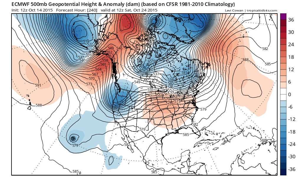
Comparing the European model and the Canadian to the GFS, the Canadian is less blocky as it has less of a log jam in the Atlantic. I can envision it looking more like the GFS if it went out another 24 hours. The European says absolutely not. It has a ridge in the Atlantic where the GFS has that parade of storms.
What does JOESTRADAMUS do other than punt? Well indicators are pointing the Atlantic Oscillation crashing to strong negative in the next 2 weeks which would favor the GFS idea. However the European has not flipped back and of course the stronger outperformance of that model leads to my degree of skepticism. Weighing against the European is that other than Joaquin which it grabbed onto in the short range, this is day 10 we are talking about and lately it has been making lows off the east coast that aren’t there and its performance has been less then stellar. Late this afternoon when the GFS updates, we will see if it holds on to this blocking idea or if it floats back to a non block look. UGH!!!
We should at this time thank Tropical Tidbits for the amazing maps he provides and is generous enough to allow me to share them!!!! Do visit his sight. Also be sure to download my app and subscribe to my forecasts. The app is free and the subscription is just 99 cents a month. Ideal for personal or business use. Android or I phone!