
Given that other than minor fluctuations between now and day 10 (September 8-9 ish) Joestradamus was looking for something to do this afternoon so he decided to see what the 10 to 16 day gfs is telling us.
First off let us quickly look at what is happening right now. We have a ridge in the east and trough in the west and through day 7 (next Sunday) it remains the case. For the most part it means hot days and warm nights with humidity and probably no thunderstorms or even brief downpours as the atmosphere is about as undynamic as you can get this time of year. In fact with the absence of true tropical air and some sort of stalled front, we are at the time of year where thunderstorms activity gradually diminishes anyway. Bake we shall and the dry conditions we have just get even drier.  This is the GFS 96 hour upper air map 18ooo ft level (roughly) with ridge in the east trough in the west.
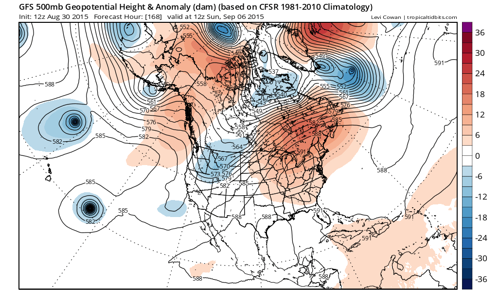
And here we have the GFS 168 hour upper air map with ridge in the east trough in the west. I guess we should be thankful this didn’t happen in late June or July or even early August otherwise we might bake to 100 degrees. I guess we will have to settle for 95. However in weather as we know patterns usually break at some point and we begin to see signs of this at 240 hours (Day 10).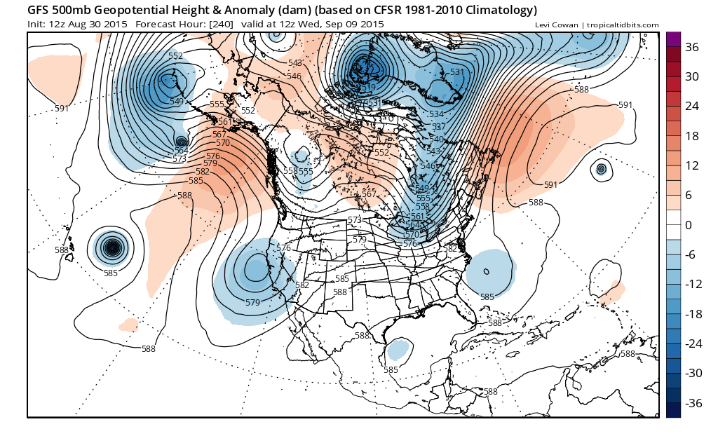
Finally by this time frame we begin to see changes. The Atlantic low south of Greenland is replaced by a ridge. also the ridge in the east flattens as troughing developes over Eastern Canada. This will break the hot weather and allow for some cooling and it might be significant cooling at that. Still through all of this it does not appear to come with any substantial rainfall. 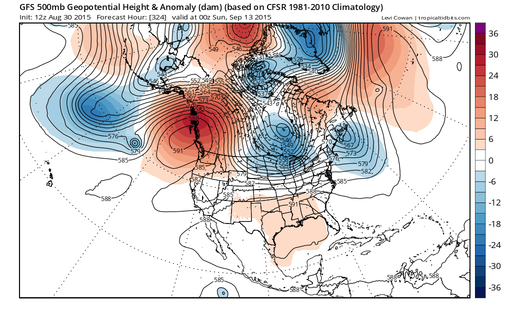 We begin to see more changes as we move out into day 12-13 as the upper atmosphere appears to be in somr sort of flux. Troughing out to the east…strengthening westerlies in Canada, ridge building into the Pacific northwest etc etc.
 Now lets look at day 16 and this is really very interesting as a vortex in Canada takes hold..ridge in the west and very strong. This would be a very strong shot of cold air coming into the United States at this point. Now of course this is in silly speculative mode but when it is 90 outside and you think its going to be 90 or higher every day for next week and a half you have to grab on to something. There are a number of long range signals that point to this idea including recurving typhoons, oscillations in the Pacific and Atlantic that are forecast to swing into colder than normal mode. For now it is in the land of pure speculation. What I am more interested in is something which suggests a break in the dry weather pattern and a good widespread rain. At least one nice rain event might be nice in the long range. Unfortunately that we don’t see at this time. Nor do I see anything that might suggest even some tropical activity though that is much more a short term issue than anything else. Enjoy the heat and the extra beach days and the late labor day weekend this year.
Im putting up a high temp map for 15 days from now. At least on this page its just a temperature map and not a hurricane map. Its not going to make you run out and hoard polyblend sweaters.