Joe’s Early Call Snow Forecast, Not Much
Cold Start to Next Week Before Warmer Pattern Develops

Joe’s Early Call Snow Forecast, Not Much
Cold Start to Next Week Before Warmer Pattern Develops

While the upper air is similar to the January 28-29 storm it doesn’t end up the same way and that’s thanks to the puzzle pieces and how they play out. The upper air is just too suppressive and the coastal low goes way out to the east with no impact. We do have the upper trough though and that might be vigorous enough to produce a light event Sunday into Sunday night. The best chances for maybe a few inches would be coastal NJ and Long Island, Southern Ct east to Southeast New England. It is hard to find much upside here unless the trough winds up sharper and enhances more snow as it nears the coast. I think the chances of that are low. There is probably a higher chance we get just some snow showers out of this and that’s it. I will monitor for any signs of change in this but upside is limited if any at all from what I’m seeing right now.
SATELLITE

WEATHER RADAR

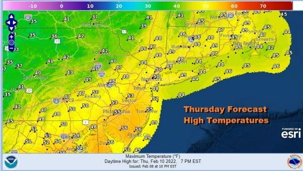
We do have some clouds around this evening especially as you go north and there are some scattered showers on the radar well to the north. We rebounded to the upper 40s to mid 50s today and that mild air continues into Saturday. Thursday should be a nice day of no worse than partly sunny skies and temperatures into the 50s and the same will hold for Friday.

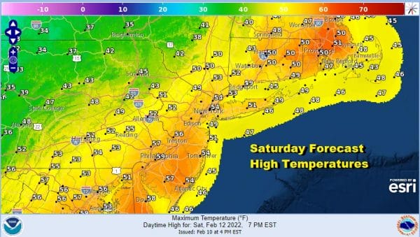
Saturday we see a stronger cold front that will be approaching and moving through later in the day. The morning launching pad will be in the 30s and 40s so mid to upper 50s are doable with some sunshine before clouds and the front move through. The front will move through dry so we are not including the chance for a shower at this time.
The front stalls to our south and a wave develops on the front and moves northeast. The precipitation from this saves us from a more sizeable snowfall. The upper trough to the west will have enough energy for a period of snow Sunday, probably during the morning hours with some leftover snow showers later in the day. Again based on the early call we aren’t calling for much and don’t see much if any upside here. There is even the chance that nothing much if anything at all happens and we spend the day cloudy cold and mostly dry. Temperatures will settle in the 20s Sunday morning and probably not move much as colder air comes in,. By Monday morning as skies clear, we will be in the teens to lower 20s. Monday will be a cold day with sunshine and highs just in the 20s.
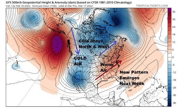
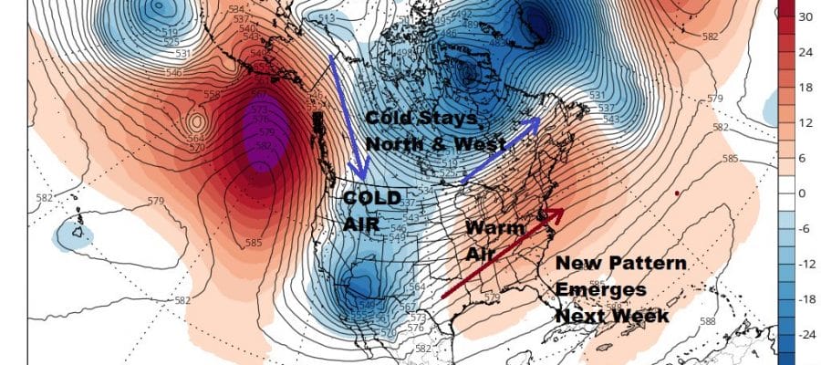
A new pattern emerges next week and that brings a break to the wintry cold pattern of the last 6 weeks. It was due to change and it will as the trough pulls out of the east and goes to the west. All the cold air will either stay in Canada or drop into the western half of the US. Our temperatures will rebound and be back in the 40s on Wednesday and at least into the 50s Thursday and Friday though by the end of next week we will have a cold front and rain to deal with. This pattern should hold for at least a week to 10 days and then we will see whether it reverts back to the pattern of January or holds on for a longer stretch into the end of February.
BE SURE TO DOWNLOAD THE FREE METEOROLOGIST JOE CIOFFI WEATHER APP &
ANGRY BEN’S FREE WEATHER APP “THE ANGRY WEATHERMAN!
MANY THANKS TO TROPICAL TIDBITS & F5 WEATHER FOR THE USE OF MAPS
Please note that with regards to any severe weather, tropical storms, or hurricanes, should a storm be threatening, please consult your local National Weather Service office or your local government officials about what action you should be taking to protect life and property.


