IRMA DESTINY DEPENDS ON ATLANTIC RIDGE
IRMA DESTINY DEPENDS ON ATLANTIC RIDGE
Irma is the new tropical storm on the map and it is an impressive looking system. It developed very quickly over night and this morning and it is evident on the satellite loop that Irma is a big system with a classic satellite signature of a strengthening tropical storm. It is also very far away at the moment as it is west of the Cabo Verde Island and moving toward the west. It will take many days for Irma to cross the Atlantic and where it winds up and how far west it gets is going to depend on the Atlantic ridge of high pressure that is forecast to build over the next 5 days.

With regards to strengthening there is an upper low in the Atlantic well to the northwest of Irma. This system is meandering northward and is not all that strong. As long as this remains the case conditions across the tropical Atlantic shoudl remain favorable for strengthening. There is some dry air evident in the Central Tropical Atlantic at the moment but it does not look like it presents a big challenge. It might slow the strengthening rate some for a time but it should not hinder this system from becoming a hurricane and possibly a major hurricane.

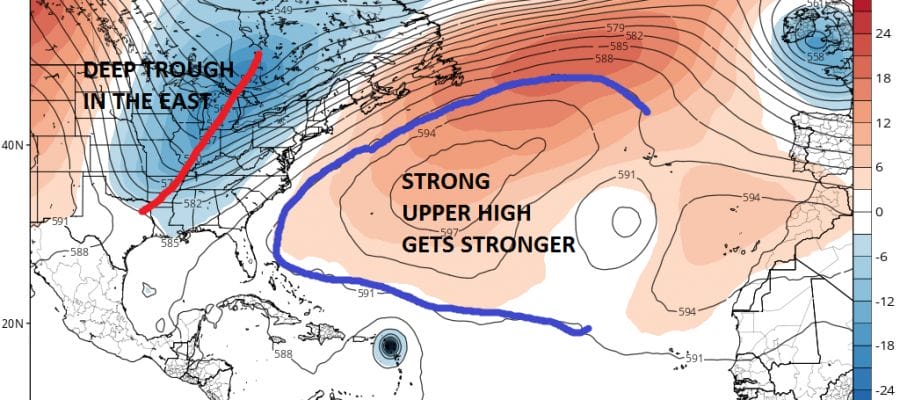
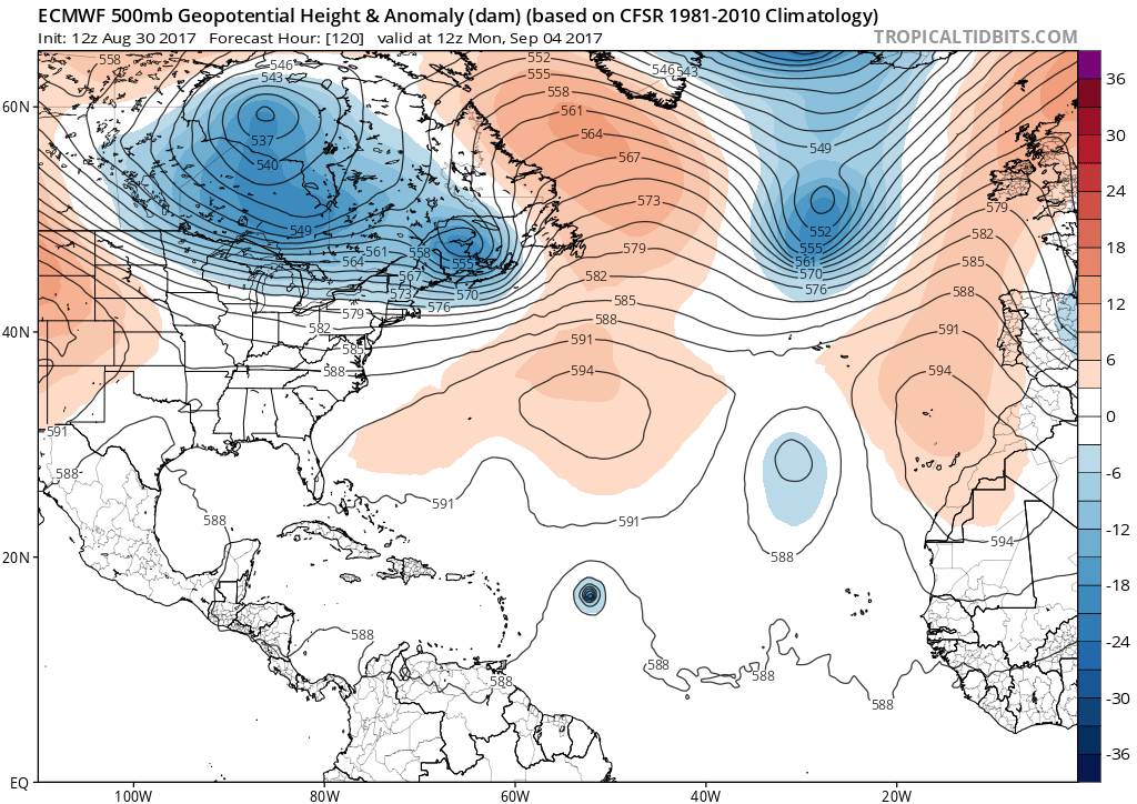
Weather models are all showing a very strong ridge building in the Atlantic. The GFS model and European model are not that much different in their profiles of the upper atmosphere at the moment

Both models actually line up pretty evenly. The European’s ridge is perhaps a bit stronger on the Western flank. This would suggest a westward motion overall through the next 5 days. Irma could be approaching the northern Leeward Islands next Tuesday.
Later next week the strong upper air system over Hudson Bay will begin to carve out a deep trough in the Eastern United States. With Irma so far west it will not time out for an East Coast run but it might start to pull Irma further north as the ridge in the Atlantic erodes some on the western flank.

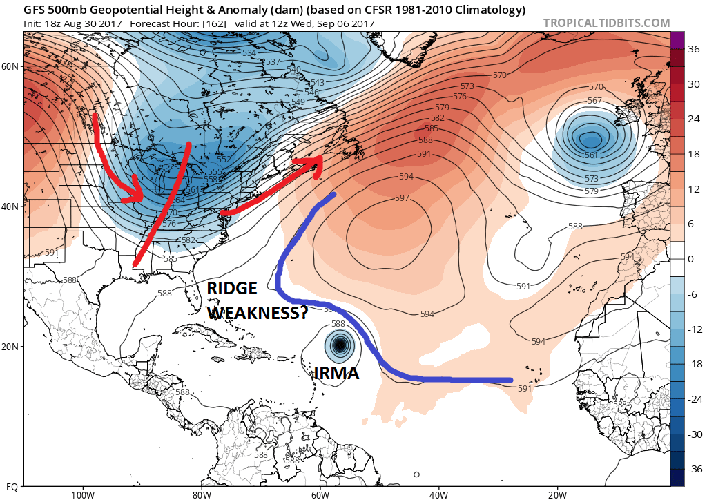
Important differences begin to develop in the models a week from today. The European has a very strong Atlantic ridge and a deep trough over the Eastern half of the US but the axis of the trough is a bit further west. The GFS has a broader look and a much weaker ridge in the Atlantic with a weakness that develops off the Southeast coast. The GFS would suggest recurvature east of 70 west at this point while the European has the ridge so strong that the west motion could continue for a much longer period of time.
The big question here is which model has a better handle on the upper air structure as we go deeper into the long range. Will the Atlantic ridge be so strong that Irma becomes a threat to the United States in the longer term. Or is the deep trough on the GFS and the weaker Atlantic ridge weak enough where Irma begins to turn northwestward and eventually northward long before it nears the US? With regards to strength both models are very aggressive with the European and the GFS both strengthening this to a category 4 hurricane and the GFS actually gets it to a category 5. As we know intensity forecasts with tropical systems can be problematic but it does seem that Irma will become a major hurricane as it gets further west in its life cycle. The European model suggests that the upper trough in the east will weaken some and that Irma may not get picked up at all. We will have a very interesting puzzle to decipher over the next week as Irma pushes across the Atlantic.
MANY THANKS TO TROPICAL TIDBITS FOR THE WONDERFUL USE OF THE MAPS
Weather App

Don’t be without Meteorologist Joe Cioffi’s weather app. It is really a meteorologist app because you get my forecasts and my analysis and not some automated computer generated forecast based on the GFS model. This is why your app forecast changes every 6 hours. It is model driven with no human input at all. It gives you an icon, a temperature and no insight whatsoever.
It is a complete weather app to suit your forecast needs. All the weather information you need is right on your phone. Android or I-phone, use it to keep track of all the latest weather information and forecasts. This weather app is also free of advertising so you don’t have to worry about security issues with your device. An accurate forecast and no worries that your device is being compromised.
Use it in conjunction with my website and my facebook and twitter and you have complete weather coverage of all the latest weather and the long range outlook. The website has been redone and upgraded. Its easy to use and everything is archived so you can see how well Joe does or doesn’t do when it comes to forecasts and outlooks.
Just click on the google play button or the apple store button on the sidebar for my app which is on My Weather Concierge. Download the app for free. Subscribe to my forecasts on an ad free environment for just 99 cents a month.
Get my forecasts in the palm of your hand for less than the cost of a cup of Joe!