Irma 2 US Landfalls Florida South Carolina Georgia Coast
Irma 2 US Landfalls Florida South Carolina Georgia Coast
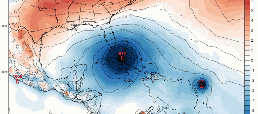
It is becoming increasingly likely that the buzzsaw that is Category 5 Irma is likely to make 2 US landfalls as a major hurricane which is something that doesn’t happen often. Given the strength of the hurricane and the fact that it may not lose a lot of intensity after a first landfall over Florida means that it could likely be a category 3 or 4 hurricane as it makes a second landfall. So say the models this afternoon which see to be coming a little closer together on the final track. Both the GFS and European and even the sloppy Canadian model is back to that idea.

The GFS model and the European model are both very close. The European is a little further west than the GFS and has more of an inland track over Florida while the GFS takes the hurricane inland in Southeast Florida and than back out offshore.
EUROPEAN MODEL SATURDAY THROUGH MONDAY CLICK TO ANIMATE
GFS MODEL SATURDAY THROUGH MONDAY CLICK TO ANIMATE
The European model track is worse for Florida since it takes it inland and takes a track where the bulk of the circulation cuts a path toward the Atlantic coast the long way. Weakening will be slow and this track will produce a large swath of wind damage on both coasts as well as inland areas.
The GFS track is no bargain either since it brings the storm onshore (barely) near Miami and than back out offshore as at least a strong category 4 and then both models go inland in somewhere along the South Carolina Georgia coast on Monday. Weather models continue to come together on the tracks. The spread continues to narrow The strength of the trough diving down from the Great Lakes to the North Central Gulf States essential hooks Irma and then turns in northwestward into the Central Appalachians where a large scale rain event is likely.
With regards to impacts in our area, storms that usually go west of the Appalachians are normally not big rain producers here. The remnant rain is dependent on how much energy is available in the jet stream and right now it appears to be a bit underwhelming. We should have a better handle on this once we are absolutely sure of the final track.
MANY THANKS TO TROPICAL TIDBITS FOR THE WONDERFUL USE OF THE MAPS
 GET JOE A CIGAR IF YOU LIKE

Weather App

Don’t be without Meteorologist Joe Cioffi’s weather app. It is really a meteorologist app because you get my forecasts and my analysis and not some automated computer generated forecast based on the GFS model. This is why your app forecast changes every 6 hours. It is model driven with no human input at all. It gives you an icon, a temperature and no insight whatsoever.
It is a complete weather app to suit your forecast needs. All the weather information you need is right on your phone. Android or I-phone, use it to keep track of all the latest weather information and forecasts. This weather app is also free of advertising so you don’t have to worry about security issues with your device. An accurate forecast and no worries that your device is being compromised.
Use it in conjunction with my website and my facebook and twitter and you have complete weather coverage of all the latest weather and the long range outlook. The website has been redone and upgraded. Its easy to use and everything is archived so you can see how well Joe does or doesn’t do when it comes to forecasts and outlooks.
Just click on the google play button or the apple store button on the sidebar for my app which is on My Weather Concierge. Download the app for free. Subscribe to my forecasts on an ad free environment for just 99 cents a month.
Get my forecasts in the palm of your hand for less than the cost of a cup of Joe!