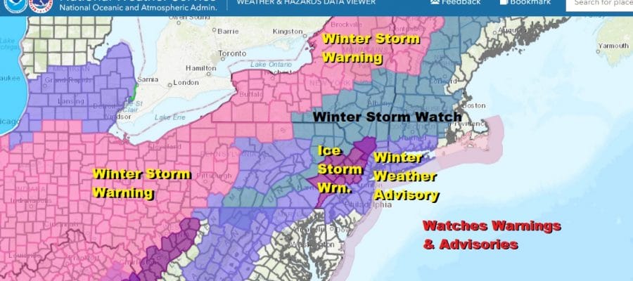
Ice Storm Warnings Winter Storm Watch Winter Weather Advisories Posted Monday into Tuesday AM

Weather in 5/Joe & Joe Weather Show Latest Podcast
Ice Storm Warnings Winter Storm Watch Winter Weather Advisories Posted Monday into Tuesday AM
A large variety of warnings and advisories have been posted for the next storm system due to begin during Monday and then go full force Monday night into Tuesday morning. Temperatures are going to be critical here inland where getting back to 32 is going to be very tough to accomplish. Ice Storm Warnings are up for Northeast Pennsylvania and Northwest New Jersey and parts of the Hudson Valley. Winter Weather Advisories from interior South Jersey northeast to Southern New England, NYC an Long Island as well as Southeastern Pennsylvania. Winter Storm Watch posted for the Catskills and Northern half of Connecticut.
This has been a rather remarkable day with winter weather warnings up of one form or another virtually from coast to coast. It is a day where the entire state of Texas is under a winter storm warning for the first time ever.

While skies managed to brighten up at times in some areas and temperatures made a break above 32 degrees it was temporary. Lots of clouds remain on the satellite view. There is a weak low to the south that is producing clouds as well as some precipitation.
SATELLITE

Precipitation from that weak low is showing up on the regional radars now in the Mid Atlantic. That rain should stay mostly offshore but it could brush some areas of Coastal New Jersey and Long Island overnight with some light precipitation be it sleet or freezing rain.
F5 WEATHER RADARS


The real battle ahead will be in the forecast trying to figure out how much warming of ground temperatures will occur. Typically in these situations weather models do not handle low level cold air very well at all. They tend to dislodge it too fast. It will be very important to monitor temperatures hour by hour.
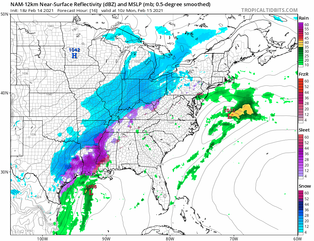
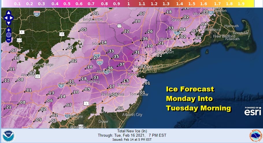
Along the coast during the day Monday not much will happen. We are looking at freezing rain however developing inland with the bulk of the precipitation Monday night into Tuesday morning. It should change to rain overnight in coastal areas and perhaps the freezing rain rain line will move far enough inland to keep ice accretion between .10 and .25 inch.
Weather conditions will improve later Tuesday. We will break this all down in detail on Monday. As far as the next storm for Thursday it appears that we could see a thumping of snow as that storm arrives before changing to freezing rain and rain. More on that tomorrow as well.
BE SURE TO DOWNLOAD THE FREE METEOROLOGIST JOE CIOFFI WEATHER APP &
ANGRY BEN’S FREE WEATHER APP “THE ANGRY WEATHERMAN!

MANY THANKS TO TROPICAL TIDBITS & F5 WEATHER FOR THE USE OF MAPS
Please note that with regards to any severe weather, tropical storms, or hurricanes, should a storm be threatening, please consult your local National Weather Service office or your local government officials about what action you should be taking to protect life and property.


