Hurricane Lee to Pass to the East of New Jersey & Long Island,
Mostly Nice Weather Through Sunday

Hurricane Lee to Pass to the East of New Jersey & Long Island,
Mostly Nice Weather Through Sunday
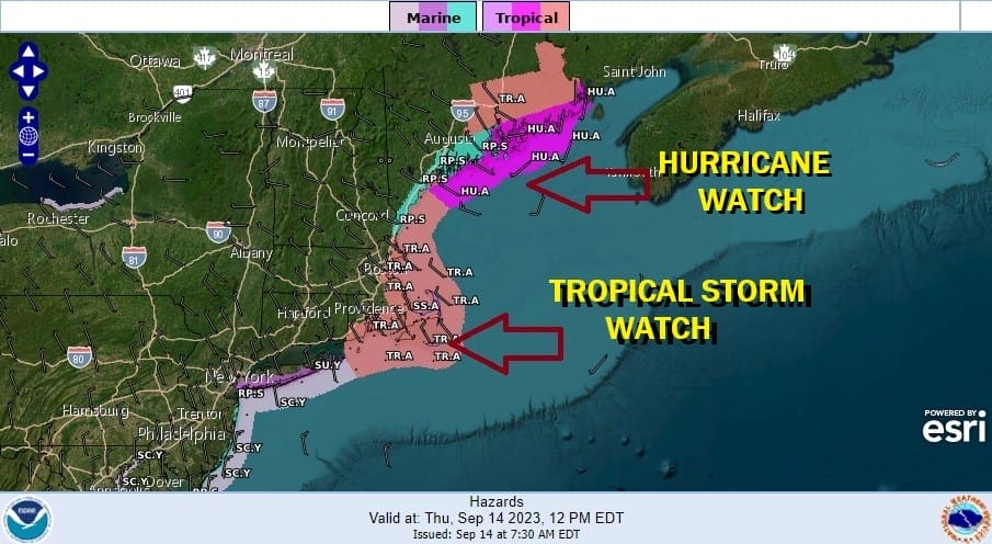
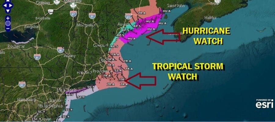
Hurricane Lee is moving northward up the East Coast and has max winds of 100 mph. However Lee has grown very large in the last few days with an immense circulation that spans over 500 miles across. This means that gale force winds extend 250 miles to the east of the center and 200 miles to the west. We have tropical storm watches up for Southeast New England to Central Maine; hurricane watches are up from the Central Maine coast to the US Canada border. Enviormental Canada has Hurricane Warnings up for Western Nova Scotia and the Bay of Fundy.
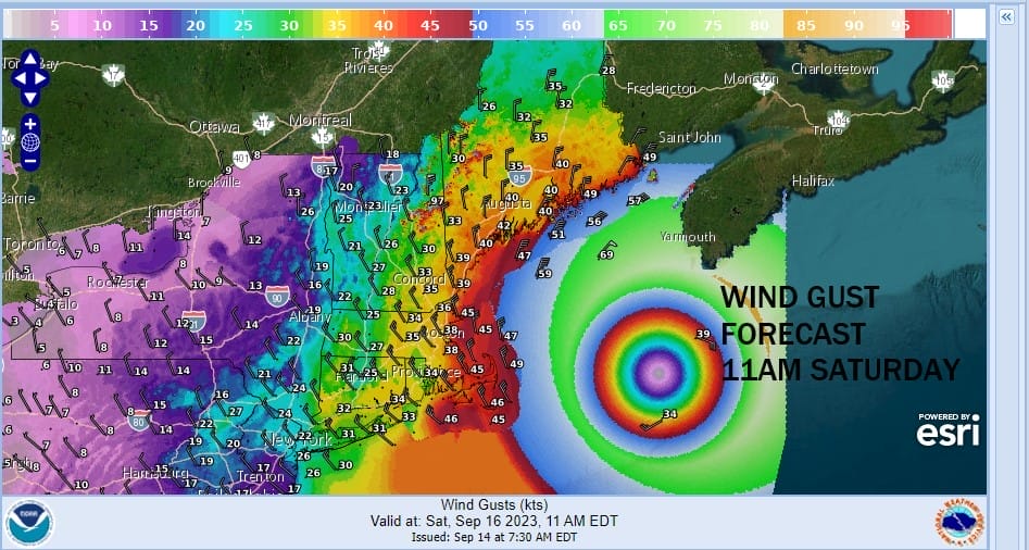
Above is a snap shot of the wind gust forecast for Saturday morning along the Northeast US coast. Gusts to 30 to 40 mph will occur as far southwest as Eastern Long Island while the areas in the tropical storm watch will see gusts of 40 to 50 mph or more especially on Cape Cod which could see gusts to 60 mph or more as Lee passes to the east.
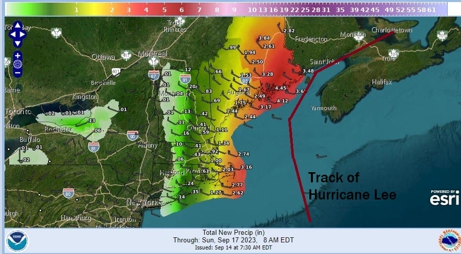
As far as rainfall is concerned, it is possible that the back edge of the rain from Lee could briefly make it to Eastern Long Island and Eastern Connecticut Friday night into Saturday morning however the heaviest rain of 2 to 4 inches or more will be along the coast from Southeastern Massachusetts to Downeast Maine.
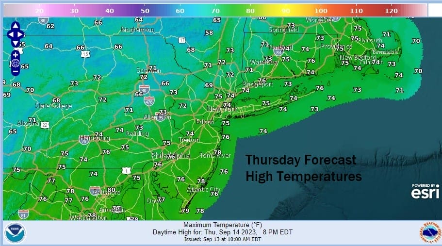
In the meantime today we have yesterday’s cold front now well offshore and high pressure is building into Upstate NY and New England. This is leaving us in a nice spot for today with sunshine, a nice northerly breeze and high temperatures that will be mostly in the 70s Most importantly, humidity levels have come way down as dew points drop into the 40s.
SATELLITE WITH LIGHTNING STRIKES

WEATHER RADAR

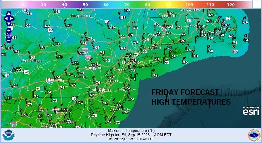
Most low temperatures tonight under clear skies will be in the 50s inland and lower 60s coast. Some cold spots inland could see lows in the 40s. Friday as Lee continues its march northward, we could see some clouds backing in from the east and those clouds could make it as far inland as New Jersey and the Hudson Valley. Some sun should be in the mix though especially early. This will impact temperatures with highs in the low to mid 70s and it is possible that some inland spots, especially in Southern New England, won’t get out of the 60s.
Friday night and Saturday Lee passes to the east. At it’s closest point it will be about 320 miles east of New York City and the New Jersey shore, 200 miles east of Montauk, Long Island. Look for clouds to be around Friday night and Saturday especially over Southern New England and Long Island. Rain could back westward for a short time into Eastern Connecticut and Eastern Long Island.
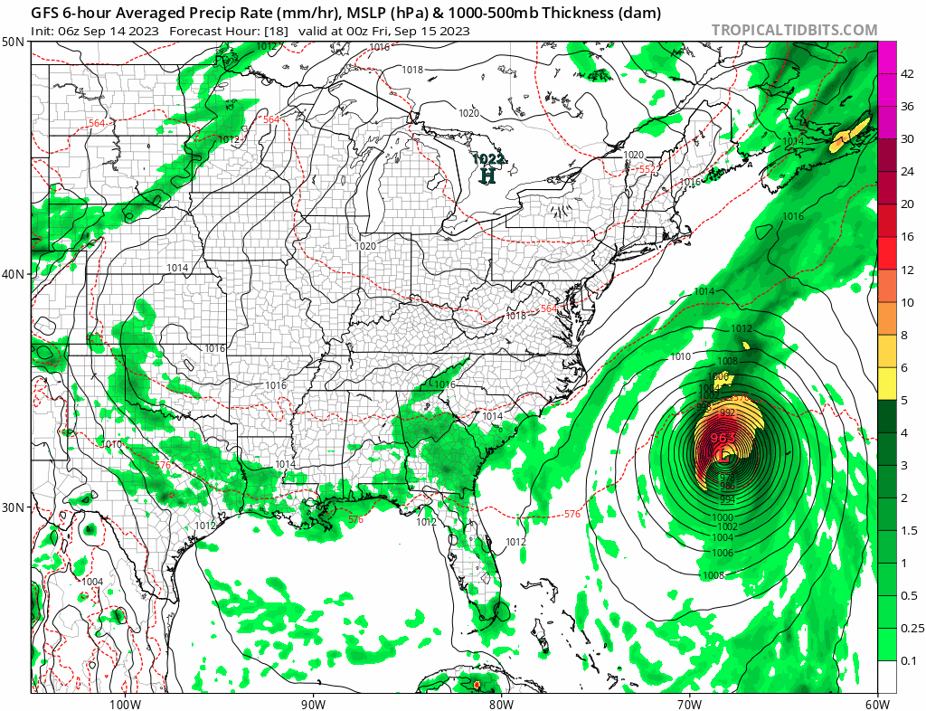
There isn’t much difference in the global models overnight with the European and the GFS relatively close to each other as far as the track is concerned. Both models as well as the hurricane tracking models are showing a track where the center passes just southeast of Eastport Maine and into the Bay of Fundy.

As the day wears on Saturday we are likely to see improvement as clouds pull out from west to east. Some sunshine should develop inland from New Jersey and the Hudson Valley westward while it might take all day for clouds to clear out of Southern New England and Long Island. Highs will be just into the 70s and some places to the east will not get out of the 60s.
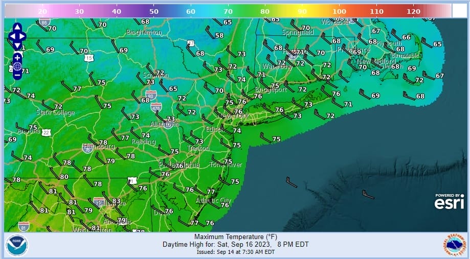
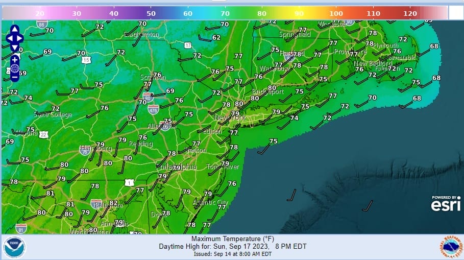
Saturday will be a bit of a breezy day with winds gusting to 20 and perhaps even 30 mph at times inland while over Eastern Long Island and Eastern Connecticut gusts could be much higher. These wind gusts will subside Saturday night. Sunday looks like a nice day of sunshine but clouds will arrive later in the day. Highs Sunday will be in the 70s Humidity remains very low all weekend.
Some showers could develop late Sunday or Sunday night ahead of another cold front, and then it is back to dry weather and sunshine to start next week. Highs Monday and Tuesday will be in the mid to upper 70s as the low humidity pattern continues.
BE SURE TO DOWNLOAD THE FREE METEOROLOGIST JOE CIOFFI WEATHER APP &
ANGRY BEN’S FREE WEATHER APP “THE ANGRY WEATHERMAN!
MANY THANKS TO TROPICAL TIDBITS FOR THE USE OF MAPS
Please note that with regards to any severe weather, tropical storms, or hurricanes, should a storm be threatening, please consult your local National Weather Service office or your local government officials about what action you should be taking to protect life and property.
(Amazon is an affilate of Meteorologist Joe Cioffi & earns commissions on sales.)


