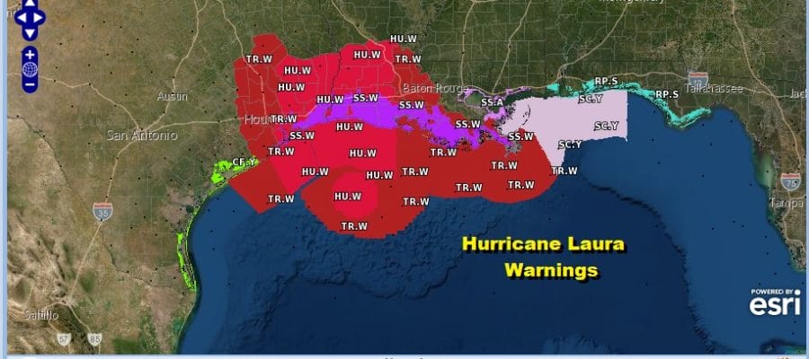
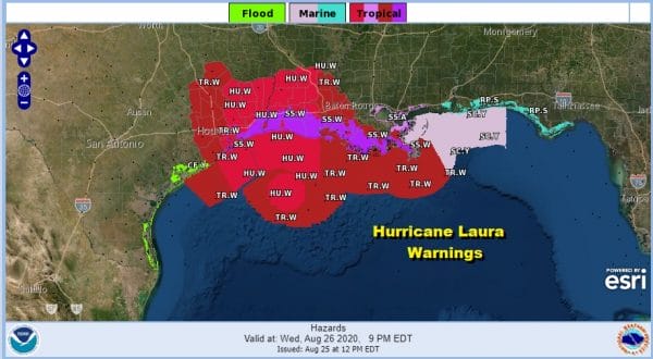
Hurricane Laura Hurricane Warnings Northwest Gulf Coast
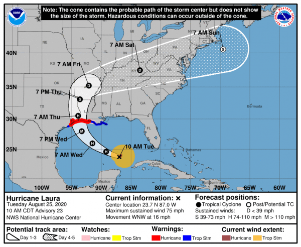
Hurricane Warnings are up for the Northwest Gulf Coast as Hurricane Laura continues to organize in the South Central Gulf of Mexico. More than half of the intensity models as well as the global models like the GFS and European forecast Laura to become a category 3 hurricane before landfall sometime Wednesday night or early Thursday.
11AM ET LOCATION…23.7N 87.0W
ABOUT 585 MI…940 KM SE OF LAKE CHARLES LOUISIANA
ABOUT 620 MI…1000 KM SE OF GALVESTON TEXAS
MAXIMUM SUSTAINED WINDS…75 MPH…120 KM/H
PRESENT MOVEMENT…WNW OR 290 DEGREES AT 16 MPH…26 KM/H
MINIMUM CENTRAL PRESSURE…990 MB…29.24 INCHES
LAURA SATELLITE
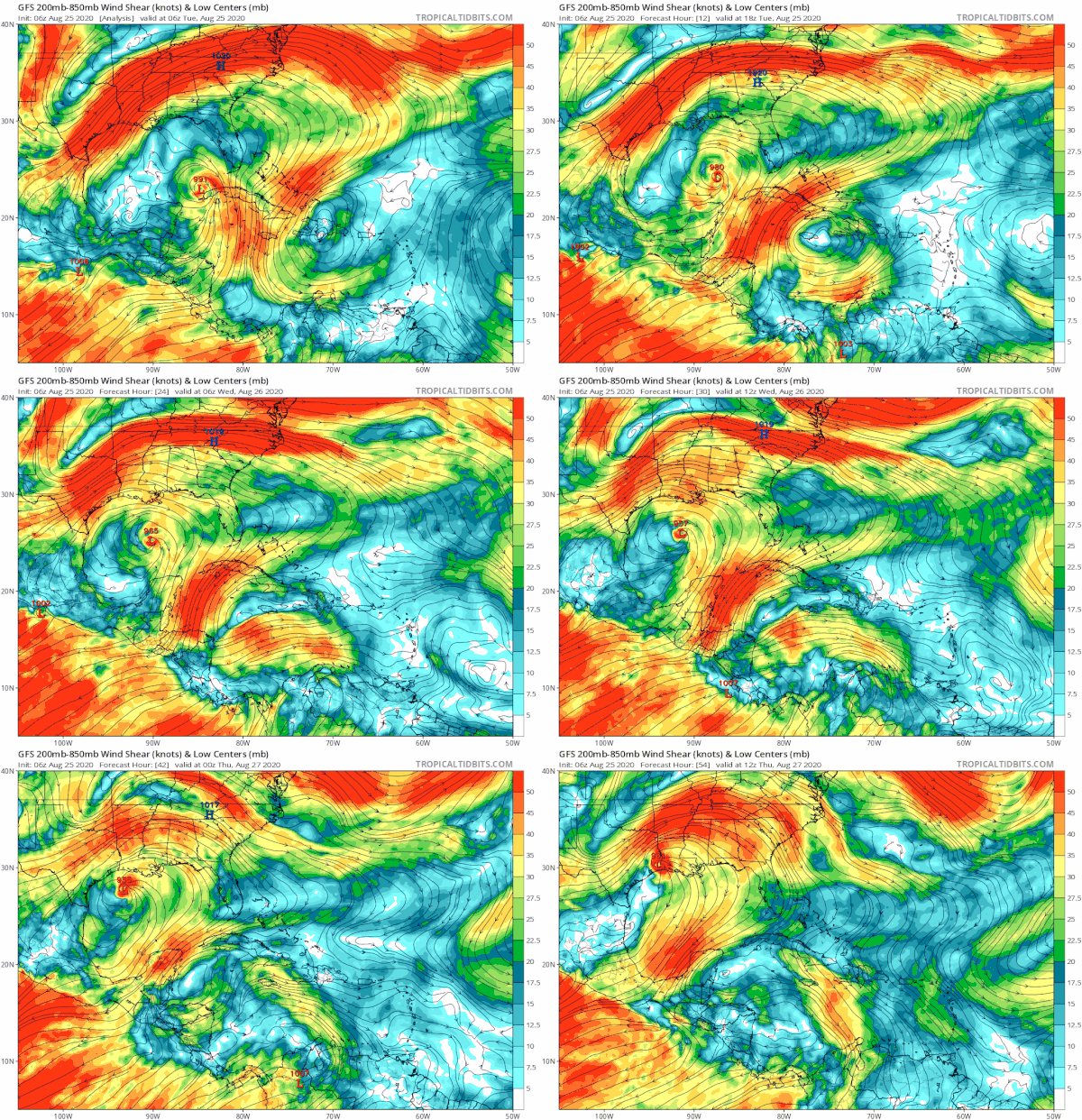
Laura still has most of its convection east of the center with not that much to the west at this time. During this afternoon we should start seeing the core of the hurricane develop more extensively and we will wait for the next recon report later this afternoon and evening for confirmation of intensification. Conditions favor a period of rapid strengthening developing tonight into Wednesday.
The deep upper air trough in the Western Gulf of Mexico that sheared Marco apart continues to retreat westward creating a conducive environment for strengthening. Laura is under an upper air high which hurricanes that it carries throughout its path until landfall.

A Hurricane Warning is in effect for San Luis Pass Texas to Intracoastal City Louisiana. A Tropical Storm Warning is in effect for Sargent Texas to San Luis Pass and East of Intracoastal City Louisiana to the Mouth of the Mississippi River.
Once inland, Laura will move northward and it eventually will be absorbed by a frontal system to the north. That front will reach the East Coast on Saturday with the likelihood that we will see showers and thunderstorms here on Saturday. It should be noted that this is a different set up from what we saw from Izaias with regards to being impacted from an inland low and we won’t see a repeat performance of wind.
BE SURE TO DOWNLOAD THE FREE METEOROLOGIST JOE CIOFFI WEATHER APP &
ANGRY BEN’S FREE WEATHER APP “THE ANGRY WEATHERMAN!
MANY THANKS TO TROPICAL TIDBITS FOR THE USE OF MAPS
Please note that with regards to any severe weather, tropical storms, or hurricanes, should a storm be threatening, please consult your local National Weather Service office or your local government officials about what action you should be taking to protect life and property.


