Hurricane Jose Has Not Gone Away & Won’t For Awhile
Hurricane Jose Has Not Gone Away & Won’t For Awhile
With all the attention that Irma has been getting we have been spending very little time on Hurricane Jose which is still lurking about in the Atlantic. It passed just barely north of the Leeward Islands yesterday as a category 4 hurricane sparing them a second major hit 2 days after Irma has passed. Since then Jose has been moving northwestward north of Puerto Rico and has weakened since almost reaching category 5 status. The future of Jose is highly uncertain because of the nature of the upper air pattern that is developing across the Atlantic. You can see Jose’s ragged appearance on the satellite loop below with the outflow from Irma not that far away to the west. This will probably continue to impact Jose for another 24 hours or so before Irma releases its stranglehold on Jose. After that the future of Jose becomes rather muddied.
SATELLITE LOOP
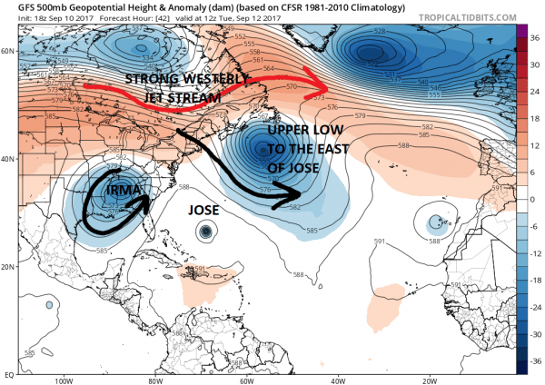
Normally we would expect a storm in a situation like this to get kicked out to sea. However there are changes in the upper air pattern that will cause Jose to take a rather unusual track. Jose is sandwiched between a strong upper air low to the northeast of it and Irma to the west. A strong jet stream is present across Southern Canada. Jose has no place to go here so it will likely either stall or do a clockwise loop somewhere between the Bahamas and Bermuda.
GFS UPPER AIR TUESDAY 9/12/2017
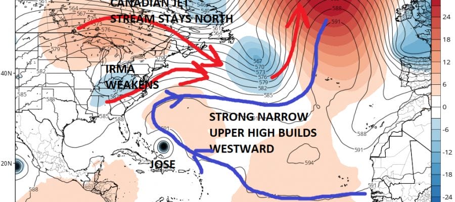
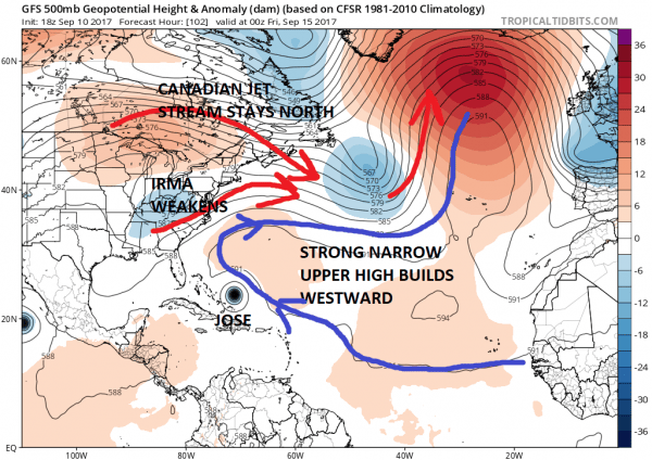
The upper air system that is Irma will move westward and weaken. The system to the northeast of Jose will move away to the east. What is left is a ridge of high pressure in between that will build during the second half of this coming week.
GFS UPPER AIR THURSDAY NIGHT 9/14/2017
This building ridge in the Atlantic is likely to turn Jose back to the west or west northwest later this week and bring it close to the Eastern Bahamas. It is also possible that it could strengthen again. Now from here the questions for the longer range. We just saw with Irma the stubborn strength of a strong ridge that took Irma much further west than models indicated. Is this about to happen again with Jose? The strength of that ridge will be key in determining how far west Jose gets before attempting any kind of turn. The most likely scenario is that it will eventually turn northward and northeastward. However if that ridge in the Atlantic is stronger it could create other scenarios. From here it is a watch and wait situation. It seems a good bet that Jose will be out there for awhile. There is an outside chance that the trough now off the New England coast could pick it up at the last minute and we can avoid all this. However almost all models including the European seem to have latched on to this idea. We will wait and see how it evolves as the new week gets underway.
 GET JOE A CIGAR IF YOU LIKE
FiOS1 News Weather Forecast For Long Island
FiOS1 News Weather Forecast For New Jersey
FiOS1 News Weather Forecast For Hudson Valley


