
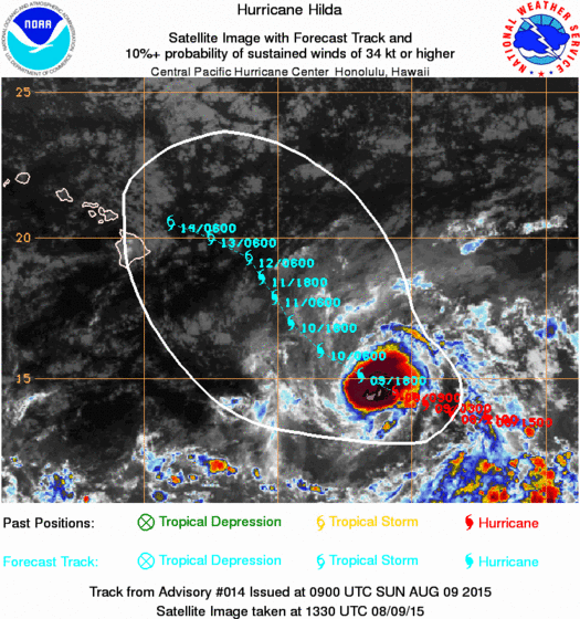
Hurricane Hilda continues to move westward and is holding its own with regards to strength with maximum winds of 125 mph with higher gusts and it has a change to reach category 4 status in the next 24 hours before weakening beings. There are strong westerly winds aloft that will accompany the turn to the northwest that is forecast. Of course if there is a threat to Hawaii it is going to depend on that turn and how far north it gets or if it gets far enough north that it would pass north of the islands in a much more weakened state.
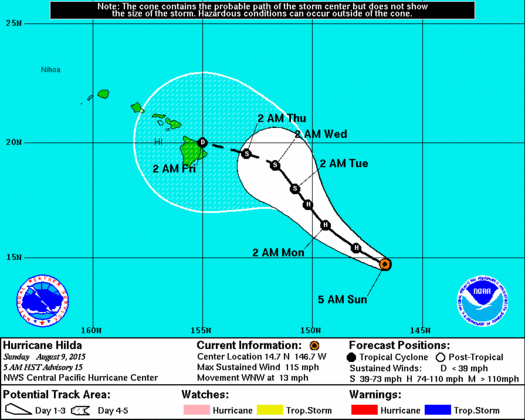
 The forecast track takes the hurricane back to the west as a tropical storm. As the system becomes more shallow in a weakened phase it will move more with the upper winds at the lower levels which are more easterly. Hurricanes coming in from the east toward Hawaii have a tendency to weaken significantly before it gets there.
Meanwhile the Atlantic remains completely asleep. There isn’t anything anywhere in the Atlantic that poses a threat for storm development, probably for the next 3 or 4 day.