
Hurricane Hector Hawaii Bound
Hurricane Hector Hawaii Bound
Please consult your local National Weather Service office at weather.gov for the latest information on any tropical or storms or hurricanes that could be a threat to your area. Consult your local government officials regarding action you may need to take to secure life and property

It still has a long way to go but Major Hurricane Hector Category 3 continues to move to the west and it looks like it has Hawaii in its sights. Top winds are 125 mph. We have seen some fluctuations in strength over the last 24 hours as the eye undergoes a replacement cycle which is typical in major hurricanes. As far as the threat to Hawaii is concerned it is has seemed clear for days that this was at the very least going to be a close call for the Hawaiian islands especially for the big island of Hawaii which lies further south than any of the others. Right now it is 1300 miles to the east and it poses no short term threat.
UPPER AIR FLOW WITH HURRICANE HECTOR CLICK TO ANIMATE
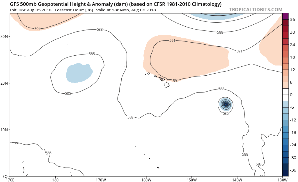
We have been discussing on our weather videos on our Youtube channel that the key to Hector will be the narrow upper ridge of high pressure to the north. Right now Hector is likely to respond to a slight weakness in that upper high over the next 2 days and move more west northwestward and gain some latitude. This is key because the hurricane is small. A weaker ridge means a further north track. Ultimately the ridge will strengthen again north of Hawaii later this week turning Hurricane Hector back to the west. The weaker the ridge, the closer this gets to the big island of Hawaii. The small size of the hurricane where gales are about 120 mile across means that it would have to come inside 60 miles of the big island in order for it to have any serious land impacts.
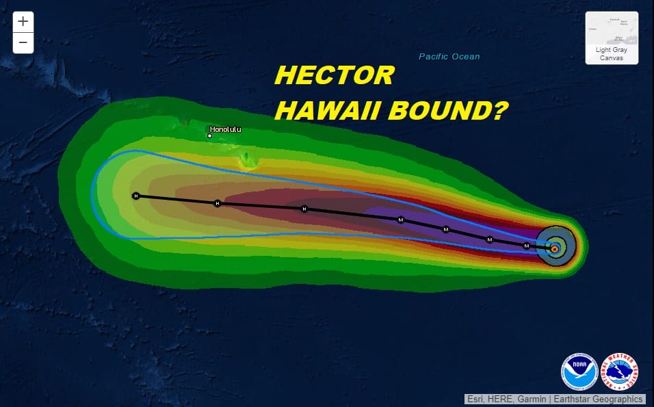
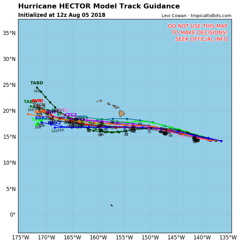
The National Hurricane Center’s forecast takes it to withing 60 miles of the Big Island of Hawaii but it would pass well south of the other islands as a category 1 or 2 hurricane. Hurricane model track guidance is all to the south of the islands.
It certainly will be close enough for impacts to the coastal waters with gales and high seas regardless. Wednesday and Thursday look to when all this will happen one way or the other. We will be doing a full update on Hurricane Hector on our You Tube Channel at 11am Eastern time when the new advisory is issued.
WIDE ATLANTIC TROPICAL SATELLITE

Meanwhile the tropical Atlantic remains quiet with weak waves strong wind shear and Saharan dust continuing to be an issue. In the Central Atlantic we do have a weak low level circulation under an upper low that has been moving southwestward. This could gain tropical characteristics in the next few days but it is likely to be picked up to the northeast later this weak regardless so we are not really concerned about this system.
Please consult your local National Weather Service office at weather.gov for the latest information on any tropical or storms or hurricanes that could be a threat to your area. Consult your local government officials regarding action you may need to take to secure life and property
FiOS1 News Weather Forecast For Long Island
FiOS1 News Weather Forecast For New Jersey
FiOS1 News Weather Forecast For Hudson Valley