

SUMMARY OF 1100 AM AST…1500 UTC…INFORMATION
———————————————–
LOCATION…14.0N 48.2W
ABOUT 930 MI…1495 KM E OF THE LEEWARD ISLANDS
MAXIMUM SUSTAINED WINDS…105 MPH…165 KM/H
PRESENT MOVEMENT…WNW OR 290 DEGREES AT 10 MPH…17 KM/H
MINIMUM CENTRAL PRESSURE…976 MB…28.82 INCHES
The small hurricane has gained more strength as it continues to remain in a light shear environment. Max winds are now estimated at 105mph making this a category 2 hurricane. Danny could strengthen some more today before it begins to get involved with increasing shear to the west and dry air to the north. It will be interesting to see how this reacts to all this if it is not able to have the current favorable conditions migrate with it.
 The Hurricane Centers track forecast remains mainly unchanged. Since the hurricane is within 1000 miles of land people in the Northern Leewards need to pay closer attention to this. The storm is still forecast to weaken as it approaches the Leewards and then it will have a problem as it interacts with the land if that track holds.
 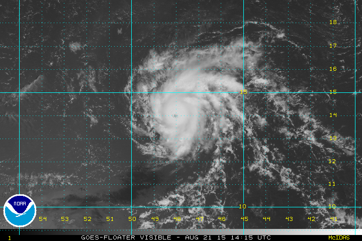 The visible satellite picture this morning shows a well defined circular eye but you can see just how small this really is. It is only several hundred miles across. The storm passed 75 miles to the north of a Noaa buoy overnight and it could only mange a 20 knot wind. The area of gales is small and the area of hurricane force winds even smaller. It is like hitting the bulls eye of a target. A NOAA plane will be checking the storm out later today.