CLOUDS CONTINUE INTO TUESDAY AS HUMIDITY STARTS TO RISE
SHOWERS THUNDERSTORMS TUESDAY NIGHT & WEDNESDAY
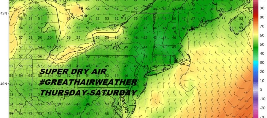
CANADIAN AIR ARRIVES DRY THURSDAY THROUGH SATURDAY
There were a couple of light showers around midday but overall it was another day of lots of clouds with some occasional brightening of skies and temperatures into the 70s. We still have an onshore flow that continues into Tuesday night with a warm front developing to our south. Clouds will be around tonight with most lows in the 60s to near 70. Tuesday looks rather cloudy though it will start to turn a bit more humid with highs in the 70s to near 80. The satellite loop tonight shows some clouds around and it seems any light showers that were on the radar earlier have disappeared.
EASTERN SATELLITE

REGIONAL RADAR

The local Upton & Fort Dix radars below show some spotty light rain showers around. Some of those showers are reaching the ground others are not. Also there are probably some showers or light rain that is under the radar and can’t be picked up. This should all die off after sunset.
LOCAL RADAR NEW YORK CITY

LOCAL RADAR PHILADELPHIA


There are no changes in the outlook going forward. A cold front approaches Tuesday night and Wednesday with rising humidity, showers, and one or two thunderstorms into Wednesday afternoon. This does not appear to be a severe weather producer thanks to the marine layer ahead of it. Temperatures Wednesday could reach into the 80s.
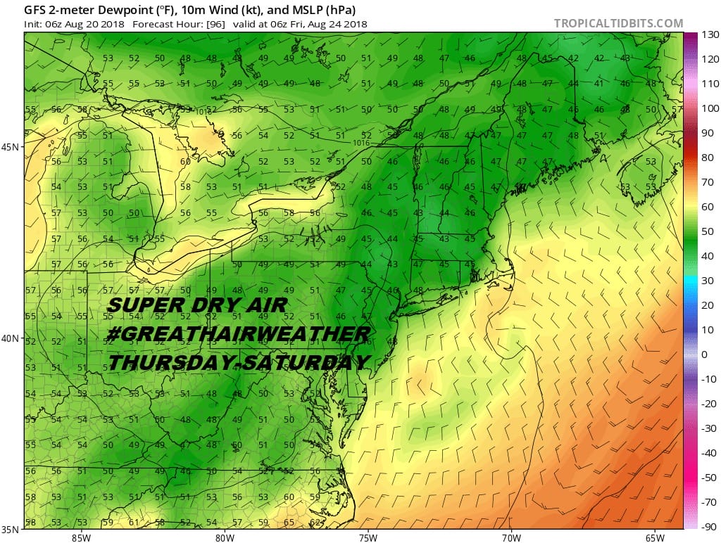 Behind the cold front though comes some much needed and much welcomed air from Canada for the end of the week. Thursday through Saturday we should be partly to mostly sunny with collapsing dew points into the 40s Thursday night into Friday morning. Temperatures will be in the 70s to near 80 by day. This is the first reminder that most of the summer is behind us and that autumn looms before too long.
Earlier today we looked at Hurricane Lane in the Central Pacific which is becoming an increasing threat to the Hawaiian Islands. You can read about Hurricane Lane here or watch the video below.
MANY THANKS TO TROPICAL TIDBITS FOR THE USE OF MAPS
Please note that with regards to any tropical storms or hurricanes, should a storm be threatening, please consult your local National Weather Service office or your local government officials about what action you should be taking to protect life and property.
LATEST JOESTRADAMUS ON THE LONG RANGE


