
Humidity Low Sunshine Cool Late June
Humidity Low Sunshine Cool Late June
What an absolutely beautiful day we have today with lots of sunshine, low humidity and cool temperatures as highs today in most areas won’t get out of the 70s. It really doesn’t get much better than this for late June. The satellite loop shows clear skies all the way west into the Ohio Valley which means we should be sunny pretty much all day and clear all night tonight with lows in the mid 50s to lower 60s. To the west we can see blow off from thunderstorms in the Plains States. That will signal the arrival of warmer and more humid air as it moves eastward. Thursday we will see some clouds mixing with the sun especially Thursday morning as that warmer more humid air mass starts to arrive. Highs Thursday will be back in the 80s. Obviously for today and tonight the radars will show no activity.
SATELLITE LOOP

REGIONAL RADAR

The weekend is going to be a very long one for many as some stretch it out to 5 days from Friday through Tuesday July 4th. Friday Saturday & Sunday will be typical summer weather with sunshine very warm to hot conditions and the chance for scattered late day thunderstorms. Highs each day will be in the upper 80s to lower 90s except cooler near coastal areas. Nighttime lows will be in the upper 60s and lower 70s.
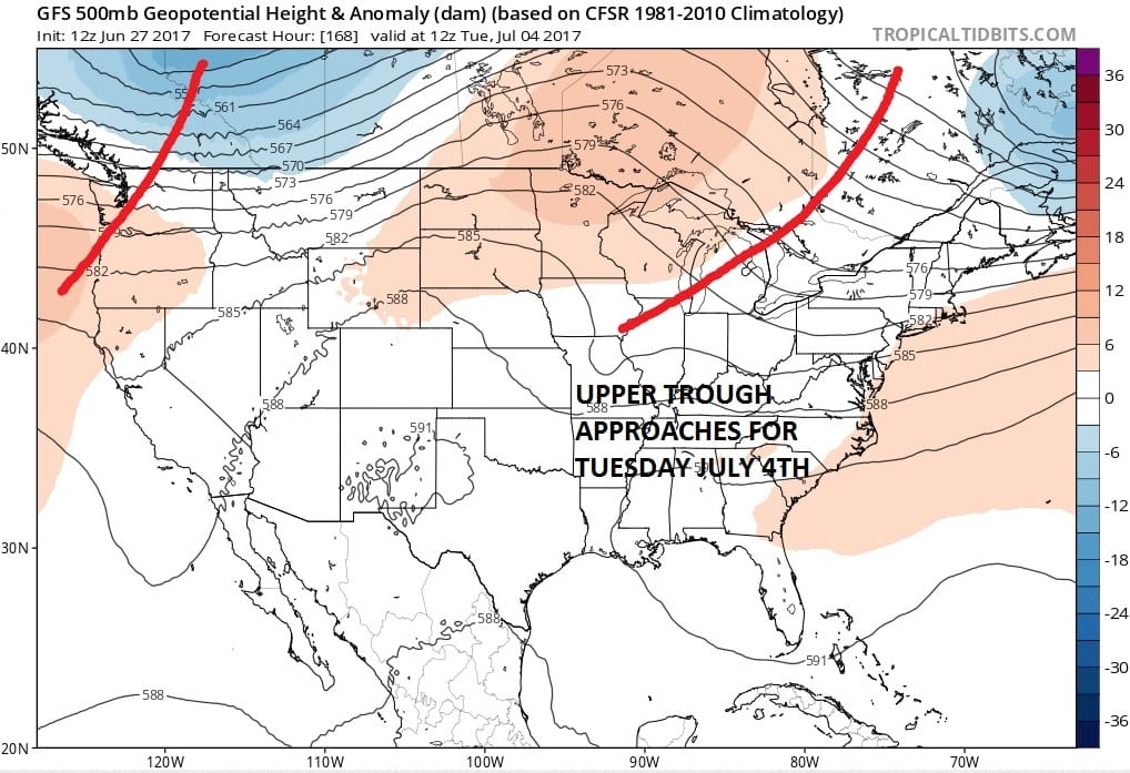
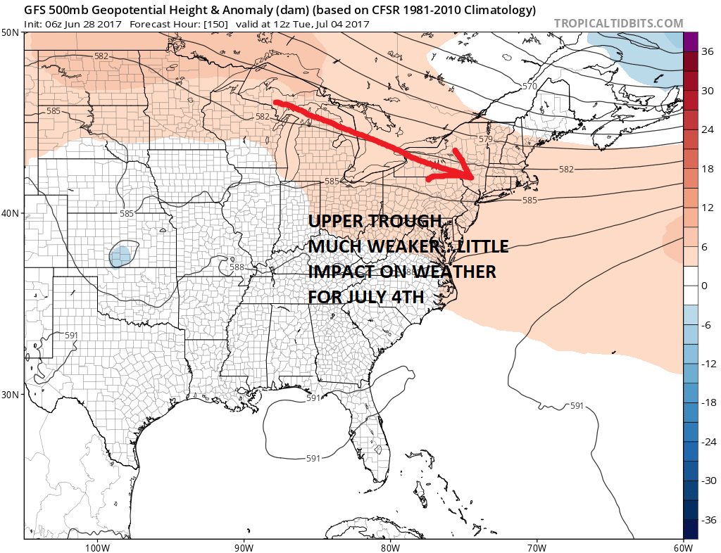
Latest weather models show a much weaker system and a drier upper air profile for early next week. The map above was the GFS model for Tuesday July 4th. The one below is the most recent model run. The flatter northwest flow would suggest no weather issues for Monday or Tuesday. We should have some sunshine both days, very warm temperatures and slightly lower humidity from the weekend..
So at least at this point we can be reasonably optimistic about the upcoming potentailly 5 day holiday weekend if you are creative and take off beginning Friday. Considering the weather today and Thursday you could start your hoilday weekend now!
 GET JOE A CIGAR IF YOU LIKE

Weather App

Don’t be without Meteorologist Joe Cioffi’s weather app. It is really a meteorologist app because you get my forecasts and my analysis and not some automated computer generated forecast based on the GFS model. This is why your app forecast changes every 6 hours. It is model driven with no human input at all. It gives you an icon, a temperature and no insight whatsoever.
It is a complete weather app to suit your forecast needs. All the weather information you need is right on your phone. Android or I-phone, use it to keep track of all the latest weather information and forecasts. This weather app is also free of advertising so you don’t have to worry about security issues with your device. An accurate forecast and no worries that your device is being compromised.
Use it in conjunction with my website and my facebook and twitter and you have complete weather coverage of all the latest weather and the long range outlook. The website has been redone and upgraded. Its easy to use and everything is archived so you can see how well Joe does or doesn’t do when it comes to forecasts and outlooks.
Just click on the google play button or the apple store button on the sidebar for my app which is on My Weather Concierge. Download the app for free. Subscribe to my forecasts on an ad free environment for just 99 cents a month.
Get my forecasts in the palm of your hand for less than the cost of a cup of Joe!


