HRRR Model Severe Weather Threat

HRRR Model Severe Weather Threat
Greatest Threat Across Central New Jersey Tuesday PM
Thunderstorms Also For Hudson Valley & Long Island

Trying to figure out the severe weather threat for Tuesday is a bit difficult. The easy part of the equation is for Central and Southern New Jersey and Southeastern Pennsylvania. There it seems pretty obvious since that area will be warm sectored all day and temperatures are going to reach the upper 70s and lower 80s before the cold front comes through. The other areas to the north and east are more difficult to figure. The biggest question is the front itself and all the models have a different perspective on where the front is and what time it passes through. First off overnight we have showers on the radar moving across Northern Pennsylvania. They stand to move across New Jersey, New York City, the Hudson Valley and Long Island between 2am and 6am You can see them on the regional radar below as they move eastward.
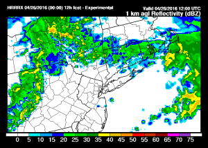
The showers are beginning to come into the view of the Philadelphia radar and will soon appear on the New York City radar. Once those showers are done the the HRRR model develops another area over New Jersey by mid morning. The maps below are the forecast radar views for 8am and 11am Tuesday.
HRRR Model Severe Weather Threat Forecast radars 8am & 11 am Tuesday
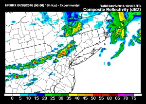
At this point you can see some showers to the northwest of the New Jersey showers in Northeast Pennsylvania. This seems to be where the line of possible severe thunderstorms develops as the day wears on. At 2pm some strong cells are indicated over the Hudson Valley Moving southeastward.
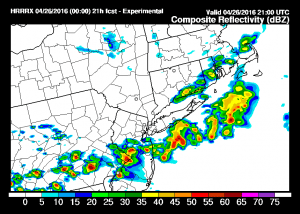
HRRR Model Severe Weather Threat Forecast Radar 2pm & 5pm Tuesday
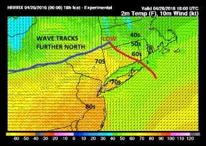
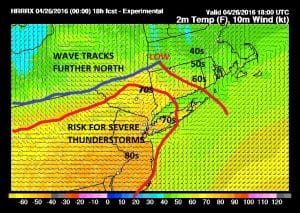
By 5pm the HRRR model has a rather strong east west line of storms across Southeastern Pennsylvania through Central New Jersey and at this point the storms have already crossed Long Island. Other weaker cells are over Coastal Conntecticut mainly east of Bridgeport. One of the big differences in this model from some other weather models is that it slows the front down. Take a look at the HRRR model 2pm temperatures. Unlike some of the other models which sink the front faster and further south, by holding it back, it actually warm sectors Long Island and the Hudson Valley. As of 2pm those areas also have temperatures in the 70s.
HRRR Model Severe Weather Threat 2pm Forecast Temperatures
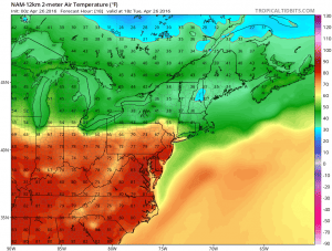
If this model is correct than the area of severe weather would be expanded further north and east. The NAM model lines up very well with this when you compare the 2pm temperature forecast from this model with the HRRR model.
The short range models seem to suggest that severe weather on Tuesday will be more extensive than what some of the other global models suggest. The key will be the wind. Fronts like this normally want to push through faster than forecast. If that is the case it cuts down the daytime heating in the areas north and east of New York City. Those areas need to watch for the wind shift. Once the wind turns northeast and the front is through, the cooler air will put an end to the severe weather threat. The longer that takes to happen, the larger the severe weather threat will be.
FiOS1 News Weather Forecast For Long Island
FiOS1 News Weather Forecast For New Jersey
FiOS1 News Weather Forecast For Hudson Valley
NATIONAL WEATHER SERVICE SNOW FORECASTS
LATEST JOESTRADAMUS ON THE LONG RANGE
Weather App
Don’t be without Meteorologist Joe Cioffi’s weather app. It is really a meteorologist app because you get my forecasts and my analysis and not some automated computer generated forecast based on the GFS model. This is why your app forecast changes every 6 hours. It is model driven with no human input at all. It gives you an icon, a temperature and no insight whatsoever.
It is a complete weather app to suit your forecast needs. All the weather information you need is right on your phone. Android or I-phone, use it to keep track of all the latest weather information and forecasts. This weather app is also free of advertising so you don’t have to worry about security issues with your device. An accurate forecast and no worries that your device is being compromised.
Use it in conjunction with my website and my facebook and twitter and you have complete weather coverage of all the latest weather and the long range outlook. The website has been redone and upgraded. Its easy to use and everything is archived so you can see how well Joe does or doesn’t do when it comes to forecasts and outlooks.
Just click on the google play button or the apple store button on the sidebar for my app which is on My Weather Concierge. Download the app for free. Subscribe to my forecasts on an ad free environment for just 99 cents a month.
Get my forecasts in the palm of your hand for less than the cost of a cup of Joe!
MENTION JOE CIOFFI AND GET A 5% DISCOUNT


