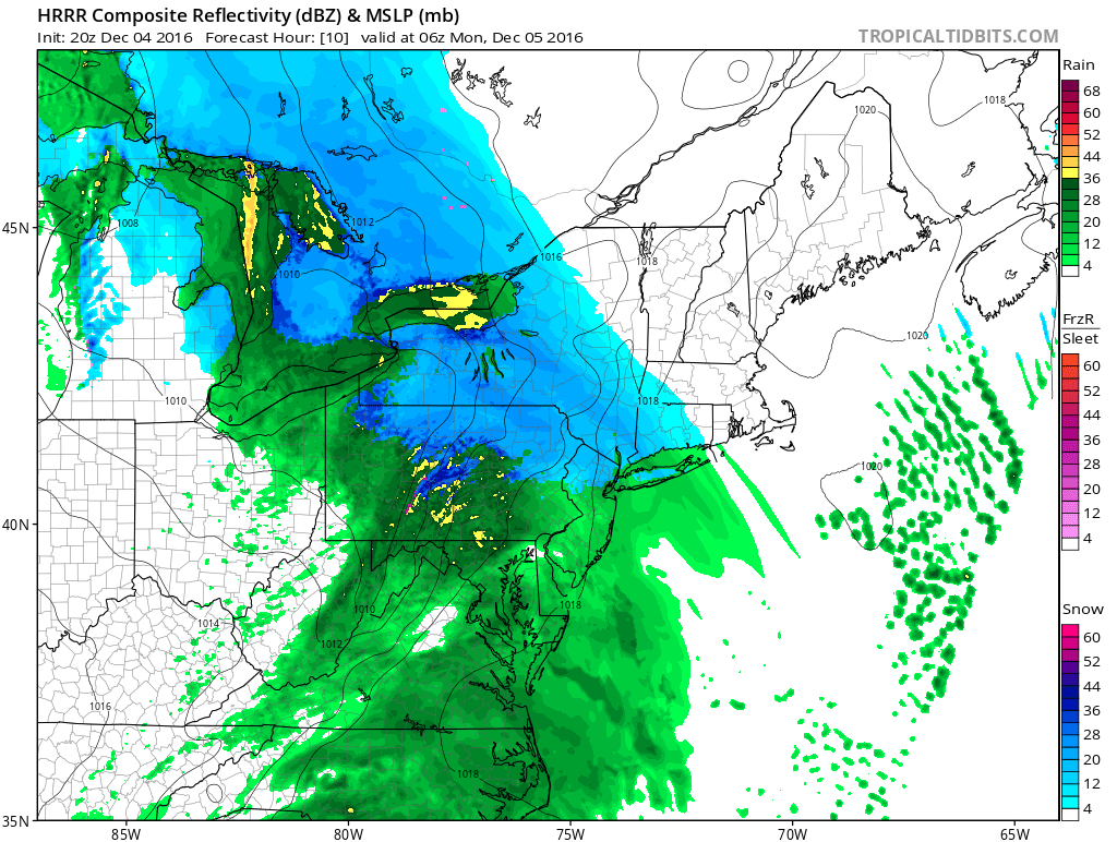
HRRR Model Overnight Monday Morning
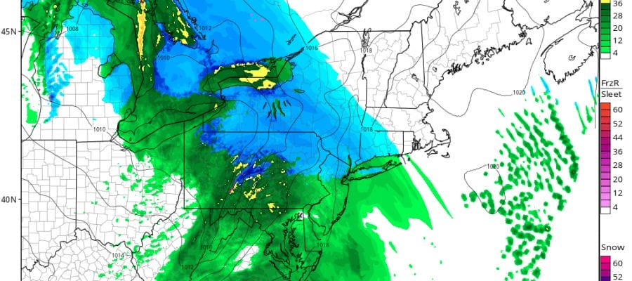
Radar this evening shows an area of snow over the Ohio Valley and Great Lakes moving eastward while moisture to the south is moving eastward as well. This will begin to spread over our area after midnight and last through the Monday morning commute.


The HRRR model starts the precipitation as snow in the early morning hours and then gradually changes it over to rain in southern areas and along the coast by 6 or 7am. Precipitation is already ending in western areas by 8am and should be done everywhere by 10 or 11am at the latest.
The maps below are the National Weather Service forecast snow maps with the most likely snowfall prediction. The forecast was updated this evening to show higher amounts in some of the northwest counties of New Jersey and parts of the Hudson Valley while tey were trimmed back a bit around NYC and Nassau County.


Once the precipitation is done we get a break until the next system from the Gulf states moves in for Tuesday. There could be some snow on the front end of this as the low moves to the Ohio Valley and then redevelops along the Middle Atlantic coast. At the very least the additional rain puts another small dent in the drought and rainfall deficit which still remains at 6 to 10 inches over most of the area. Once these systems are done we turn our attention to colder air coming out of Canada and spreading across the Eastern United States. We should see the leading edge of that air mass arrive on Thursday. The question is whether that comes with another round of precipitation when the cold arrives. Weather models remain mixed on this idea. ANGRY BEN has his latest opinions on this and the long range in his latest long range post.


