
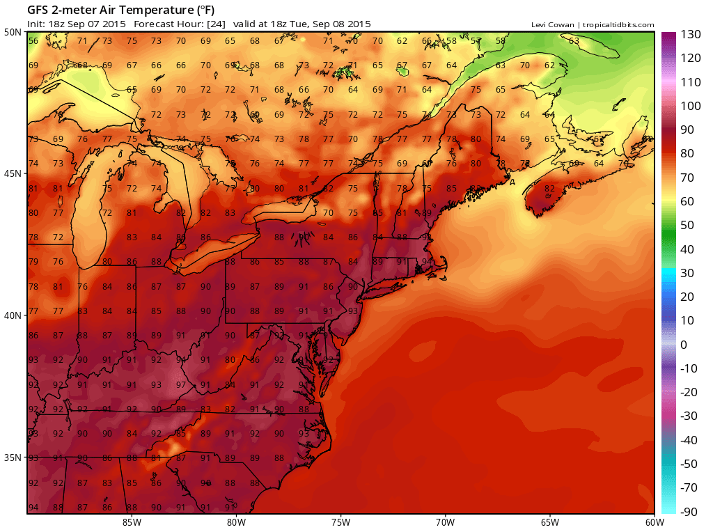
The summer vacation season is over however the summer weather is not for another 2 days. Today and Wednesday will be hot and sunny and temperatures will reach the 90s. Try and stay cool and if you a lucky enough to have a couple of extra days off the beaches are going to be there with small crowds so you will have them all to yourself.
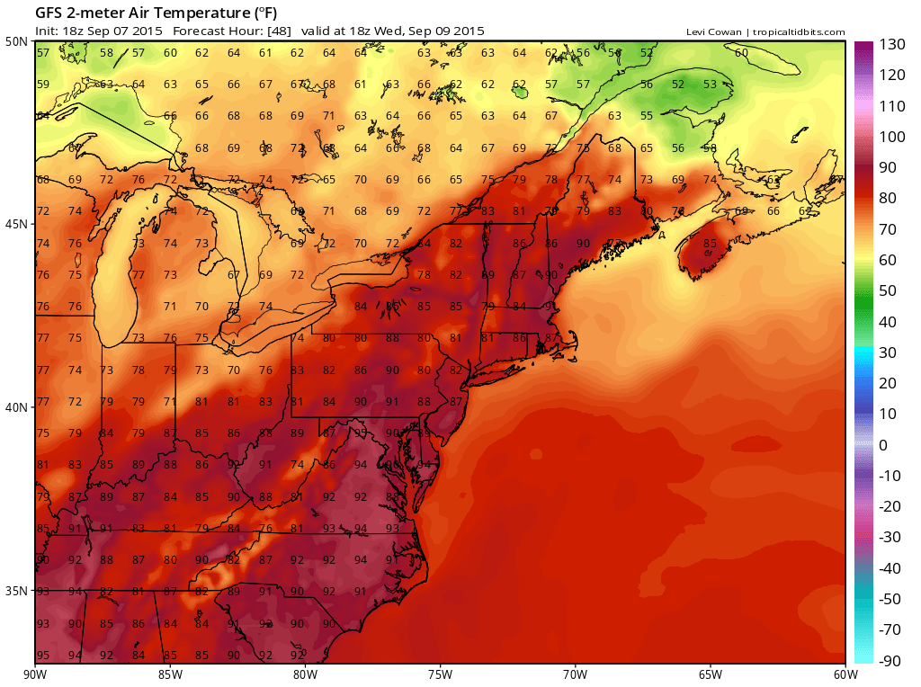
Showers and thunderstorms will approach late Wednesday afternoon and evening that will produce the first round of rain for the area into Thursday morning. Thursday we could see all day clouds and rain and that’s why you see temperatures holding in the 70s.
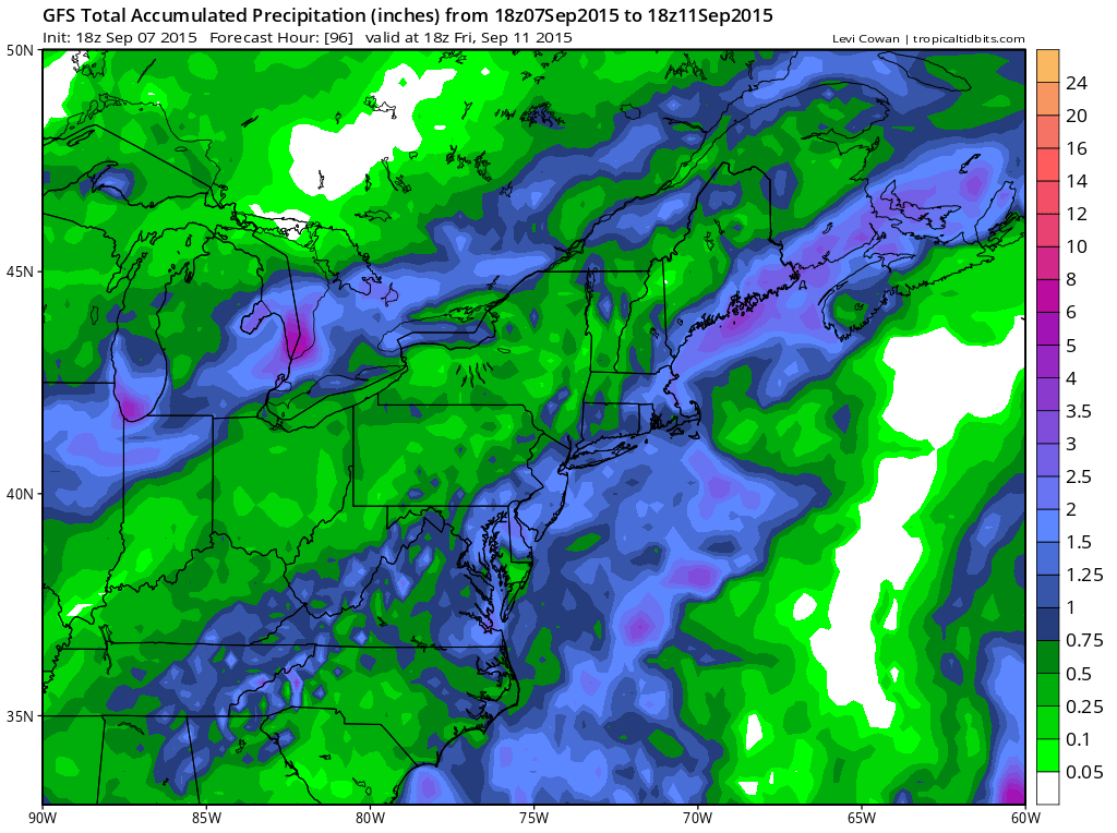
 Thursday’s range will hinge on a wave developing to our south and moving through. All the rain should be done by early Friday morning. The GFS model as well as some of the other models have a solid 1 to 2 inches of rain. The rainfall deficits are running quite high right now and the ground is baked like concrete in many places with burnt lawns. The dry summer is going to probably make the fall leaf changing season short as leave are just drying up now rather than wait for the change. Still fingers are crossed that models may under perform reality.
An early peek at the weekend shows another weather system will be approaching but I’m not sure yet how this is going to play out. The European model has another soaking rain for late Saturday into Sunday while the other models just have a few showers going through. More on this during the day Tuesday.
For more information on this check the Joe’s forecast page for details on how the models play this event out. For specific forecasts subscribe to my app for all mobile platforms. You can download the app for free and a subscription is just 99 cents for an advertising free platform with no security risks.