Hot Sunday Severe Weather Risk NYC Northward Cooler Monday Before Heat Returns

Weather in 5/Joe & Joe Weather Show Latest Podcast
Hot Sunday Severe Weather Risk NYC Northward Cooler Monday Before Heat Returns
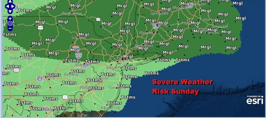
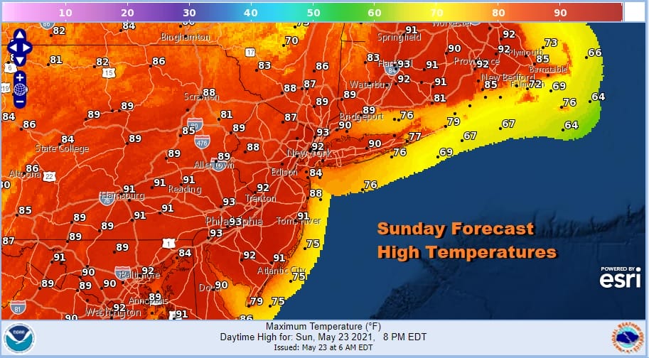
No doubt about it folks, today will be a hot day and it will be hot everywhere including shore locations as the sea breeze will be fighting against a northwest wind and an approaching cold front from the north. It is rather easy forecast today with lots of sunshine into this afternoon. Highs will reach the upper 80s and lower 90s. Someone might push up against 93 or 94 for a high today.
The cold front opens the door to scattered thunderstorms later this afternoon and evening. Dew points will be rising into the upper 50s and lower 60s. Add an upper trough to the mix and you have a set up for possibly some isolated severe thunderstorms.

The biggest risk from these thunderstorms will be wind gusts of 50 mph or more in any severe cells. Rain from these storms should be relatively minimal as there isn’t much in the way of moisture around and the front is moving along at rather fast clip. Meanwhile we have just a few patchy leftover clouds on the satellite this morning across the Northeast and Northern Mid Atlantic states and these clouds will disappear in a hurry this morning.
SATELLITE

The front goes by tonight and keeps right on moving so we should see skies clear out with lows in the 50s to around 60. A much cooler Monday starts of the last week of May with sunshine to start. Then clouds will move in later in the day as the next high moves in quick and then moves out quick.

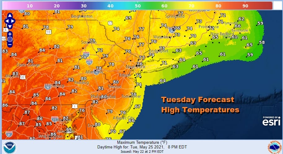
Monday highs will shave off about 20 degrees from today with highs just reaching into the 70s and some places having a tough time getting out of the 60s. It is a quick trip to normal temperatures as we are setting up for another warm up Tuesday and especially Wednesday.

Tuesday the warm front will be moving quickly from the Great Lakes into New England so it will be a day of clouds and sunshine. Temperatures will be lower as you head northeast and and warmer as you head southwest. Highs from NYC north and east will be in the 70s while from Philadelphia and Central New Jersey south and west we will see mid to upper 80s.
Wednesday will be a hot day with a bit of gusty west wind and sunshine taking highs up to a range of 90 to 95 degrees. Dew points will reach into the lower 60s making it a bit uncomfortable or certainly uncomfortable compared to Monday or Tuesday. Some thunderstorms are possible later in the day as another cold front moves through.
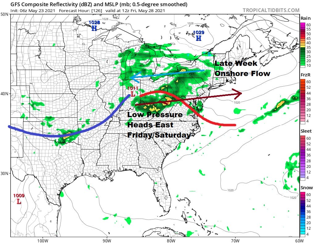
While Thursday will be dry and still a bit on the warm side, gradually cooler air coming down from Canada will wedge into the Northeast and Northern Mid Atlantic states at the end of the week. Low pressure coming across the Ohio Valley threatens to bring much needed rain for the end of the week and for getaway day for the Memorial Day weekend. The issue for the weekend is whether we see this low getting suppressed far enough south to take us out of the rain. There still may be clouds and rain issues for part of the Memorial Day weekend. This is always the summer holiday weekend which has a risk for one or two days to be less than stellar. More on the holiday weekend will be on my subscription platform on Patreon later today.

BE SURE TO DOWNLOAD THE FREE METEOROLOGIST JOE CIOFFI WEATHER APP &
ANGRY BEN’S FREE WEATHER APP “THE ANGRY WEATHERMAN!
MANY THANKS TO TROPICAL TIDBITS FOR THE USE OF MAPS
Please note that with regards to any severe weather, tropical storms, or hurricanes, should a storm be threatening, please consult your local National Weather Service office or your local government officials about what action you should be taking to protect life and property.


