Hot Humid Wednesday Severe Weather Risks Inland Rain Getaway Day Friday

Weather in 5/Joe & Joe Weather Show Latest Podcast
Hot Humid Wednesday Severe Weather Risks Inland Rain Getaway Day Friday
Today is a bit of a transition day as cooler air moves out to the east and we begin to set up for a hot and more humid Wednesday. The satellite shows clouds in the Northern Mid Atlantic states with mainly clear skies in New England to start the day. Gradually some of those clouds on the southern flank will move east and northeast today masking away some of the sunshine. Temperatures today from Northern Virginia to Southern New England will be mostly in the 70s. This will be a quiet transition to heat as there are no showers to concern ourselves with today or tonight.
SATELLITE

Let us move on to Wednesday. Low pressure moves across Southern Canada with a trailing northwest southeast cold front. Dew points rise into the 60s across much of the Northteast and Northern Mid Atlantic. We have an upper trough dropping southeast from Canada.
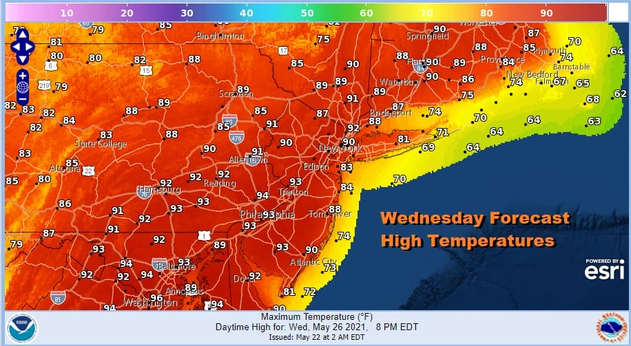
Daytime heating and sunshine will take temperatures into the 90s Wednesday. The immediate coast is a bit of a tougher call and some areas over Central and Eastern Long Island and Southeast New England might benefit from a wind off the ocean and keeping temperatures in the 70s to perhaps near 80. Wind direction will need to be watched as this will impact highs.
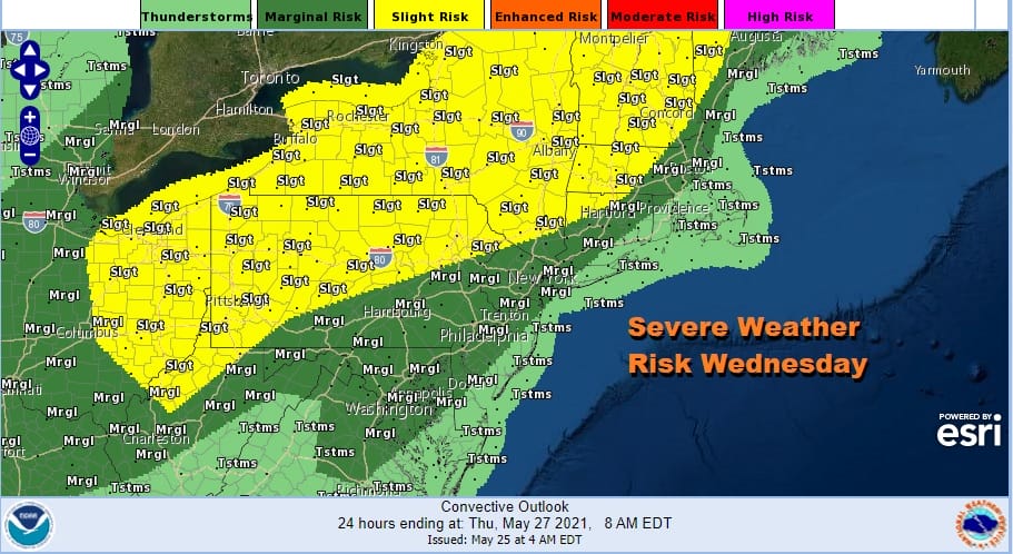
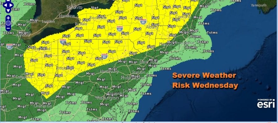
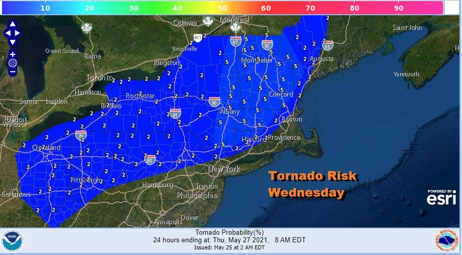
All of the above factors lead us to a very unstable atmosphere and the Storm Prediction Center has responded with an upgrade of severe weather risks bringing marginal risk close to the coast and raises the interior Northeast to a slight risk for severe weather. Aside from hail and wind risks we do have risk for tornadoes.
Wednesday is going to be a busy thunderstorm day for inland areas north and west of the big cities. The front will pass and head south Wednesday night and Thursday and weather conditions will improve. We will have sunshine Thursday and while it will still be warm with highs in the lower to a few middle 80s, it will be cooler than Wednesday and less humid. Friday is getaway day for the holiday weekend and we will be posting the holiday weekend outlook shortly

BE SURE TO DOWNLOAD THE FREE METEOROLOGIST JOE CIOFFI WEATHER APP &
ANGRY BEN’S FREE WEATHER APP “THE ANGRY WEATHERMAN!
MANY THANKS TO TROPICAL TIDBITS FOR THE USE OF MAPS
Please note that with regards to any severe weather, tropical storms, or hurricanes, should a storm be threatening, please consult your local National Weather Service office or your local government officials about what action you should be taking to protect life and property.


