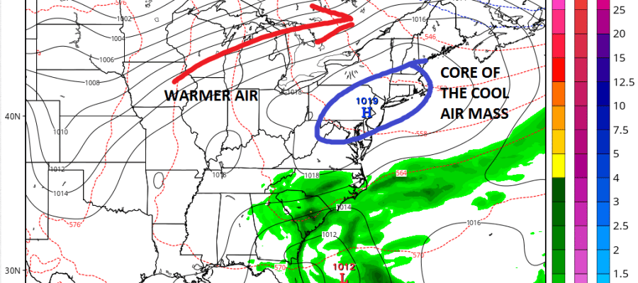
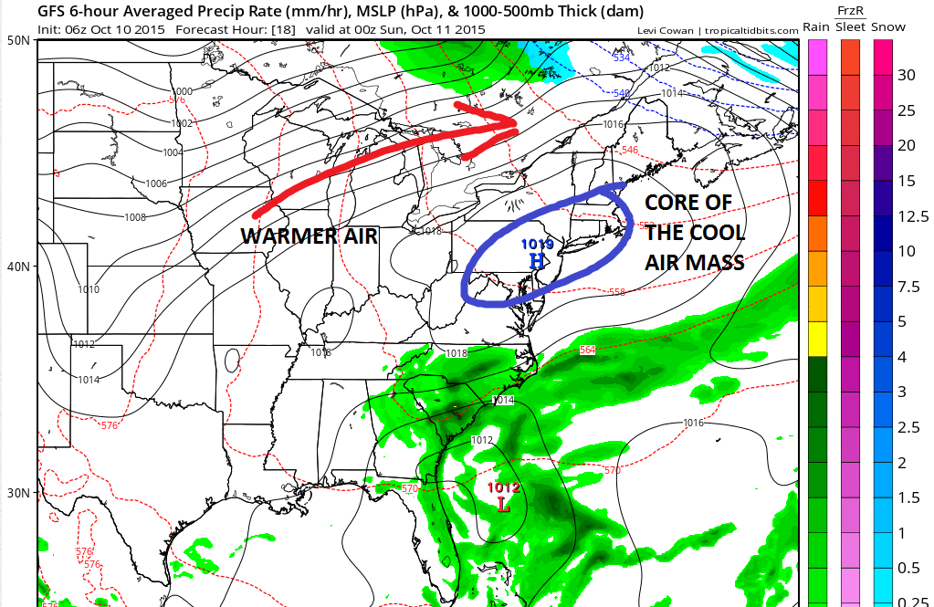
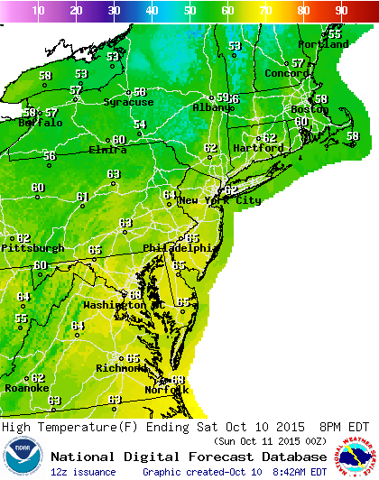
Day one of the holiday weekend is underway and we start off with a shot of cool air that came in last night and that cool air stays here into tonight. There will be a good deal of sunshine today but temperatures are going to have a tough time getting much above the low 60s which is pretty close to normal for this time of year. Warmer air is poised to return Sunday and Monday as everything in the atmosphere is moving along.
 Tonight we will see lows in the 40s to near 50 however with clear skies and light winds there will be some 30s in many inland areas but there should not be any frost issues.

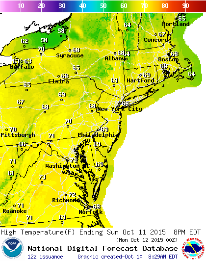
Sunday and Monday temperatures rebound and we should see a fair amount of sun both days with highs reaching the upper 60s Sunday and lower 70s should be attainable on Monday. No rain is in the forecast.
Tuesday the next cold front approaches but it appears that the front will be rather moisture starved as tropical moisture out in the Atlantic remains separate and stays to the east. We are going from dry air mass to a dry air mass so there really isnt much for the front to work on. The rest of the week will see a slow downtrend in temperatures before a very cool air mass comes in toward the end of the week. That could bring the first frosts of the season for some as head into next weekend.
For a view of the longer range the signs continue to point to colder weather for the second half of October though the devil is going to be in the details and whether blocking develops. JOESTRADAMUS tackled this yesterday on his long range post.
Be sure to download my app and subscribe to my forecasts. The app is free and a subscription costs just 99 cents a month. You get specific forecasts for your zone plus access to JOESTRADAMUS long range posts 2 hours before everyone else plus specific discussions and forecasts when weather gets active. The app has no advertising and no security or tracking issues.