
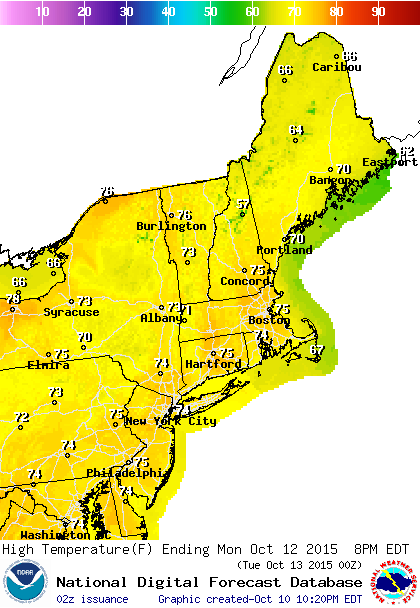
The holiday weekend continues with no issues through Tuesday morning with sunshine for Sunday and for Monday. The core of the cool air is moving out very quickly so temperatures will respond this afternoon by rising toward or even over 70 in some spots. Sunday night temperatures will not be as chilly as they were this morning and should be at least 10 degrees higher.

There is no rain to speak of any where coast and in fact most of the nation over the next 72 hours will be dry with hardly any precipitation anywhere which is highly unusual.

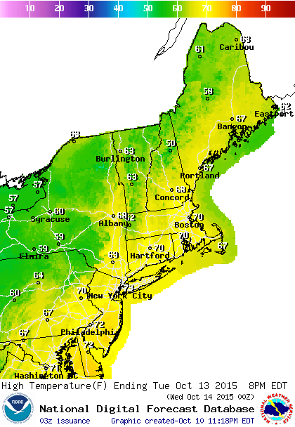
October is usually the driest month of the year here and we have been in a very dry pattern overall. Much of this week looks very dry with the next cold front arriving on Tuesday. The moisture is limited here and with the Atlantic and Gulf of Mexico completely turned off, this front will produce only a few scattered showers which many not even make it to the coast. Nothing in the models suggests a change in this idea. Even the more aggressive European model from last night backed off on the idea of rain here late in the week though I would caution that if we are entering a blocking phase, the models may become more volatile than usual with day to day runs. For now we will wait to see what the overnight models offer us for down the road.
The tropics are quiet and there are no systems around that will provide any kind of tropical storm development potential over the next several days at least. The calmness can’t last forever.
Be sure to download my weather app and subscribe to my specific forecasts for New York, New Jersey, Connecticut, and Eastern Pennsylvania, and Southern New England. The app is free and a subscription costs justs 99 cent a month. The app is free from web advertising and there are no security or tracking issues. It is available for both I phones and andriod platforms.